Bull Pen Springs Trail
- 0.9 mi
- round trip
- 201 ft
- climb
- 9,312 ft
- high point
- Out and back
- route
- May–Jun, Sep
- best months
Is Bull Pen Springs Trail open right now?
Alert in the area
The Forest Service lists 11 alerts for Pike and San Isabel National Forests.
FSR 286, Radical Hill, is closed due to washouts and unsafe conditions
Agency alert covering Pike and San Isabel National Forests · USFS · Pike and San Isabel National Forests
Interlaken Hotel Tree Hazards
Agency alert covering Pike and San Isabel National Forests · USFS · Pike and San Isabel National Forests
Sharpe Fire Update
Agency alert covering Pike and San Isabel National Forests · USFS · Pike and San Isabel National Forests
Turquoise Lake Road (County Road 4) Closure
Agency alert covering Pike and San Isabel National Forests · USFS · Pike and San Isabel National Forests
Waldo Canyon Burn Area Closure
Agency alert covering Pikes Peak Ranger District · Order 02-12-09-24-07 · USFS · Pikes Peak Ranger District
As of · Source: USFS · Pike and San Isabel National Forests. Agencies don't list every closure — check before you go.
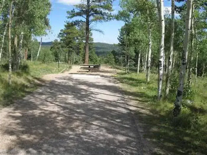
Bull Pen Springs Trail is a short, easy out-and-back hike in Colorado's Pikes Peak Ranger District, part of the Pike and San Isabel National Forests. The trail is about 0.86 miles long, with a total elevation gain of 201 feet, and it starts at 9,312 feet, the highest point on the route. The climb is back-loaded, with the steepest stretch at about 0.21 miles in, and the trail ends at a low point of 9,148 feet. Summer is the most comfortable time to go. Typical averages from a nearby weather station at Ruxton Park show July highs around 74°F with lows near 46°F, while winter highs stay around 39°F. The station sits a few hundred feet lower than the trail, so temperatures on the route run slightly cooler. The hike takes about half an hour. The Flatland Trail (South) and Middle Ridge Trail both lie within half a mile, and Meadow Ridge and Thunder Ridge campgrounds are about 1.3 to 1.4 miles away.
Local outfitters
- Broadmoor Outfitters16 mi away
- Gold Belt Tour Scenic and Historic Byway26 mi away
Not on Roamze yet. Their page has how to reach them.
- Flatland Trail (South)Hiking0.3 mi
- Middle Ridge TrailHiking0.4 mi
 Meadow RidgeCampingPhoto: Recreation.gov (RIDB) / public domain1.3 mi
 Thunder RidgeCampingPhoto: Recreation.gov (RIDB) / public domain1.4 mi
- Homestake Fishing SiteLake fishing2.2 mi
- Woodland Park Boulders (The Corridor)Rock climbing2.3 mi
- Dikeside Boating SiteLake fishing2.4 mi
- Air Force AcademyRock climbing4.5 mi
Source: Roamze catalog (indexable pages within 10 miles, PostGIS distance)
 Rampart ReservoirHiking · ~4 min drivePhoto: Glenn Harper from Grapevine, Texas, USA, CC BY 2.0 (via Wikimedia Commons)
 Crystal TrailHiking · ~8 min drivePhoto: TEDBARTH, CC BY-SA 3.0 (via Wikimedia Commons)
- SchubarthHiking · ~3 min drive
- BackdoorHiking · ~4 min drivePhoto: Glenn Harper from Grapevine, Texas, USA, CC BY 2.0 (via Wikimedia Commons)
 Mount Esther TrailHiking · ~9 min drivePhoto: Sack-Sama, CC BY-SA 2.0 (via Flickr)
- West Monument Creek Trail 713Hiking · ~9 min drive
- Nichols ReservoirHiking · ~4 min drivePhoto: Glenn Harper from Grapevine, Texas, USA, CC BY 2.0 (via Wikimedia Commons)
- Shubarth TrailHiking · ~2 min drive
 Centennial TrailHiking · ~6 min drivePhoto: buba69, CC BY 2.0 (via Flickr)
- HELL CREEK TRAILHiking · ~4 min drive
Best time to visit Bull Pen Springs Trail
Best months: May–June and September. Best months have typical highs of 55–85 °F, lows of 30 °F or warmer (32 °F where the station doesn't record snow), at most one snowy day and no more than 12 wet days.
Jan
39° / 13°
5 wet
Feb
39° / 14°
6 wet
Mar
45° / 20°
7 wet
Apr
50° / 26°
8 wet
May
59° / 33°
10 wet
Jun
70° / 42°
11 wet
Jul
74° / 46°
16 wet
Aug
72° / 45°
16 wet
Sep
66° / 39°
9 wet
Oct
56° / 30°
6 wet
Nov
46° / 19°
5 wet
Dec
39° / 13°
5 wet
Typical high / low (°F) and days with rain or snow, 1991–2020. Measured at Ruxton Park, CO, 10.5 mi away at 9,060 ft. This station doesn't record snowfall. Source: NOAA NCEI U.S. Climate Normals 1991–2020.

Map and trail data © OpenStreetMap contributors
