
Berkeley Echo Lake Camp
Campground
1.7 mi from the trail
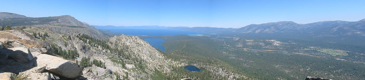
 Photo: Peter, CC BY-SA 2.0 (via Wikimedia Commons)
Talking Mountain is a summit of 8,812 feet in California's Lake Tahoe Basin Management Unit, about 2.7 miles from the town of Meyers. The peak sits within national forest land managed by the Forest Service. Summer is the most comfortable time to visit. Typical averages from a nearby weather station at Dagget Pass, Nevada, show July highs around 75°F with lows near 49°F and only a couple of wet days, though that station sits roughly 1,500 feet below the summit, so temperatures up high run cooler. Saucer Lake Trail lies about half a mile away, and the Echo Lakes climbing area is about 0.7 miles off. The Pacific Crest Trail passes about 1.4 miles away, and the Upper Truckee River is about 3.1 miles away.
Where it is: Lake Tahoe Basin Management Unit
Near: Meyers, California · 2.7 mi
Best months: May–October. Best months have typical highs of 55–85 °F, lows of 30 °F or warmer (32 °F where the station doesn't record snow), at most one snowy day and no more than 12 wet days.
Jan
36°
23°
9 wet
Feb
37°
23°
8 wet
Mar
42°
26°
7 wet
Apr
48°
29°
5 wet
May
56°
35°
4 wet
Jun
66°
42°
2 wet
Jul
75°
49°
2 wet
Aug
74°
49°
1 wet
Sep
67°
44°
2 wet
Oct
55°
36°
3 wet
Nov
43°
28°
5 wet
Dec
35°
23°
7 wet
Typical high / low (°F) and days with rain or snow, 1991–2020. Measured at Dagget Pass, NV, 13.9 mi away at 7,334 ft. The station sits about 1,500 ft lower than this place, so expect it a little cooler here. This station doesn't record snowfall. Source: NOAA NCEI U.S. Climate Normals 1991–2020.
Been here? Tell people how it was.
We don't know of a mapped trail or route to the summit of Talking Mountain. Plan the approach with local maps, a guidebook or a local guide, and check conditions before you go.


 Saucer Lake TrailHikingPhoto: lewinb, CC BY-SA 2.0 (via Flickr)0.5 mi
 Echo LakesRock climbingPhoto: brewbooks, CC BY-SA 2.0 (via Flickr)0.7 mi
 Billy LandRock climbingPhoto: brewbooks, CC BY-SA 2.0 (via Flickr)0.9 mi
 Pacific Crest TrailHikingPhoto: lewinb, CC BY-SA 2.0 (via Flickr)1.4 mi
 Lovers Leap Cg & Day UseCampingPhoto: -Jérôme- — CC BY 2.0 (via Flickr)4.5 miEcho PeakSummitPhoto: Peter, CC BY-SA 2.0 (via Wikimedia Commons)~3 min driveRalston PeakSummitPhoto: Jonathan Fox, CC BY-SA 2.0 (via Wikimedia Commons)~3 min drive
 Angora PeakSummitPhoto: Brian Sterling, CC BY-SA 2.0 (via Wikimedia Commons)~4 min drive
 Pyramid PeakSummitPhoto: Phreakdigital at English Wikipedia, Public domain (via Wikimedia Commons)~8 min drive
 Mount TallacSummitPhoto: Rabit 115 at English Wikipedia, Public domain (via Wikimedia Commons)~9 min drive
 Mount PriceSummitPhoto: Jonathan Fox, CC BY-SA 2.0 (via Wikimedia Commons)~10 min drive
 Maggies PeaksSummitPhoto: Phreakdigital (talk · contribs), Public domain (via Wikimedia Commons)~12 min driveFreel PeakSummitPhoto: J Brew, CC BY-SA 2.0 (via Wikimedia Commons)~16 min drive
 Phipps PeakSummitPhoto: Tim Berger, CC BY 2.0 (via Wikimedia Commons)~16 min drive
 Jobs SisterSummitPhoto: Tim Berger, CC BY 2.0 (via Wikimedia Commons)~17 min drive
Also worth it near here
Daily highs and lows, wind and the chance of precipitation at the summit for the next 7 days, from the Open-Meteo model.
8,812 ft (2,686 m).
We don't know of a mapped trail or route to the summit. Plan the approach with local maps, a guidebook or a local guide.
Questions about Talking Mountain: conditions, access, timing. Answers say when something isn't known.
Berkeley Echo Lake Camp
Campground
Solstice Eatery
Restaurant
Baldwin Home
Museum
Places © OpenStreetMap contributors
More in Sunnyside-Tahoe City