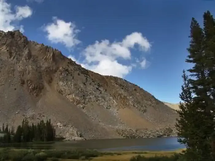
Dunderberg Peak
 Photo: Adorabutton, CC BY-SA 3.0 (via Wikimedia Commons)
- 12,367 ft
- summit
- Forest Service
- managed by
Is Dunderberg Peak open right now?
Closure in the area
There's a closure order in Humboldt-Toiyabe National Forest. It doesn't name Dunderberg Peak, so check the source for the area it covers.
Elephant Fire Closure
Agency closure covering Humboldt-Toiyabe National Forest · Order 04-17-26-01-04 · USFS · Humboldt-Toiyabe National Forest
Area, Road, and Trail Closures (Spring Mountains National Recreation Area)
Agency alert covering Humboldt-Toiyabe National Forest · Order 04-17-25-04 · USFS · Humboldt-Toiyabe National Forest
Year-Round Fire Restrictions (Spring Mountains National Recreation Area)
Agency alert covering Humboldt-Toiyabe National Forest · Order 04-17-24-01 · USFS · Humboldt-Toiyabe National Forest
Vehicle Snow Chain Requirements during Inclement Weather (Spring Mountains National Recreation Area)
Agency alert covering Humboldt-Toiyabe National Forest · Order 04-17-23-01 · USFS · Humboldt-Toiyabe National Forest
Rainbow Canyon Flood Diversion Structure Closure (Spring Mountains National Recreation Area)
Agency alert covering Humboldt-Toiyabe National Forest · Order 04-17-15-01 · USFS · Humboldt-Toiyabe National Forest
As of · Source: USFS · Humboldt-Toiyabe National Forest. Agencies don't list every closure — check before you go.
Dunderberg Peak is a summit of about 12,367 feet in Mono County, California, inside the Hoover Wilderness. The peak lies within the Bridgeport Ranger District of the Humboldt-Toiyabe National Forest, which the Forest Service manages, and the nearest town is Virginia Lakes, about 1.6 miles away. Green Creek is a hike about 0.9 miles away, and Trumbull Lake and West Virginia Creek campgrounds are both within about 2 miles. Summit Lake is another hike about 2 miles off.
Conditions and forecast
Daily highs and lows, wind and the chance of precipitation at the summit for the next 7 days, from the Open-Meteo model.
- Summit elevation
- 12,367 ft
- Land manager
- Forest Service
Elevation from USGS 3D Elevation Program terrain data (about 10 m resolution).
We don't know of a mapped trail or route to the summit of Dunderberg Peak. Plan the approach with local maps, a guidebook or a local guide, and check conditions before you go.
Questions about Dunderberg Peak
How tall is Dunderberg Peak?
12,367 ft (3,769 m).
Is there a trail to the top of Dunderberg Peak?
We don't know of a mapped trail or route to the summit. Plan the approach with local maps, a guidebook or a local guide.
 Mount Dana13,054 ft · California1 route12 mi awayPhoto: Jim Bahn, CC BY 2.5 (via Wikimedia Commons)
 Lembert Dome9,446 ft · California1 route13 mi awayPhoto: Inklein, CC BY 3.0 (via Wikimedia Commons)
 Pywiack Dome8,840 ft · California1 route18 mi awayPhoto: Stan Shebs, CC BY-SA 3.0 (via Wikimedia Commons)
 Koip Peak12,981 ft · California1 route18 mi awayPhoto: Smokeybear69, CC BY-SA 4.0 (via Wikimedia Commons)
 Mount Hoffmann10,845 ft · California1 route20 mi awayPhoto: David McCracken, CC BY 2.0 (via Wikimedia Commons)
 Vogelsang Peak11,504 ft · California1 route20 mi awayPhoto: Paxson Woelber, CC BY-SA 4.0 (via Wikimedia Commons)
 Green CreekHikingPhoto: Moo.The.Cow, CC BY 2.0 (via Flickr)0.9 mi
 Trumbull LakeCampingPhoto: Recreation.gov (RIDB) / public domain1.3 mi
- West Virginia CreekCamping1.8 mi
 Green Creek TrailHikingPhoto: Moo.The.Cow, CC BY 2.0 (via Flickr)2 mi
- Summit LakeHikingPhoto: Moo.The.Cow, CC BY 2.0 (via Flickr)2 mi
- Lower Virginia Creek Primitive CampgroundCamping2.6 mi
 Mt. ConnessRock climbingPhoto: scorpio-tiger, CC BY-SA 2.0 (via Flickr)7.2 mi
- Hoover WildernessRock climbing7.2 mi
Source: Roamze catalog (indexable pages within 10 miles, PostGIS distance)
 Black MountainSummit · ~3 min drivePhoto: Don Graham, CC BY-SA 2.0 (via Wikimedia Commons)
 Page PeaksSummit · ~3 min drivePhoto: Tom Hilton, CC BY 2.0 (via Wikimedia Commons)
 Camiaca PeakSummit · ~5 min drivePhoto: Michael Kwok, CC BY 2.5 (via Wikimedia Commons)
 Mount ScowdenSummit · ~7 min drivePhoto: David Wood, CC BY 2.0 (via Wikimedia Commons)
 Twin PeaksSummit · ~8 min drivePhoto: C N, CC BY-SA 2.0 (via Wikimedia Commons)
 Mount WarrenSummit · ~10 min drivePhoto: Pimlico27, CC BY-SA 4.0 (via Wikimedia Commons)
 Whorl MountainSummit · ~10 min drivePhoto: oliver.dodd, CC BY 2.0 (via Wikimedia Commons)
 North PeakSummit · ~10 min drivePhoto: Adorabutton, CC BY-SA 3.0 (via Wikimedia Commons)
 Mount ConnessSummit · ~12 min drivePhoto: Cullen328, CC BY-SA 4.0 (via Wikimedia Commons)
 Lee Vining PeakSummit · ~13 min drivePhoto: C N, CC BY-SA 2.5 (via Wikimedia Commons)
