Summit Lake
 Photo: Moo.The.Cow, CC BY 2.0 (via Flickr)
- 2.0 mi
- round trip
- 165 ft
- climb
- 10,194 ft
- high point
- Out and back
- route
- Jun–Sep
- best months
Is Summit Lake open right now?
Closure in the area
There's a closure order in Humboldt-Toiyabe National Forest. It doesn't name Summit Lake, so check the source for the area it covers.
Elephant Fire Closure
Agency closure covering Humboldt-Toiyabe National Forest · Order 04-17-26-01-04 · USFS · Humboldt-Toiyabe National Forest
Area, Road, and Trail Closures (Spring Mountains National Recreation Area)
Agency alert covering Humboldt-Toiyabe National Forest · Order 04-17-25-04 · USFS · Humboldt-Toiyabe National Forest
Year-Round Fire Restrictions (Spring Mountains National Recreation Area)
Agency alert covering Humboldt-Toiyabe National Forest · Order 04-17-24-01 · USFS · Humboldt-Toiyabe National Forest
Vehicle Snow Chain Requirements during Inclement Weather (Spring Mountains National Recreation Area)
Agency alert covering Humboldt-Toiyabe National Forest · Order 04-17-23-01 · USFS · Humboldt-Toiyabe National Forest
Rainbow Canyon Flood Diversion Structure Closure (Spring Mountains National Recreation Area)
Agency alert covering Humboldt-Toiyabe National Forest · Order 04-17-15-01 · USFS · Humboldt-Toiyabe National Forest
As of · Source: USFS · Humboldt-Toiyabe National Forest. Agencies don't list every closure — check before you go.
Summit Lake is a 2-mile out-and-back hike in the Hoover Wilderness, part of the Bridgeport Ranger District of the Humboldt-Toiyabe National Forest in California. The trail gains about 165 feet, from a low point of roughly 10,017 feet to a high of about 10,194 feet. The route is an easy walk on natural surface, and it is open year-round. Horses are allowed, and bikes are not. The nearest town is likely Bridgeport, a few miles away. Summer is the most comfortable time to go. Typical averages from a nearby weather station at Tuolumne Meadows, about 12 miles away and roughly 1,500 feet lower, put July highs around 71°F with lows near 38°F. That station's figures are not a perfect match for the trail's higher elevation, so expect cooler temperatures here. The Green Creek Trail starts just 0.1 mile away. Summit Pass and Virginia Pass are both about 1.7 miles off. For an overnight stay, Trumbull Lake campground is about 2.7 miles away.
Local outfitters
- Mammoth Lakes Pack Outfit35 mi away
Not on Roamze yet. Their page has how to reach them.
- Green Creek TrailHikingPhoto: Moo.The.Cow, CC BY 2.0 (via Flickr)0.1 mi
- Summit PassHiking1.7 mi
- Virginia PassHiking1.7 mi
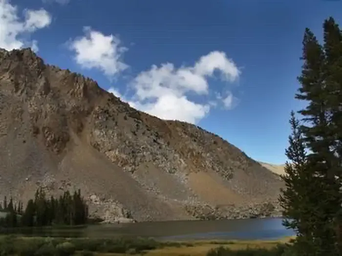 Trumbull LakeCampingPhoto: Recreation.gov (RIDB) / public domain2.7 mi
- West Virginia CreekCamping3.6 mi
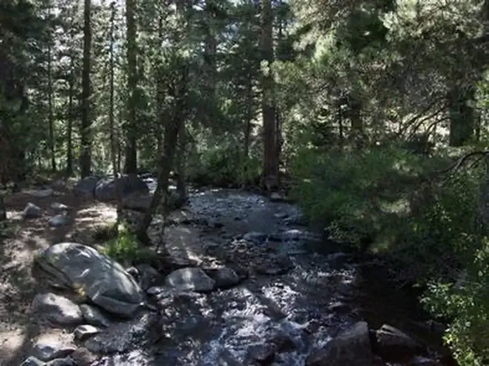 Green Creek GroupCampingPhoto: Recreation.gov (RIDB) / public domain4.5 mi
 Mt. ConnessRock climbingPhoto: scorpio-tiger, CC BY-SA 2.0 (via Flickr)5.8 mi
- Hoover WildernessRock climbing5.9 mi
Source: Roamze catalog (indexable pages within 10 miles, PostGIS distance)
 LUNDY CANYONHiking · ~5 min drivePhoto: GSEC, CC BY 2.0 (via Flickr)
 Lake CanyonHiking · ~7 min drivePhoto: simonov, CC BY-SA 2.0 (via Flickr)
 Horse & Cattle Creek TrailHiking · ~13 min drivePhoto: scorpio-tiger, CC BY-SA 2.0 (via Flickr)
 Horse Creek RouteHiking · ~10 min drivePhoto: scorpio-tiger, CC BY-SA 2.0 (via Flickr)
 20 Lakes Basin LoopHiking · ~6 min drivePhoto: Dcrjsr, CC BY-SA 3.0 (via Wikimedia Commons)
 Kavanaugh Ridge TrailHiking · ~7 min drivePhoto: RuggyBearLA, CC BY 2.0 (via Flickr)
 HORSE-CATTLE CREEKHiking · ~13 min drivePhoto: Tom Hilton, CC BY 2.0 (via Flickr)
 Hess MineHiking · ~6 min drivePhoto: mjhbower, CC BY-SA 2.0 (via Flickr)
 McCabe Lakes TrailHiking · ~9 min drivePhoto: Jesse Wagstaff, CC BY 2.0 (via Flickr)
- Virginia PassHiking · ~3 min drive
Best time to visit Summit Lake
Best months: June–September. Best months have typical highs of 55–85 °F, lows of 30 °F or warmer (32 °F where the station doesn't record snow), at most one snowy day and no more than 12 wet days.
Jan
41° / 13°
Feb
38° / 12°
Mar
42° / 15°
Apr
45° / 22°
May
54° / 27°
Jun
65° / 33°
Jul
71° / 38°
Aug
70° / 36°
Sep
65° / 32°
Oct
57° / 26°
Nov
47° / 20°
Dec
40° / 12°
Typical high / low (°F) and days with rain or snow, 1991–2020. Measured at Tuolumne Meadows Rs, CA, 12.1 mi away at 8,694 ft. The station sits about 1,500 ft lower than this place, so expect it a little cooler here. This station doesn't record snowfall. Source: NOAA NCEI U.S. Climate Normals 1991–2020.

