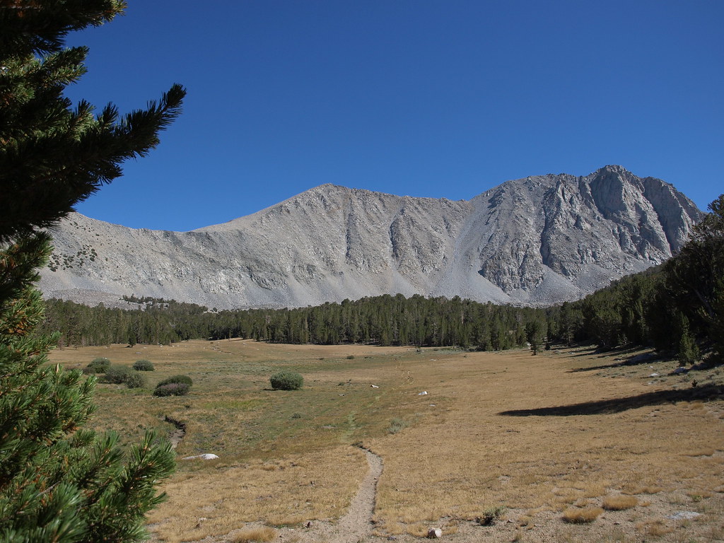
Mayfield Canyon Towers
Mayfield Canyon Towers has 6 climbing routes in California.
- 6 routes
- 5.5 – 5.10c
- Alpine
Is Mayfield Canyon Towers open right now?
Alert in the area
The Forest Service lists 4 alerts for Inyo National Forest.
Stage 1 Fire Restrictions in Effect
Agency alert covering Inyo National Forest · Order 05-04-50-26-23 · USFS · Inyo National Forest
Help Halt Golden Mussel Invasion
Agency alert covering Inyo National Forest · USFS · Inyo National Forest
Ansel Adams and John Muir Wilderness Campfire Restrictions
Agency alert covering Inyo National Forest · Order 05-04-50-25-04 · USFS · Inyo National Forest
Golden Trout and Hoover Wilderness Campfire Restrictions
Agency alert covering Inyo National Forest · Order 05-04-50-25-05 · USFS · Inyo National Forest
As of · Source: USFS · Inyo National Forest. Agencies don't list every closure — check before you go.
Best time to visit Mayfield Canyon Towers
Best months: May–September. Best months have typical highs of 55–85 °F, lows of 30 °F or warmer (32 °F where the station doesn't record snow), at most one snowy day and no more than 12 wet days.
Jan
41° / 17°
Feb
41° / 18°
Mar
45° / 22°
Apr
51° / 27°
May
60° / 35°
Jun
70° / 42°
Jul
78° / 49°
Aug
77° / 47°
Sep
71° / 40°
Oct
61° / 30°
Nov
49° / 23°
Dec
41° / 17°
Typical high / low (°F) and days with rain or snow, 1991–2020. Measured at Mammoth Lakes Rs, CA, 21.7 mi away at 7,804 ft. This station doesn't record snowfall. Source: NOAA NCEI U.S. Climate Normals 1991–2020.
Mayfield Canyon Towers is a climbing area in the John Muir Wilderness, within the White Mountain Ranger District of Inyo National Forest in California. The Forest Service manages the land. Summer is the most comfortable time to visit. Typical averages from a nearby weather station at Mammoth Lakes show July highs around 78°F with lows near 49°F, while winter highs sit around 41°F with lows in the teens. Wheeler Crest, another climbing area, lies just 0.4 miles away, and Wells Peak / Rabbit Ears is about 1.9 miles off. For hiking, the Lower Rock Creek Trail, Section 3, is about 3.2 miles away, and Palisades Group Campground is about 4.1 miles away.
Routes (6)
Bedrock Tower(1)
Hot Tuna Tower(2)
Soaring Eagle Tower(2)
Tower of Babel(1)
Keep exploring — more climbs worth the drive
 Photo: GSEC, CC BY 2.0 (via Flickr)
Elderberry Buttress
~8 min drive
Elderberry Buttress in California has 6 routes across 5 grades, offering sport and trad climbing.
Photo: GSEC, CC BY 2.0 (via Flickr)PSOM Slab
~8 min drive
PSOM Slab in California has 32 routes on slab rock with 15 difficulty grades.
 Photo: GSEC, CC BY 2.0 (via Flickr)
Planetarium / Gecko Wall
~9 min drive
Planetarium / Gecko Wall in California has 27 climbing routes with 16 difficulty grades.
Photo: GSEC, CC BY 2.0 (via Flickr)Secret Cliffs
~9 min drive
Secret Cliffs in California has 9 climbing routes across 8 grades, offering mixed, sport, and trad styles.
 Photo: inkknife_2000 (7.5 million views +), CC BY-SA 2.0 (via Wikimedia Commons)
4:20 Wall
~9 min drive
4:20 Wall is a California climbing crag with 2 trad routes.
Photo: inkknife_2000 (7.5 million views +), CC BY-SA 2.0 (via Wikimedia Commons)Inconsiderate Wall
~9 min drive
Inconsiderate Wall in California has 11 routes with 6 difficulty grades, offering sport and trad climbing.
Photo: inkknife_2000 (7.5 million views +), CC BY-SA 2.0 (via Wikimedia Commons)Juniper Wall
~9 min drive
Juniper Wall in California has 17 climbing routes across 9 grades, offering sport and trad options.
Wells Peak / Rabbit Ears
~3 min drive
Wells Peak / Rabbit Ears in California has 7 climbing routes with 4 difficulty grades.
Avalanche Wall
~7 min drive
Avalanche Wall in California has 7 climbing routes with 6 difficulty grades.
Clifflet
~8 min drive
Clifflet in California offers 8 climbing routes with mixed and sport styles across 6 grades.