Wolf Area
Wolf Area in California has 11 bouldering routes across 7 grades.
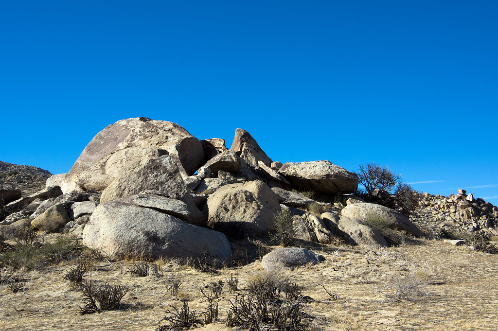 Photo: RuggyBearLA, CC BY-SA 2.0 (via Flickr)
- 11 routes
- V0- – V7+
- Bouldering
Best time to visit Wolf Area
Best months: February–June and October–November. Best months have typical highs of 55–85 °F, lows of 30 °F or warmer (32 °F where the station doesn't record snow), at most one snowy day and no more than 12 wet days.
Jan
60° / 31°
7 wet
Feb
61° / 32°
8 wet
Mar
65° / 35°
8 wet
Apr
69° / 38°
5 wet
May
75° / 43°
3 wet
Jun
85° / 46°
1 wet
Jul
92° / 53°
1 wet
Aug
93° / 54°
1 wet
Sep
89° / 49°
2 wet
Oct
79° / 40°
3 wet
Nov
68° / 34°
5 wet
Dec
60° / 30°
7 wet
Typical high / low (°F) and days with rain or snow, 1991–2020. Measured at Henshaw Dam, CA, 17.6 mi away at 2,700 ft. This station doesn't record snowfall. Source: NOAA NCEI U.S. Climate Normals 1991–2020.
Wolf Area is a bouldering area in Anza-Borrego Desert State Park in California, managed by State Park and Recreation. It sits among a cluster of climbing spots, with Vector Boulder, Vector Crack Area and Chocolate Boulder all about 0.1 mile away, and Cottonwood Camp about 0.2 mile off. The area is a compact, close-together set of boulders rather than a long route, and the climbing here is all bouldering. The boulders range from easy to challenging. Of the 11 routes listed, the easiest is Big Babies at V0-, and the hardest is The Wolf at V7+. The median grade is V2. Peso Face runs V2-3, and Rams Hill is V2. Spring and fall are the most comfortable times to visit. Typical averages from a nearby weather station at Henshaw Dam show May highs around 75°F and October highs around 79°F, while July and August average in the low 90s. The California Riding & Hiking Trail and Culp Valley Trail are both about 0.9 mile away, and Peña Springs Trail is a similar distance. Wilson Trail is about 1.9 miles off.
Routes (11)
Football and Peso Face, The(2)
Horn Boulder, The(2)
Kris Boulder(4)
Split Rock(2)
Wolf Boulder, The(1)
Keep exploring — more climbs worth the drive
 Photo: RuggyBearLA, CC BY-SA 2.0 (via Flickr)
Vector Boulder
~0 min drive
Vector Boulder in California offers 11 bouldering routes across 7 difficulty grades.
Photo: RuggyBearLA, CC BY-SA 2.0 (via Flickr)Cottonwood Area
~0 min drive
Cottonwood Area in California has 8 bouldering routes across 5 difficulty grades.
 Photo: RuggyBearLA, CC BY-SA 2.0 (via Flickr)
Windy Boulders South
~0 min drive
Windy Boulders South in California has 8 bouldering routes with 6 difficulty grades.
Photo: RuggyBearLA, CC BY-SA 2.0 (via Flickr)Windy Boulders
~0 min drive
Windy Boulders in California has 1 bouldering route rated 5.11a.
Photo: RuggyBearLA, CC BY-SA 2.0 (via Flickr)Culp Valley
~1 min drive
Culp Valley in California has 17 climbing routes with 12 difficulty grades, featuring bouldering pads and sport climbing.
Photo: RuggyBearLA, CC BY-SA 2.0 (via Flickr)Windy Boulders North
~1 min drive
15 bouldering routes at Windy Boulders North in California.
Photo: RuggyBearLA, CC BY-SA 2.0 (via Flickr)Granitica Hill
~1 min drive
Granitica Hill in California has 12 climbing routes across 5 grades.
 Photo: RuggyBearLA, CC BY-SA 2.0 (via Flickr)
Hilltop Boulders
~1 min drive
Hilltop Boulders in California has 9 bouldering routes across 6 grades.
 Photo: RuggyBearLA, CC BY-SA 2.0 (via Flickr)
Center Mast
~1 min drive
Center Mast is a California climbing area with 6 routes on bouldering pads.
Photo: RuggyBearLA, CC BY-SA 2.0 (via Flickr)Cvpc
~1 min drive
CVPC is a California climbing crag with 13 routes across 9 difficulty grades.

