Plum Creek
- 11.3 mi
- distance
- 2,983 ft
- high point
- Feb–Jun, Oct–Nov
- best months
Is Plum Creek open right now?
Closure in the area
There's a closure order in Lassen National Forest. It doesn't name Plum Creek, so check the source for the area it covers (3 listed).
Harmful Algal Blooms
Agency closure covering Lassen National Forest · USFS · Lassen National Forest
Forest Road Closure Order
Agency closure covering Lassen National Forest · Order 06-26-01 · USFS · Lassen National Forest
SAFETY ALERT - South Antelope Bridge out, Do Not Cross
Agency closure covering Lassen National Forest · USFS · Lassen National Forest
As of · Source: USFS · Lassen National Forest. Agencies don't list every closure — check before you go.
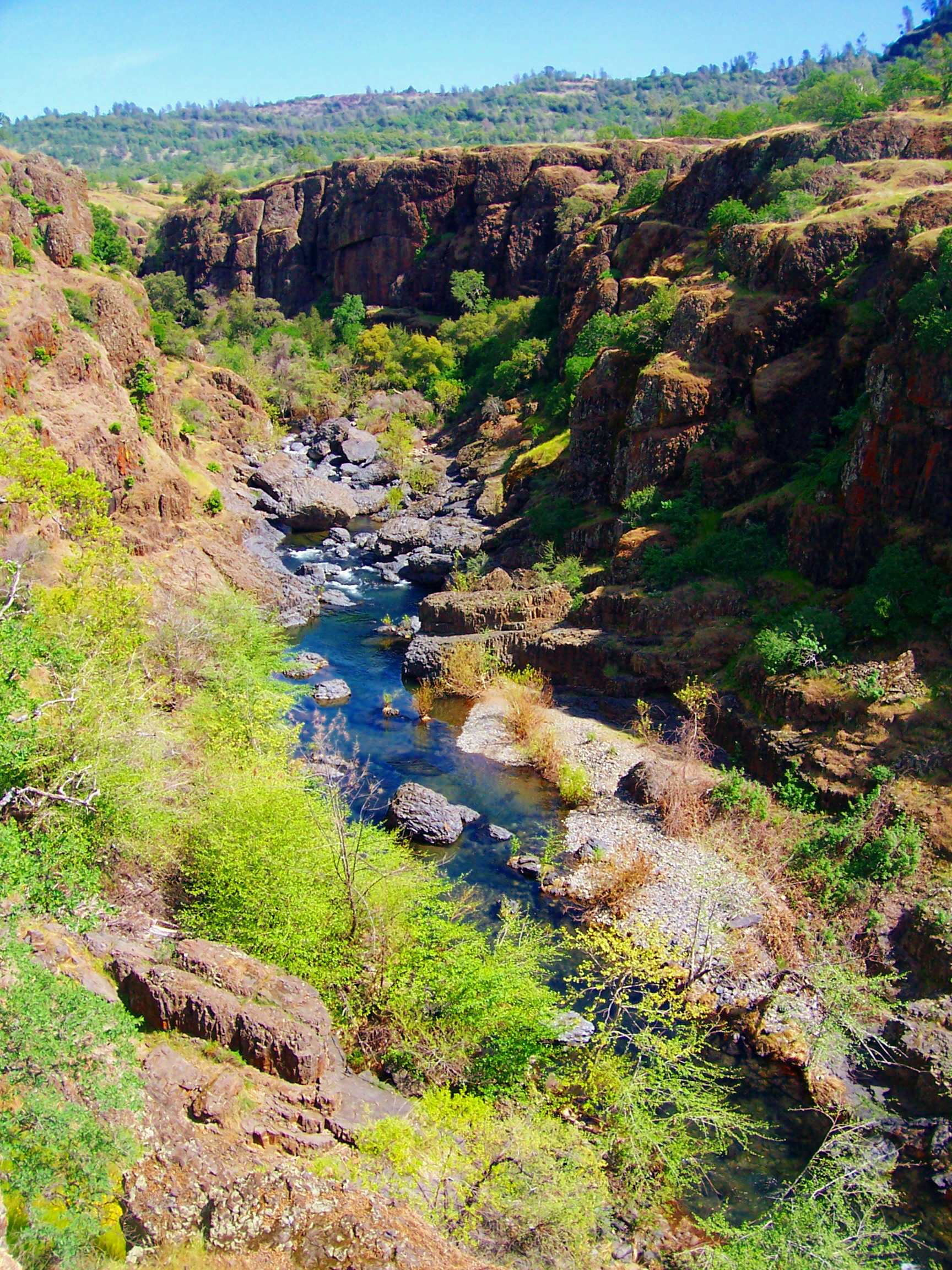
Plum Creek is an 11-mile paddling stretch near Paynes Creek, California, running through land in the Almanor Ranger District of Lassen National Forest and the Tehama Wildlife Area. The land along the creek is managed by the state fish and wildlife agency. The creek flows year-round, with a modeled average flow of about 34 cfs. It is a steep run, dropping about 171 feet per mile on average over its roughly 11.3 miles. Typical averages from a nearby weather station at De Sabla put the most comfortable weather in spring and fall, with May and October highs around 74°F and lows in the mid-40s. July and August average about 91°F, and December and January bring around 13 wet days a month. Nearby, the Mcclure Trail is about 3 miles away, and Paynes Creek and South Fork Battle Creek offer more paddling within about 7 miles. Indian Ridge is a hike about 7 miles off.
Local outfitters
- Headwaters Adventure Co31 mi away
Not on Roamze yet. Their page has how to reach them.
- Mcclure TrailHiking3.1 mi
- Paynes CreekCanoeing4.2 mi
- South Fork Battle CreekCanoeing6.8 mi
- Indian RidgeHiking7.1 mi
- South Fork Antelope CreekCanoeing7.9 mi
- HORSEBACK RIDGEHiking8.6 mi
- RANCHERIA TRAIL ISHIHiking9 mi
- Table Mountain IshiHiking9.1 mi
Source: Roamze catalog (indexable pages within 10 miles, PostGIS distance)
 Battle CreekCanoeing · ~18 min drivePhoto: Richard Jordana, Public domain (via Wikimedia Commons)
- Jelly's FerryBoat launch · ~28 min drive
 Deer CreekCanoeing · ~28 min drivePhoto: Kmmontandon at English Wikipedia, Public domain (via Wikimedia Commons)
- Red Bluff Recreation Area Boat RampBoat launch · ~34 min drive
 Big Chico CreekCanoeing · ~54 min drivePhoto: Ebryden at English Wikipedia, Public domain (via Wikimedia Commons)
- Manzanita Lake Boat LaunchBoat launch · ~39 min drive
- Paynes CreekCanoeing · ~7 min drive
- Drift Boat LaunchBoat launch · ~51 min drive
- South Fork Battle CreekCanoeing · ~12 min drive
- Juniper Lake Boat LaunchBoat launch · ~55 min drive
Best time to visit Plum Creek
Best months: February–June and October–November. Best months have typical highs of 55–85 °F, lows of 30 °F or warmer (32 °F where the station doesn't record snow), at most one snowy day and no more than 12 wet days.
Jan
53° / 35°
13 wet
Feb
55° / 35°
12 wet
Mar
60° / 37°
12 wet
Apr
66° / 40°
9 wet
May
74° / 47°
7 wet
Jun
84° / 53°
3 wet
Jul
91° / 58°
1 wet
Aug
91° / 57°
1 wet
Sep
86° / 53°
2 wet
Oct
74° / 46°
6 wet
Nov
59° / 38°
10 wet
Dec
51° / 34°
13 wet
Typical high / low (°F) and days with rain or snow, 1991–2020. Measured at De Sabla, CA, 33.5 mi away at 2,710 ft. Source: NOAA NCEI U.S. Climate Normals 1991–2020.

