Clavey River
- 18.0 mi
- distance
- 5,999 ft
- high point
- May–Jun, Sep–Oct
- best months
Is Clavey River open right now?
Closure in the area
There's a closure order in Stanislaus National Forest. It doesn't name Clavey River, so check the source for the area it covers (2 listed).
Stanislaus National Forest extends seasonal MVUM closure for two high elevation roads
Agency closure covering Stanislaus National Forest · USFS · Stanislaus National Forest
Extension of Seasonal Road Closures
Agency closure covering Stanislaus National Forest · USFS · Stanislaus National Forest
As of · Source: USFS · Stanislaus National Forest. Agencies don't list every closure — check before you go.
The Clavey River is a paddling route in California's Stanislaus National Forest, within the Mi-Wok Ranger District. The Forest Service manages the land, and the paddling here is the focus of a stretch of river that works well as a base for a day or a longer trip in this corner of the forest. For timing, the most comfortable stretch runs from late spring through early fall. Typical averages from the nearby Cherry Valley Dam weather station show June highs around 80°F with lows near 51°F, while September cools to highs around 82°F. That station sits about 1,200 feet lower than the river, so temperatures on the water run cooler. Several other spots lie close by. Hull Creek campground is about 4 miles away, and Reed Creek offers more canoeing at a similar distance. The North Fork Tuolumne River is roughly 6 miles off. For climbing, Roadside Rocks is about 8 miles away.
- Hull CreekCamping3.7 mi
- Reed CreekCanoeing3.9 mi
- Thomas PeakHiking4.6 mi
- Whittle Upper CampHiking4.9 mi
- North Fork Tuolumne RiverCanoeing5.7 mi
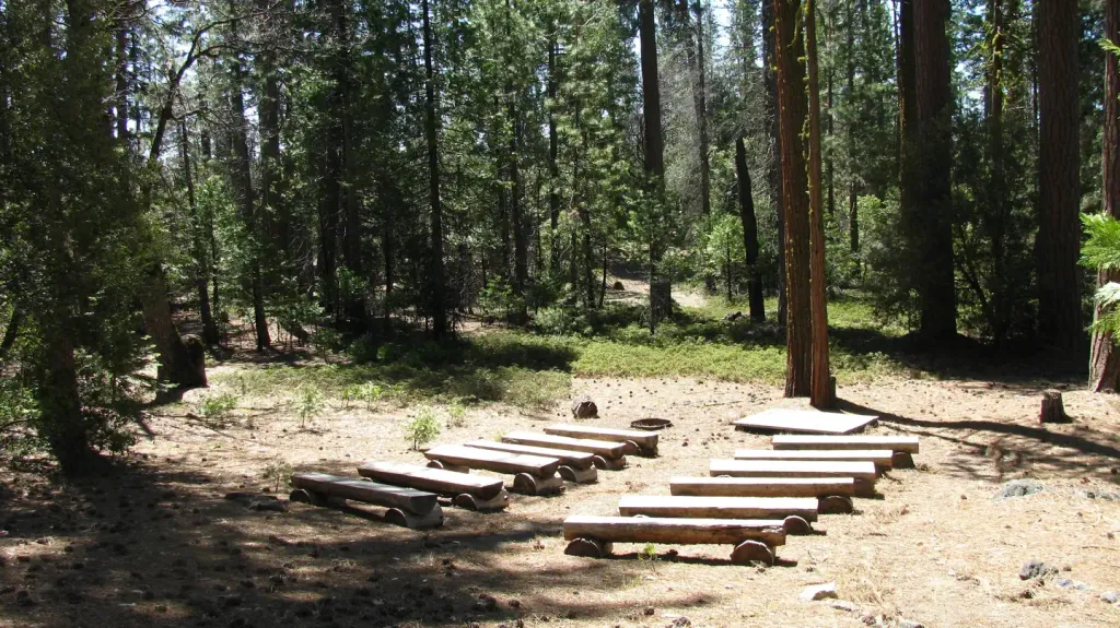 Cherry ValleyCampingPhoto: Recreation.gov (RIDB) / public domain7.1 mi
- Roadside RocksRock climbing7.9 mi
- Beached Whale BouldersRock climbing8.1 mi
Source: Roamze catalog (indexable pages within 10 miles, PostGIS distance)
 South Fork Tuolumne RiverCanoeing · ~30 min drivePhoto: Eeekster, CC BY 3.0 (via Wikimedia Commons)
- Cherry Lake Boating SiteBoat launch · ~13 min drive
- Briceburg Put-inFloat trip · ~52 min drive
 Stanislaus RiverCanoeing · ~35 min drivePhoto: Michael Nevins, U.S. Army Corps of Engineers, Public domain (via Wikimedia Commons)
- Beardsley BoatrampBoat launch · ~20 min drive
- Reed CreekCanoeing · ~7 min drive
- Merals Pool RampBoat launch · ~24 min drive
- Cherry CreekCanoeing · ~13 min drive
- Spicer Meadow Boat LaunchBoat launch · ~43 min drive
- West Fork Cherry CreekCanoeing · ~21 min drive
Best time to visit Clavey River
Best months: May–June and September–October. Best months have typical highs of 55–85 °F, lows of 30 °F or warmer (32 °F where the station doesn't record snow), at most one snowy day and no more than 12 wet days.
Jan
49° / 31°
10 wet · 5 snow
Feb
51° / 31°
10 wet · 5 snow
Mar
55° / 33°
10 wet · 5 snow
Apr
61° / 37°
8 wet · 2 snow
May
70° / 44°
6 wet · 1 snow
Jun
80° / 51°
3 wet
Jul
89° / 58°
1 wet
Aug
89° / 57°
1 wet
Sep
82° / 53°
2 wet
Oct
70° / 44°
4 wet
Nov
57° / 36°
7 wet · 2 snow
Dec
49° / 31°
9 wet · 4 snow
Typical high / low (°F) and days with rain or snow, 1991–2020. Measured at Cherry Valley Dam, CA, 7.6 mi away at 4,765 ft. The station sits about 1,200 ft lower than this place, so expect it a little cooler here. Source: NOAA NCEI U.S. Climate Normals 1991–2020.

