Calaveras Creek
- 2.3 mi
- distance
- 861 ft
- high point
- Jan–Dec
- best months
Calaveras Creek is a canoeing route in California's San Francisco Watershed Lands, on county land about 2.3 miles away. The San Jose weather station, about 9 miles away, sits roughly 800 feet lower than the creek, so temperatures up here run a little cooler than its averages. Spring and fall are the most comfortable times to paddle, with typical highs around 70°F in April and 75°F in October, while July and August average highs in the low 80s with almost no wet days. Several trails lie within about 3 miles, including the Agua Caliente Trail, Spring Valley Trail and Airpoint Trail. Climbers can head to Indian Joe Caves, about 4 miles away, and paddlers looking for another outing can try Alameda Creek, about 4.6 miles off.
Local outfitters
- Dive N Trips15 mi away
- California Boat Company33 mi away
Not on Roamze yet. Their page has how to reach them.
- Agua Caliente TrailHiking2.7 mi
- Spring Valley TrailHiking2.8 mi
 Airpoint TrailHikingPhoto: Ken Lund, CC BY-SA 2.0 (via Flickr)2.9 mi
 Indian Joe Caves boulderingRock climbingPhoto: npdoty, CC BY 2.0 (via Flickr)4.2 mi
- Cleavage RockRock climbing4.2 mi
- Indian Joe CavesRock climbingPhoto: npdoty, CC BY 2.0 (via Flickr)4.2 mi
 Alameda CreekCanoeingPhoto: Pi.1415926535, CC BY-SA 4.0 (via Wikimedia Commons)4.6 mi
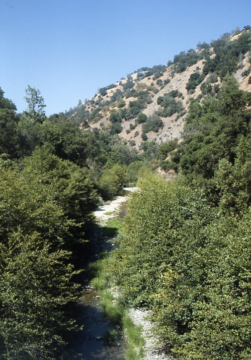 Arroyo HondoCanoeingPhoto: Robert A. Leidy PhD, US EPA, Public domain (via Wikimedia Commons)5.2 mi
Source: Roamze catalog (indexable pages within 10 miles, PostGIS distance)
- Alameda CreekCanoeing · ~8 min drivePhoto: Pi.1415926535, CC BY-SA 4.0 (via Wikimedia Commons)
- Del Valle Boat RampBoat launch · ~18 min drive
- Arroyo HondoCanoeing · ~9 min drivePhoto: Robert A. Leidy PhD, US EPA, Public domain (via Wikimedia Commons)
- Public Boat Launch RampBoat launch · ~39 min drive
 Arroyo ValleCanoeing · ~14 min drivePhoto: Michael C. Berch, CC BY-SA 3.0 (via Wikimedia Commons)
- San Leandro Marina SlipBoat launch · ~45 min drive
 Arroyo de la LagunaCanoeing · ~20 min drivePhoto: Alameda County Resource Conservation District, CC BY-SA 4.0 (via Wikimedia Commons)
- Kite launch 3rd Ave LowerBoat launch · ~46 min drive
 Coyote CreekCanoeing · ~29 min drivePhoto: Dicklyon, CC BY-SA 4.0 (via Wikimedia Commons)
- Kite Launch 3rd Ave UpperBoat launch · ~46 min drive
Also worth it near here
Best time to visit Calaveras Creek
Best months: Year-round. Best months have typical highs of 55–85 °F, lows of 30 °F or warmer (32 °F where the station doesn't record snow), at most one snowy day and no more than 12 wet days.
Jan
59° / 43°
10 wet
Feb
63° / 45°
11 wet
Mar
66° / 48°
10 wet
Apr
70° / 50°
6 wet
May
75° / 53°
4 wet
Jun
80° / 57°
1 wet
Jul
82° / 59°
0 wet
Aug
83° / 60°
0 wet
Sep
81° / 58°
1 wet
Oct
75° / 54°
3 wet
Nov
65° / 47°
7 wet
Dec
59° / 43°
10 wet
Typical high / low (°F) and days with rain or snow, 1991–2020. Measured at San Jose, CA, 9.4 mi away at 67 ft. The station sits about 800 ft lower than this place, so expect it a little cooler here. Source: NOAA NCEI U.S. Climate Normals 1991–2020.

