One Shot: Brandon Semenuk's unReal Segment
- 0.6 mi
- round trip
- 405 ft
- climb
- Singletrack
- surface
- Out and back
- route
- Oct–May
- best months
One Shot: Brandon Semenuk's unReal Segment is a mountain biking route in California, about 2.4 miles from the town of Harmony. It is an out-and-back ride of roughly 1.1 miles, with a one-way climb of about 405 feet from a low point of 416 feet to a high of 848 feet. The route is rated expert, so it is best suited for riders with advanced skills. Spring and fall are the most comfortable times to ride. Typical averages from a nearby weather station in Paso Robles show May highs around 80°F and October highs around 81°F, while July and August average in the low 90s. Several hiking trails lie within a short drive. Cinnabar Rock Trail is about 3.5 miles away, Strawberry Canyon is about 5 miles away, and Santa Rosa Creek Trail - East is about 5.8 miles away. Rocky Butte Truck Trail is about 8.9 miles away.
- Cinnabar Rock TrailHiking3.5 mi
- Strawberry CanyonHiking5 mi
- Santa Rosa Creek Trail - EastHiking5.8 mi
- Rocky Butte Truck TrailHiking8.9 mi
- Town Creek Truck TrailHiking9.3 mi
Source: Roamze catalog (indexable pages within 10 miles, PostGIS distance)
 San AntonioMountain biking · ~1h 15m drivePhoto: Nerijus Navickas, CC BY 3.0 (via Wikimedia Commons)
- Meadow TrailMountain biking · ~31 min drive
- Pick And ShovelMountain biking · ~36 min drive
- Morning GloryMountain biking · ~38 min drive
 Stone RidgeMountain biking · ~1h 16m drivePhoto: garmonb0zia, CC0 (via Wikimedia Commons)
- Oak Woodland Loop TrailMountain biking · ~31 min drive
 Vicente Flat CampMountain biking · ~1h 16m drivePhoto: garmonb0zia, CC0 (via Wikimedia Commons)
- Hazard Peak TrailMountain biking · ~32 min drive
- Cone Peak SummitMountain biking · ~1h 18m drivePhoto: garmonb0zia, CC0 (via Wikimedia Commons)
- Rocky TrailMountain biking · ~53 min drive
Also worth it near here
- Estero Bluffs State Park (West)Beach · ~10 min drive
 Morro Strand State Beach CampgroundCamping · ~20 min drivePhoto: Fred Moore 1947 — CC BY 2.0 (via Flickr)
- Paso Robles CreekCanoeing · ~22 min drive
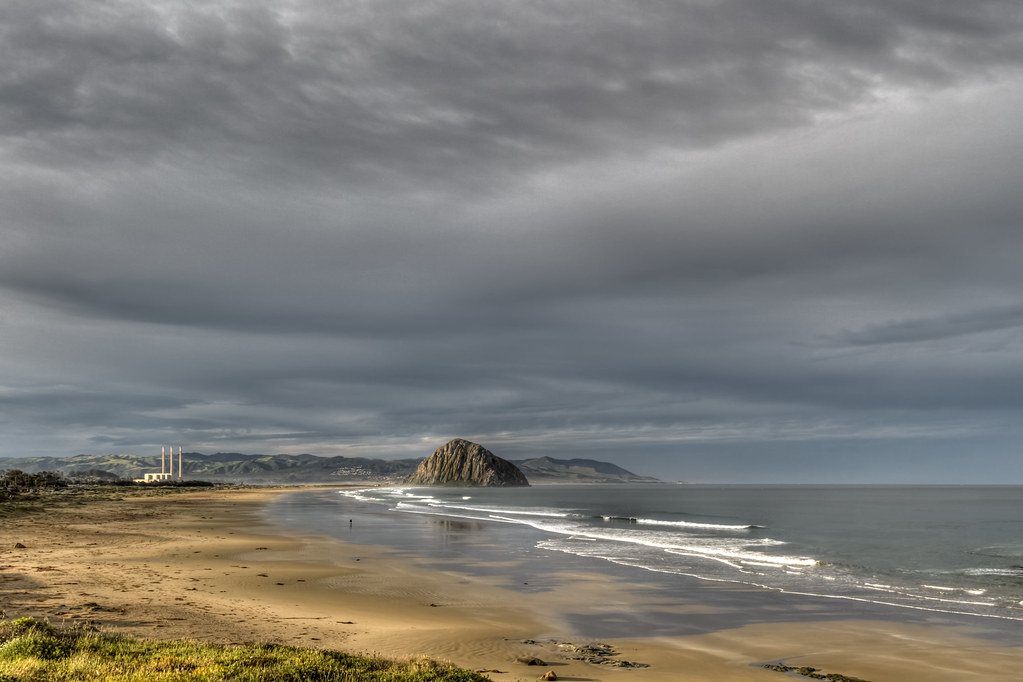
 Morro RockSummit · ~23 min drivePhoto: No machine-readable author provided. Kjkolb assumed (based on copyright claims)., CC BY 2.5 (via Wikimedia Commons)
Best time to visit One Shot: Brandon Semenuk's unReal Segment
Best months: October–May. Best months have typical highs of 55–85 °F, lows of 30 °F or warmer (32 °F where the station doesn't record snow), at most one snowy day and no more than 12 wet days.
Jan
62° / 34°
8 wet
Feb
64° / 37°
9 wet
Mar
68° / 40°
8 wet
Apr
73° / 41°
4 wet
May
80° / 46°
2 wet
Jun
87° / 50°
1 wet
Jul
91° / 53°
0 wet
Aug
92° / 53°
0 wet
Sep
89° / 50°
1 wet
Oct
81° / 43°
2 wet
Nov
69° / 37°
5 wet
Dec
61° / 33°
7 wet
Typical high / low (°F) and days with rain or snow, 1991–2020. Measured at Paso Robles, CA, 18.4 mi away at 730 ft. Source: NOAA NCEI U.S. Climate Normals 1991–2020.
Map and trail data © OpenStreetMap contributors
