University Peak
- 8.5 mi
- round trip
- 5,191 ft
- climb
- 13,607 ft
- high point
- Out and back
- route
Is University Peak open right now?
Alert in the area
The Forest Service lists 3 alerts for Inyo National Forest.
Help Halt Golden Mussel Invasion
Agency alert covering Inyo National Forest · USFS · Inyo National Forest
Ansel Adams and John Muir Wilderness Campfire Restrictions
Agency alert covering Inyo National Forest · Order 05-04-50-25-04 · USFS · Inyo National Forest
Golden Trout and Hoover Wilderness Campfire Restrictions
Agency alert covering Inyo National Forest · Order 05-04-50-25-05 · USFS · Inyo National Forest
As of · Source: USFS · Inyo National Forest. Agencies don't list every closure — check before you go.
University Peak is a demanding out-and-back hike in California's high country, rising to 13,607 feet with a total elevation gain of about 5,191 feet. The route covers roughly 8.5 miles, and it is rated as an expert-level climb. The peak sits within Kings Canyon National Park, on land managed by the National Park Service, and the surrounding area falls within the Mt. Whitney Ranger District of Inyo National Forest. The high point of the climb is the summit itself, and the route folds back on itself, with the same amount of gain as loss. That makes it a natural choice for a base camp at Onion Valley, about 0.3 miles away, or for linking with nearby hikes like Mount Gould and Robinson Basin, both within about a tenth of a mile. The trip takes about 5.5 hours. For an overnight stay, Onion Valley Campground is the closest option, and Grays Meadows Campground is about 2.6 miles away. Climbers will find the Kearsarge Pass to Cedar Grove route about 4.5 miles off.
Local outfitters
- Big Willi Mountaineering Company19 mi away
- Glacier Lodge25 mi away
Not on Roamze yet. Their page has how to reach them.
Conditions and forecast on University Peak
Daily highs and lows, wind and the chance of precipitation at the summit and route start for the next 7 days, from the Open-Meteo model.
- Mount GouldHiking0.1 mi
- Robinson BasinHiking0.1 mi
- Onion Valley Pack StationHiking0.2 mi
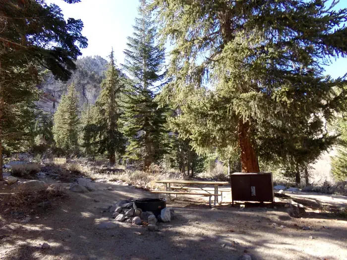 Onion ValleyCampingPhoto: Recreation.gov (RIDB) / public domain0.3 mi
- Grays MeadowsCamping2.6 mi
- Kearsarge Pass to Cedar GroveRock climbing4.5 mi
 Shepherd PassRock climbingPhoto: Jesse Wagstaff, CC BY 2.0 (via Flickr)6.9 mi
- Woods CreekCanoeing9.6 mi
Source: Roamze catalog (indexable pages within 10 miles, PostGIS distance)
 Kearsarge PassHiking · Next doorPhoto: mjhbower, CC BY-SA 2.0 (via Flickr)
 Matlock LakeHiking · ~2 min drivePhoto: mjhbower, CC BY-SA 2.0 (via Flickr)
 Golden Trout Lake North Spur TrailHiking · ~2 min drivePhoto: Jim Morefield, CC BY-SA 2.0 (via Flickr)
- SARDINE LAKEHiking · ~5 min drive
 Baxter PassHiking · ~10 min drivePhoto: Matt Lavin, CC BY-SA 2.0 (via Flickr)
 Kearsarge LakesHiking · ~4 min drivePhoto: Rick McCharles, CC BY 2.0 (via Flickr)
 Dragon Lake TrailHiking · ~6 min drivePhoto: Jeffrey Pang from Berkeley, CA, USA, CC BY 2.0 (via Wikimedia Commons)
- Polychrome PeakHiking · ~8 min drive
 Bubbs CreekHiking · ~10 min drivePhoto: ilya_ktsn, CC BY 2.0 (via Flickr)
- Bullfrog LakeHiking · ~4 min drivePhoto: Rick McCharles, CC BY 2.0 (via Flickr)

Route details
- Distance
- 8.5 mi round trip
- Climbing
- About 5,191 ft
- Starts at
- Onion Valley Trailhead
- Summit
- 13,591 ft
- Difficulty
- Expert
Questions about this route
How long is the University Peak on University Peak?
About 8.5 mi round trip from Onion Valley Trailhead.
How much elevation gain is on the University Peak?
About 5,191 ft of climbing round trip.
How hard is the University Peak?
It is rated expert.
Where does the University Peak start?
Onion Valley Trailhead.
© openrouteservice.org by HeiGIT | Map data © OpenStreetMap contributors
