Dragon Lake Trail
 Photo: Jeffrey Pang from Berkeley, CA, USA, CC BY 2.0 (via Wikimedia Commons)
- 0.7 mi
- round trip
- 865 ft
- climb
- 11,106 ft
- high point
- Out and back
- route
Is Dragon Lake Trail open right now?
No closures listed
The National Park Service lists no closures for Kings Canyon National Park.
As of · Source: NPS · Kings Canyon National Park. Agencies don't list every closure — check before you go.
Dragon Lake Trail is a short, out-and-back hike of about 1.5 miles in Kings Canyon National Park, within the Sequoia-Kings Canyon Wilderness of California. It starts at about 11,100 feet, reaches a high point of 11,106 feet, and ends at the same elevation, with a total climb of about 865 feet and a drop of the same. The steepest stretch, a 46% grade, comes roughly halfway along the route. The trail is managed by the National Park Service. The trip takes about an hour. It makes a good addition to a longer day in the surrounding wilderness, and the trail's own climb gives it a moderate rating. The trail begins inside Kings Canyon National Park, so plan on carrying everything you need for the day. Nearby, Upper Sixty Lakes Basin is about 0.9 miles away, and Rae Lakes is about 1.7 miles off. Climbers can look to the Kearsarge Pass to Cedar Grove route, about 1.9 miles away. Onion Valley campground is about 3 miles from the trail.
Local outfitters
- Glacier Lodge22 mi away
- Big Willi Mountaineering Company23 mi away
Not on Roamze yet. Their page has how to reach them.
- Upper Sixty Lakes BasinHikingPhoto: Jeffrey Pang from Berkeley, CA, USA, CC BY 2.0 (via Wikimedia Commons)0.9 mi
- Rae LakesHiking1.7 mi
- Glen Pass SouthHiking1.7 mi
- Kearsarge Pass to Cedar GroveRock climbing1.9 mi
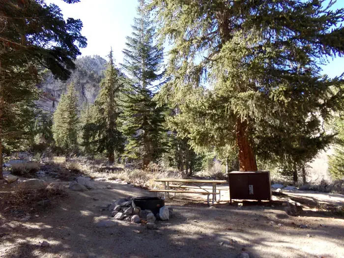 Onion ValleyCampingPhoto: Recreation.gov (RIDB) / public domain3 mi
- Grays MeadowsCamping5.6 mi
- Woods CreekCanoeing6.5 mi
 Shepherd PassRock climbingPhoto: Jesse Wagstaff, CC BY 2.0 (via Flickr)9.3 mi
Source: Roamze catalog (indexable pages within 10 miles, PostGIS distance)
- Upper Sixty Lakes BasinHiking · ~2 min drivePhoto: Jeffrey Pang from Berkeley, CA, USA, CC BY 2.0 (via Wikimedia Commons)
 Golden Trout Lake North Spur TrailHiking · ~4 min drivePhoto: Jim Morefield, CC BY-SA 2.0 (via Flickr)
 Baxter PassHiking · ~4 min drivePhoto: Matt Lavin, CC BY-SA 2.0 (via Flickr)
 Gardiner Basin TrailHiking · ~9 min drivePhoto: Kurt Minard, CC BY-SA 3.0 (via Wikimedia Commons)
 Bullfrog LakeHiking · ~4 min drivePhoto: Rick McCharles, CC BY 2.0 (via Flickr)
- Woods Creek Crossing - Dollar LakeHiking · ~4 min drivePhoto: Matt Lavin, CC BY-SA 2.0 (via Flickr)
 Kearsarge PassHiking · ~5 min drivePhoto: mjhbower, CC BY-SA 2.0 (via Flickr)
- Mount GouldHiking · ~6 min drive
- Kearsarge LakesHiking · ~4 min drivePhoto: Rick McCharles, CC BY 2.0 (via Flickr)
 Vidette SwitchbacksHiking · ~5 min drivePhoto: Matt Lavin, CC BY-SA 2.0 (via Flickr)
Map and trail data © OpenStreetMap contributors
