Soapstone Pond
- 1.0 mi
- round trip
- 106 ft
- climb
- 5,761 ft
- high point
- Out and back
- route
Is Soapstone Pond open right now?
Closure in the area
There's a closure order in Shasta-Trinity National Forest. It doesn't name Soapstone Pond, so check the source for the area it covers (2 listed).
Mud and Ash Creek Area and Road Closure
Agency closure covering Shasta-Trinity National Forest · Order 14-26-13 · USFS · Shasta-Trinity National Forest
Road Closure on Wild Mad Road
Agency closure covering Shasta-Trinity National Forest · Order 14-25-09 · USFS · Shasta-Trinity National Forest
Trout Creek Bridge Closure Order
Agency alert covering Shasta-Trinity National Forest · Order 14-26-02 · USFS · Shasta-Trinity National Forest
South Fork Suspension Bridge Closure
Agency alert covering Shasta-Trinity National Forest · Order 14-25-30 · USFS · Shasta-Trinity National Forest
Ah-Di-Na Area Closure
Agency alert covering Shasta-Trinity National Forest · Order 14-25-10 · USFS · Shasta-Trinity National Forest
As of · Source: USFS · Shasta-Trinity National Forest. Agencies don't list every closure — check before you go.
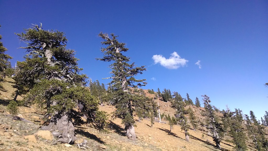
Soapstone Pond is a short, easy hike in the Mt. Shasta Ranger District of Shasta-Trinity National Forest in California, about a mile from the trailhead. The route is an out-and-back that gains about 100 feet in elevation, from a low point of roughly 5,630 feet to a high of about 5,760 feet. The trail is natural-surface and open year-round. Bikes and horses are allowed, and it is not an accessible trail. The Soapstone hike lies about half a mile away, and Gray Rock Lake is about 1.3 miles off. For an overnight stay, Gumboot Lake Campground is about 3.5 miles away, and Castle Lake Campground is about 4.2 miles away.
- SoapstoneHiking0.4 mi
- GRAY ROCK LAKEHiking1.3 mi
- Mt. Shasta AreaLake fishing2.5 mi
- South Fork Sacramento RiverCanoeing3.3 mi
- Gumboot Lake Cg-FCamping3.5 mi
- Bathroom BoulderRock climbing3.9 mi
- Castle Lake CampgroundCamping4.2 mi
 The GrottoRock climbingPhoto: theforestprimeval, CC BY-SA 2.0 (via Flickr)6.5 mi
Source: Roamze catalog (indexable pages within 10 miles, PostGIS distance)
 Gumboot Tie TrailHiking · ~7 min drivePhoto: randomduck, CC BY-SA 2.0 (via Flickr)
 Castle DomeHiking · ~12 min drivePhoto: theforestprimeval, CC BY-SA 2.0 (via Flickr)
 Toad LakeHiking · ~12 min drivePhoto: theforestprimeval, CC BY-SA 2.0 (via Flickr)
- Pacific Crest TrailHiking · ~7 min drivePhoto: randomduck, CC BY-SA 2.0 (via Flickr)
- Picayune Lake South TrailHiking · ~8 min drivePhoto: randomduck, CC BY-SA 2.0 (via Flickr)
- Root Creek TrailHiking · ~12 min drivePhoto: theforestprimeval, CC BY-SA 2.0 (via Flickr)
 Flume TrailHiking · ~13 min drivePhoto: AlishaV, CC BY 2.0 (via Flickr)
- Pacific Crest TrailHiking · ~7 min drive
- Indian Creek Nature Loop TrailHiking · ~12 min drivePhoto: AlishaV, CC BY 2.0 (via Flickr)
- Seven LakesHiking · ~5 min drive

