Seven Lakes
- 5.5 mi
- round trip
- 884 ft
- climb
- 6,804 ft
- high point
- Out and back
- route
Is Seven Lakes open right now?
Closure in the area
There's a closure order in Shasta-Trinity National Forest. It doesn't name Seven Lakes, so check the source for the area it covers (2 listed).
Mud and Ash Creek Area and Road Closure
Agency closure covering Shasta-Trinity National Forest · Order 14-26-13 · USFS · Shasta-Trinity National Forest
Road Closure on Wild Mad Road
Agency closure covering Shasta-Trinity National Forest · Order 14-25-09 · USFS · Shasta-Trinity National Forest
Trout Creek Bridge Closure Order
Agency alert covering Shasta-Trinity National Forest · Order 14-26-02 · USFS · Shasta-Trinity National Forest
South Fork Suspension Bridge Closure
Agency alert covering Shasta-Trinity National Forest · Order 14-25-30 · USFS · Shasta-Trinity National Forest
Ah-Di-Na Area Closure
Agency alert covering Shasta-Trinity National Forest · Order 14-25-10 · USFS · Shasta-Trinity National Forest
As of · Source: USFS · Shasta-Trinity National Forest. Agencies don't list every closure — check before you go.
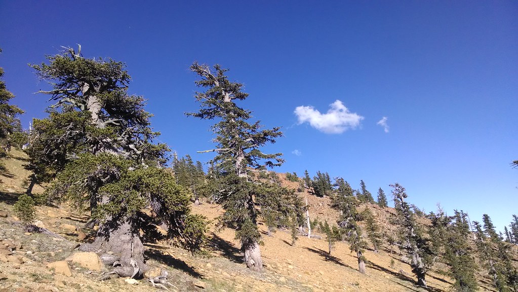
Seven Lakes is a moderate out-and-back hike in the Mt. Shasta Ranger District of Shasta-Trinity National Forest in California, about 5.5 miles long with an elevation gain of 884 feet. The trail starts at a low point of about 5,917 feet and climbs to a high point of about 6,804 feet. The route is natural-surfaced and allows bikes, so it works for hikers and riders alike. It is open year-round, and the surrounding forest makes it a base for exploring other trails and campgrounds in the area. Heaven's Spring Trail lies about 1.6 miles away, and Gumboot Tie Trail and Gumboot Lake Campground are both about 1.9 miles off. Farther out, the Mt. Shasta Area fishing waters sit about 5.2 miles away.
- Heaven's Spring TrailHiking1.6 mi
 Gumboot Tie TrailHikingPhoto: randomduck, CC BY-SA 2.0 (via Flickr)1.9 mi
- Gumboot Lake Cg-FCamping1.9 mi
- Mt. Shasta AreaLake fishing5.2 mi
- South Fork Sacramento RiverCanoeing5.4 mi
- Toad Lake CgCamping6.6 mi
- Bathroom BoulderRock climbing6.7 mi
 Castle CragsRock climbingPhoto: theforestprimeval, CC BY-SA 2.0 (via Flickr)8.9 mi
Source: Roamze catalog (indexable pages within 10 miles, PostGIS distance)
- Gumboot Tie TrailHiking · ~3 min drivePhoto: randomduck, CC BY-SA 2.0 (via Flickr)
- Pacific Crest TrailHiking · ~4 min drivePhoto: randomduck, CC BY-SA 2.0 (via Flickr)
 Toad LakeHiking · ~14 min drivePhoto: theforestprimeval, CC BY-SA 2.0 (via Flickr)
 Castle DomeHiking · ~16 min drivePhoto: theforestprimeval, CC BY-SA 2.0 (via Flickr)
- Picayune Lake South TrailHiking · ~5 min drivePhoto: randomduck, CC BY-SA 2.0 (via Flickr)
- Pacific Crest TrailHiking · ~11 min drive
 Flume TrailHiking · ~16 min drivePhoto: AlishaV, CC BY 2.0 (via Flickr)
 Root Creek TrailHiking · ~16 min drivePhoto: theforestprimeval, CC BY-SA 2.0 (via Flickr)
- Sisson Callahan TrailHiking · ~14 min drivePhoto: theforestprimeval, CC BY-SA 2.0 (via Flickr)
- Bear Lakes TrailHiking · ~15 min drive

