Skyline Loop # 1
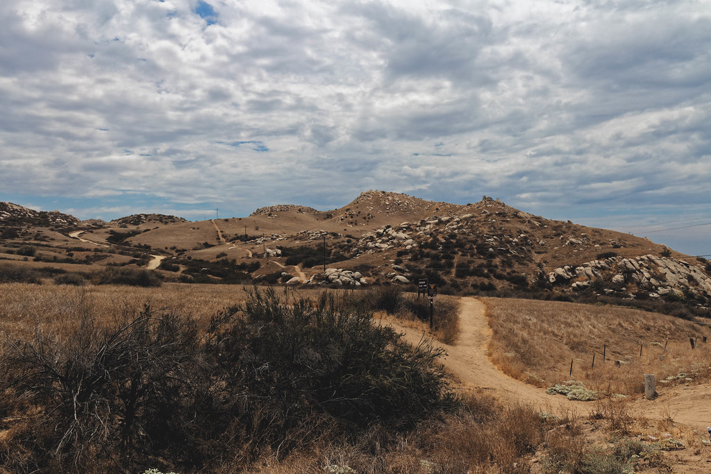 Photo: grimneko, CC BY-SA 2.0 (via Flickr)
- 2.5 mi
- loop
- 1,079 ft
- climb
- 2,345 ft
- high point
- Loop
- route
- Oct–May
- best months
Skyline Loop #1 is a 2.5-mile loop hike in California, about 1.2 miles from the town of Belvedere Heights. The trail climbs to a high point of 2,345 feet, with a total elevation gain of 1,079 feet. The climb is moderate, with the steepest stretch at about 1.6 miles in, where the grade reaches 16%. Spring and fall bring the most comfortable conditions. Typical averages from a nearby weather station show April highs around 74°F and October highs around 82°F, while summer highs there climb into the low 90s. The hike takes about 1.5 hours. Two Trees Trail and Edison Trail both start within a quarter mile. The Pigeon Pass Area climbing spot is 0.3 miles away, and the Belvedere Heights Area is 0.9 miles away.
 Two Trees TrailHikingPhoto: grimneko, CC BY-SA 2.0 (via Flickr)0.1 mi
- Edison TrailHikingPhoto: grimneko, CC BY-SA 2.0 (via Flickr)0.2 mi
- Pigeon Pass AreaRock climbing0.3 mi
 Spring TrailHikingPhoto: grimneko, CC BY-SA 2.0 (via Flickr)0.3 mi
- Two Trees Trail AreaRock climbing0.6 mi
- Belvedere Heights AreaRock climbing0.9 mi
- San Timoteo WashCanoeing5.4 mi
 Santa Ana RiverCanoeingPhoto: Basar, CC BY-SA 3.0 (via Wikimedia Commons)7 mi
Source: Roamze catalog (indexable pages within 10 miles, PostGIS distance)
- Two Trees TrailHiking · Next doorPhoto: grimneko, CC BY-SA 2.0 (via Flickr)
- Edison TrailHiking · Next doorPhoto: grimneko, CC BY-SA 2.0 (via Flickr)
 "M" TrailHiking · ~3 min drivePhoto: grimneko, CC BY-SA 2.0 (via Flickr)
- Spring TrailHiking · Next doorPhoto: grimneko, CC BY-SA 2.0 (via Flickr)
- West RidgeHiking · ~7 min drive
- Skyline Loop # 2Hiking · ~1 min drivePhoto: grimneko, CC BY-SA 2.0 (via Flickr)
- Gage Canal PathHiking · ~11 min drive
 "M" TrailHiking · ~1 min drivePhoto: grimneko, CC BY-SA 2.0 (via Flickr)
- Jurupa Hills HikeHiking · ~16 min drive
 Cocomaricopa TrailHiking · ~10 min drivePhoto: inkknife_2000 (7.5 million views +), CC BY-SA 2.0 (via Wikimedia Commons)
Also worth it near here
- Poorman's ReservoirLake fishing · ~5 min drive
- Mountain View AvenueMountain biking · ~8 min drive
 Hardy Boy AreaRock climbing · ~10 min drivePhoto: nccmrm97, CC BY-SA 2.0 (via Flickr)
 Mount RubidouxSummit · ~10 min drivePhoto: No machine-readable author provided. Takwish assumed (based on copyright claims)., CC BY-SA 2.5 (via Wikimedia Commons)
Best time to visit Skyline Loop # 1
Best months: October–May. Best months have typical highs of 55–85 °F, lows of 30 °F or warmer (32 °F where the station doesn't record snow), at most one snowy day and no more than 12 wet days.
Jan
66° / 37°
Feb
66° / 38°
Mar
71° / 40°
Apr
74° / 44°
May
80° / 51°
Jun
87° / 56°
Jul
94° / 62°
Aug
95° / 62°
Sep
92° / 59°
Oct
82° / 49°
Nov
72° / 41°
Dec
65° / 37°
Typical high / low (°F) and days with rain or snow, 1991–2020. Measured at March Afb, CA, 6.2 mi away at 1,516 ft. The station sits about 800 ft lower than this place, so expect it a little cooler here. This station doesn't record snowfall. Source: NOAA NCEI U.S. Climate Normals 1991–2020.
Map and trail data © OpenStreetMap contributors
