North Fork Coffee Creek Trail
- 1.5 mi
- round trip
- 2,319 ft
- climb
- 4,134 ft
- high point
- Out and back
- route
- Mar–Jun, Sep–Oct
- best months
Caution today
Agency alerts are in effect for this area; weather is marginal · USFS, OpenWeather · checked 7 h ago
Is North Fork Coffee Creek Trail open right now?
Closure in the area
There's a closure order in Shasta-Trinity National Forest. It doesn't name North Fork Coffee Creek Trail, so check the source for the area it covers (2 listed).
Mud and Ash Creek Area and Road Closure
Agency closure covering Shasta-Trinity National Forest · Order 14-26-13 · USFS · Shasta-Trinity National Forest
Road Closure on Wild Mad Road
Agency closure covering Shasta-Trinity National Forest · Order 14-25-09 · USFS · Shasta-Trinity National Forest
Trout Creek Bridge Closure Order
Agency alert covering Shasta-Trinity National Forest · Order 14-26-02 · USFS · Shasta-Trinity National Forest
South Fork Suspension Bridge Closure
Agency alert covering Shasta-Trinity National Forest · Order 14-25-30 · USFS · Shasta-Trinity National Forest
Ah-Di-Na Area Closure
Agency alert covering Shasta-Trinity National Forest · Order 14-25-10 · USFS · Shasta-Trinity National Forest
As of · Source: USFS · Shasta-Trinity National Forest. Agencies don't list every closure — check before you go.
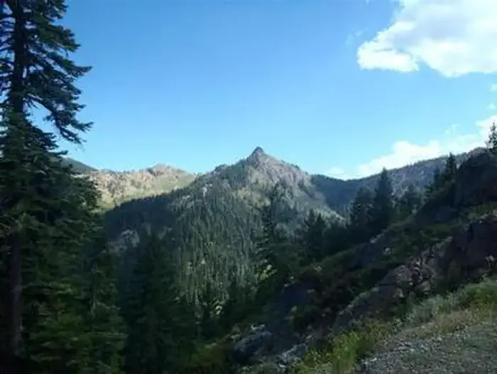
North Fork Coffee Creek Trail is a moderate out-and-back hike in California's Trinity Alps Wilderness, within the Weaverville Ranger District of the Shasta-Trinity National Forest. The Forest Service manages the land, and the trail starts at about 4,134 feet, rising to a high point of 4,134 feet before descending back to the same level. That makes the total elevation gain about 2,319 feet for the round trip, with the steepest stretch at about 0.8 miles in, where the grade reaches 21 percent. The most comfortable months for a visit are typically late spring and early fall. Typical averages from a nearby weather station at Callahan, CA, show May highs around 73°F and September highs around 83°F, while July and August average near 90°F. That station sits roughly 1,000 feet lower than the trail, so temperatures on the route run cooler. The hike takes about two hours. The North Fork Coffee Creek and Milk Ranch Trail are both within about 1.5 miles, and Coffee Creek offers canoeing about 1.8 miles away. For an overnight stay, Goldfield Campground is about 4.5 miles off.
- NORTH FORK COFFEE CREEKHiking1.2 mi
- Milk Ranch TrailHiking1.5 mi
- Coffee CreekCanoeing1.8 mi
- East Fork Coffee CreekHiking2 mi
- Sugar Pine LakeHiking2 mi
- Goldfield Cg-FCamping4.5 mi
- Big Flat CampgroundCamping6.4 mi
 Carter Meadows Horse GroupCampingPhoto: Recreation.gov (RIDB) / public domain6.7 mi
Source: Roamze catalog (indexable pages within 10 miles, PostGIS distance)
- NORTH FORK COFFEE CREEKHiking · ~2 min drive
- East Fork Coffee CreekHiking · ~3 min drive
- Union CreekHiking · ~4 min drive
- Milk RanchHiking · ~4 min drive
- North Fork Coffee Creek TrailHiking · ~5 min drive
- Sugar Pine LakeHiking · ~3 min drive
- EAST FORK COFFEE CREEKHiking · ~4 min drive
- Saloon CreekHiking · ~5 min drive
- East Fork Coffee Creek TrailHiking · ~8 min drive
- SUGAR PINE LAKEHiking · ~4 min drive
Best time to visit North Fork Coffee Creek Trail
Best months: March–June and September–October. Best months have typical highs of 55–85 °F, lows of 30 °F or warmer (32 °F where the station doesn't record snow), at most one snowy day and no more than 12 wet days.
Jan
48° / 28°
13 wet
Feb
53° / 30°
12 wet
Mar
59° / 32°
12 wet
Apr
65° / 35°
10 wet
May
73° / 40°
8 wet
Jun
81° / 45°
4 wet
Jul
90° / 51°
3 wet
Aug
89° / 49°
2 wet
Sep
83° / 43°
3 wet
Oct
70° / 36°
6 wet
Nov
54° / 31°
11 wet
Dec
46° / 28°
13 wet
Typical high / low (°F) and days with rain or snow, 1991–2020. Measured at Callahan, CA, 14 mi away at 3,085 ft. The station sits about 1,000 ft lower than this place, so expect it a little cooler here. This station doesn't record snowfall. Source: NOAA NCEI U.S. Climate Normals 1991–2020.
Map and trail data © OpenStreetMap contributors
