Mesa Trail
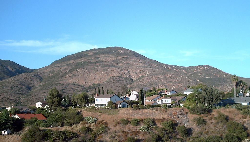
 Photo: Richard Leneau, CC BY-SA 3.0 (via Wikimedia Commons)
- 0.8 mi
- round trip
- 930 ft
- climb
- 889 ft
- high point
- Out and back
- route
- Oct–Jun
- best months
Mesa Trail is a 1.5-mile out-and-back hike in Mission Trails Regional Park, a city-managed park in San Diego, California. The trail starts at about 500 feet and climbs to a high point of 890 feet, with a total gain of 930 feet over the round trip. The climb is front-loaded, and the steepest stretch comes within the first quarter mile, where the grade reaches about 26 percent. Spring and fall are the most comfortable times to go. Typical averages from a nearby weather station in El Cajon show April highs around 75°F and October highs around 81°F, while August averages reach 89°F. That station sits about 400 feet lower than the trail's high point, so temperatures on the ridge run a little cooler. The hike takes about an hour. Big Rock Trail is 0.6 miles away, and Barker Way Trail and East Barker Spur Trail are both within a mile. Climbers can find The Donkey Dick Area about 2 miles off.
Local outfitters
- Hike Bike Kayak Adventure Tours14 mi away
- Borrego Outfitters47 mi away
Not on Roamze yet. Their page has how to reach them.
- Big Rock TrailHikingPhoto: Richard Leneau, CC BY-SA 3.0 (via Wikimedia Commons)0.6 mi
 Barker Way TrailHikingPhoto: ptjoe12000, CC BY 2.0 (via Flickr)0.9 mi
 East Barker Spur TrailHikingPhoto: michaelwm25, CC BY 3.0 (via Wikimedia Commons)1 mi
 Pyles Peak Trail (closed)HikingPhoto: michaelwm25, CC BY 3.0 (via Wikimedia Commons)1.3 mi
- The Donkey Dick AreaRock climbing1.9 mi
- Hillside AreaRock climbing2 mi
- Painted Crack BoulderRock climbing2 mi
- San Diego RiverCanoeing8.9 mi
Source: Roamze catalog (indexable pages within 10 miles, PostGIS distance)
- Big Rock TrailHiking · Next doorPhoto: Richard Leneau, CC BY-SA 3.0 (via Wikimedia Commons)
- Barker Way TrailHiking · ~2 min drivePhoto: ptjoe12000, CC BY 2.0 (via Flickr)
- East Barker Spur TrailHiking · ~2 min drivePhoto: michaelwm25, CC BY 3.0 (via Wikimedia Commons)
- Pyles Peak TrailHiking · ~3 min drivePhoto: michaelwm25, CC BY 3.0 (via Wikimedia Commons)
- Pyles Peak Trail (closed)Hiking · ~2 min drivePhoto: michaelwm25, CC BY 3.0 (via Wikimedia Commons)
 Cowles Mountain TrailHiking · ~3 min drivePhoto: michaelwm25, CC BY 3.0 (via Wikimedia Commons)
 San Diego River TrailHiking · ~3 min drivePhoto: Allan Ferguson, CC BY 2.0 (via Flickr)
 Kwaay Paay Peak TrailHiking · ~3 min drivePhoto: Roebot, CC BY-SA 2.0 (via Flickr)
 North Fortuna Perimeter TrailHiking · ~3 min drivePhoto: Robert DuHamel, CC BY-SA 3.0 (via Wikimedia Commons)
 South Fortuna TrailHiking · ~5 min drivePhoto: sdstrowes, CC BY-SA 2.0 (via Flickr)
Also worth it near here
Best time to visit Mesa Trail
Best months: October–June. Best months have typical highs of 55–85 °F, lows of 30 °F or warmer (32 °F where the station doesn't record snow), at most one snowy day and no more than 12 wet days.
Jan
69° / 43°
6 wet
Feb
69° / 44°
6 wet
Mar
71° / 48°
5 wet
Apr
75° / 51°
3 wet
May
76° / 56°
2 wet
Jun
81° / 59°
1 wet
Jul
86° / 63°
1 wet
Aug
89° / 65°
0 wet
Sep
87° / 62°
1 wet
Oct
81° / 56°
2 wet
Nov
75° / 47°
3 wet
Dec
69° / 42°
5 wet
Typical high / low (°F) and days with rain or snow, 1991–2020. Measured at El Cajon, CA, 5.2 mi away at 495 ft. Source: NOAA NCEI U.S. Climate Normals 1991–2020.

Map and trail data © OpenStreetMap contributors
