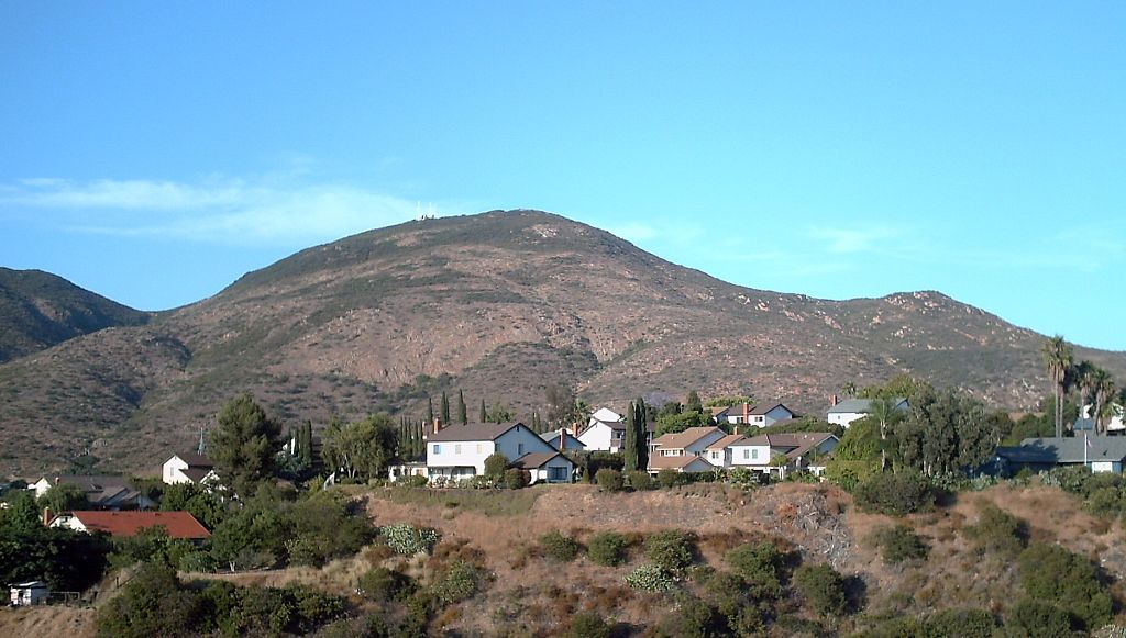
Cowles Mountain Trail
 Photo: michaelwm25, CC BY 3.0 (via Wikimedia Commons)
- 1.5 mi
- round trip
- 1,071 ft
- climb
- 1,544 ft
- high point
- Out and back
- route
- Oct–Jun
- best months
Cowles Mountain Trail is a 3.0-mile out-and-back hike in California with 1,071 feet of elevation gain. The route reaches a maximum elevation of 1,544 feet.
Local outfitters
- Hike Bike Kayak Adventure Tours13 mi away
- Borrego Outfitters49 mi away
Not on Roamze yet. Their page has how to reach them.
Conditions and forecast on Cowles Mountain
Daily highs and lows, wind and the chance of precipitation at the summit and route start for the next 7 days, from the Open-Meteo model.
 East Barker Spur TrailHikingPhoto: michaelwm25, CC BY 3.0 (via Wikimedia Commons)0.8 mi
 Barker Way TrailHikingPhoto: ptjoe12000, CC BY 2.0 (via Flickr)0.9 mi
- Navajo - Rancho Mission PathHiking1 mi
 Pyles Peak TrailHikingPhoto: michaelwm25, CC BY 3.0 (via Wikimedia Commons)1.1 mi
- The UnderworldRock climbing1.4 mi
 Middle EarthRock climbingPhoto: The Dye Clan, CC BY-SA 3.0 (via Wikimedia Commons)1.5 mi
- The Big Orange Block (aka The Spear Head)Rock climbing1.6 mi
- The Grinding Stones CircuitRock climbing1.6 mi
Source: Roamze catalog (indexable pages within 10 miles, PostGIS distance)
- East Barker Spur TrailHiking · ~1 min drivePhoto: michaelwm25, CC BY 3.0 (via Wikimedia Commons)
- Barker Way TrailHiking · ~2 min drivePhoto: ptjoe12000, CC BY 2.0 (via Flickr)
 Cabaret - Rancho Mission Park pathHiking · ~2 min drivePhoto: chrisinphilly5448, CC BY-SA 2.0 (via Flickr)
- Pyles Peak TrailHiking · ~2 min drivePhoto: michaelwm25, CC BY 3.0 (via Wikimedia Commons)
- Pyles Peak Trail (closed)Hiking · ~2 min drivePhoto: michaelwm25, CC BY 3.0 (via Wikimedia Commons)
 Mesa TrailHiking · ~3 min drivePhoto: Richard Leneau, CC BY-SA 3.0 (via Wikimedia Commons)
 Oak Grove Loop TrailHiking · ~3 min drivePhoto: Robert DuHamel, CC BY-SA 3.0 (via Wikimedia Commons)
 South Fortuna TrailHiking · ~4 min drivePhoto: sdstrowes, CC BY-SA 2.0 (via Flickr)
- Visitor Center Loop TrailHiking · ~3 min drivePhoto: Robert DuHamel, CC BY-SA 3.0 (via Wikimedia Commons)
 Kwaay Paay Peak TrailHiking · ~4 min drivePhoto: Roebot, CC BY-SA 2.0 (via Flickr)
Best time to visit Cowles Mountain Trail
Best months: October–June. Best months have typical highs of 55–85 °F, lows of 30 °F or warmer (32 °F where the station doesn't record snow), at most one snowy day and no more than 12 wet days.
Jan
69° / 43°
6 wet
Feb
69° / 44°
6 wet
Mar
71° / 48°
5 wet
Apr
75° / 51°
3 wet
May
76° / 56°
2 wet
Jun
81° / 59°
1 wet
Jul
86° / 63°
1 wet
Aug
89° / 65°
0 wet
Sep
87° / 62°
1 wet
Oct
81° / 56°
2 wet
Nov
75° / 47°
3 wet
Dec
69° / 42°
5 wet
Typical high / low (°F) and days with rain or snow, 1991–2020. Measured at El Cajon, CA, 6.4 mi away at 495 ft. The station sits about 1,000 ft lower than this place, so expect it a little cooler here. Source: NOAA NCEI U.S. Climate Normals 1991–2020.
Route details
- Distance
- 1.5 mi round trip
- Climbing
- About 1,071 ft
- Summit
- 1,587 ft
- Difficulty
- Moderate
- Time
- About 1 hour
Other routes up Cowles Mountain
Questions about this route
How long is the Cowles Mountain Trail on Cowles Mountain?
About 1.5 mi round trip.
How much elevation gain is on the Cowles Mountain Trail?
About 1,071 ft of climbing round trip.
How hard is the Cowles Mountain Trail?
It is rated moderate.
How long does the Cowles Mountain Trail take?
About 1 hour round trip.
How many routes go up Cowles Mountain?
2: Pyles Peak Trail and Cowles Mountain Trail.
Map and trail data © OpenStreetMap contributors
