Barker Way Trail
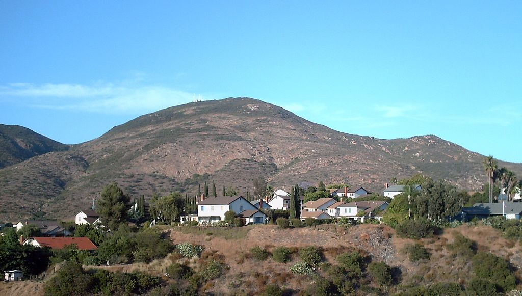
 Photo: ptjoe12000, CC BY 2.0 (via Flickr)
- 0.7 mi
- round trip
- 1,083 ft
- climb
- 1,292 ft
- high point
- Out and back
- route
- Oct–Jun
- best months
Barker Way Trail is a moderate out-and-back hike in Mission Trails Regional Park, a city-managed park in San Diego, California. The trail is about 0.7 miles long, and the round trip climbs about 1,080 feet, with the steepest stretch at the start, where the grade reaches about 21 percent. The high point is roughly 1,290 feet, and the trail begins at about 857 feet. Spring and fall are the most comfortable times to go. Typical averages from a nearby weather station in El Cajon show April highs around 75°F and October highs around 81°F, while August averages about 89°F. That station sits well below the trail, so temperatures on the climb run cooler. The East Barker Spur Trail starts just 0.1 mile away, and Cowles Mountain Trail and Mesa Trail are each about 0.9 mile off. Climbers can find the Middle Earth area about 1.8 miles away.
Local outfitters
- Hike Bike Kayak Adventure Tours14 mi away
- Borrego Outfitters48 mi away
Not on Roamze yet. Their page has how to reach them.
 East Barker Spur TrailHikingPhoto: michaelwm25, CC BY 3.0 (via Wikimedia Commons)0.1 mi
 Cowles Mountain TrailHikingPhoto: michaelwm25, CC BY 3.0 (via Wikimedia Commons)0.9 mi
 Mesa TrailHikingPhoto: Richard Leneau, CC BY-SA 3.0 (via Wikimedia Commons)0.9 mi
 Pyles Peak TrailHikingPhoto: michaelwm25, CC BY 3.0 (via Wikimedia Commons)1.1 mi
 Middle EarthRock climbingPhoto: The Dye Clan, CC BY-SA 3.0 (via Wikimedia Commons)1.8 mi
- Limbo AreaRock climbing1.8 mi
- Lunch RockRock climbing1.9 mi
- San Diego RiverCanoeing9.8 mi
Source: Roamze catalog (indexable pages within 10 miles, PostGIS distance)
- East Barker Spur TrailHiking · Next doorPhoto: michaelwm25, CC BY 3.0 (via Wikimedia Commons)
- Cowles Mountain TrailHiking · ~2 min drivePhoto: michaelwm25, CC BY 3.0 (via Wikimedia Commons)
- Pyles Peak Trail (closed)Hiking · ~2 min drivePhoto: michaelwm25, CC BY 3.0 (via Wikimedia Commons)
- Mesa TrailHiking · ~2 min drivePhoto: Richard Leneau, CC BY-SA 3.0 (via Wikimedia Commons)
- Big Rock TrailHiking · ~2 min drivePhoto: Richard Leneau, CC BY-SA 3.0 (via Wikimedia Commons)
- Pyles Peak TrailHiking · ~2 min drivePhoto: michaelwm25, CC BY 3.0 (via Wikimedia Commons)
 Oak Grove Loop TrailHiking · ~3 min drivePhoto: Robert DuHamel, CC BY-SA 3.0 (via Wikimedia Commons)
 Kwaay Paay Peak TrailHiking · ~4 min drivePhoto: Roebot, CC BY-SA 2.0 (via Flickr)
- Visitor Center Loop TrailHiking · ~3 min drivePhoto: Robert DuHamel, CC BY-SA 3.0 (via Wikimedia Commons)
 South Fortuna TrailHiking · ~4 min drivePhoto: sdstrowes, CC BY-SA 2.0 (via Flickr)
Also worth it near here
Best time to visit Barker Way Trail
Best months: October–June. Best months have typical highs of 55–85 °F, lows of 30 °F or warmer (32 °F where the station doesn't record snow), at most one snowy day and no more than 12 wet days.
Jan
69° / 43°
6 wet
Feb
69° / 44°
6 wet
Mar
71° / 48°
5 wet
Apr
75° / 51°
3 wet
May
76° / 56°
2 wet
Jun
81° / 59°
1 wet
Jul
86° / 63°
1 wet
Aug
89° / 65°
0 wet
Sep
87° / 62°
1 wet
Oct
81° / 56°
2 wet
Nov
75° / 47°
3 wet
Dec
69° / 42°
5 wet
Typical high / low (°F) and days with rain or snow, 1991–2020. Measured at El Cajon, CA, 5.6 mi away at 495 ft. The station sits about 800 ft lower than this place, so expect it a little cooler here. Source: NOAA NCEI U.S. Climate Normals 1991–2020.
Map and trail data © OpenStreetMap contributors
