Mallard Slough Trail Spur
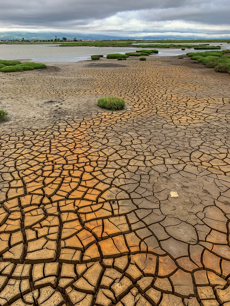
 Photo: PLeia2, CC BY 2.0 (via Flickr)
- 0.5 mi
- round trip
- 32 ft
- climb
- 5 ft
- high point
- Out and back
- route
- Jan–Dec
- best months
Mallard Slough Trail Spur is a short, easy hike of about half a mile on the Don Edwards San Francisco Bay National Wildlife Refuge in California, managed by the U.S. Fish and Wildlife Service. The trail is an out-and-back with a total round-trip distance of about 1.1 miles and a total elevation gain of about 32 feet, so it's a flat, low-effort walk. Late spring through early fall is the most comfortable time to go. Typical averages from a nearby weather station in Newark show highs around 71°F in May and 77°F in July and August, with only a few wet days in summer. Winter brings highs near 58°F and about 10 wet days a month. Alviso Slough Trail, a mountain biking route, lies about 0.6 miles away, and Mallard Slough Trail and West Lagoon Trail are both within about 2 miles. Paddlers can reach Alameda Creek, roughly 8.6 miles off.
- Alviso Slough TrailMountain biking0.6 mi
 Mallard Slough TrailHikingPhoto: donjd2, CC BY 2.0 (via Flickr)1.5 mi
- West Lagoon TrailHiking1.7 mi
 Alameda CreekCanoeingPhoto: Pi.1415926535, CC BY-SA 4.0 (via Wikimedia Commons)8.6 mi
- Calaveras CreekCanoeing9 mi
 Indian Joe Caves boulderingRock climbingPhoto: npdoty, CC BY 2.0 (via Flickr)9.6 mi
- Cleavage RockRock climbing9.7 mi
- Indian Joe CavesRock climbingPhoto: npdoty, CC BY 2.0 (via Flickr)9.7 mi
Source: Roamze catalog (indexable pages within 10 miles, PostGIS distance)
- Mallard Slough TrailHiking · ~3 min drivePhoto: donjd2, CC BY 2.0 (via Flickr)
 Hidden Valley TrailHiking · ~8 min drivePhoto: J Doll, CC BY 3.0 (via Wikimedia Commons)
 Sierra TrailHiking · ~10 min drivePhoto: Lukáš Lalinský, CC BY-SA 2.0 (via Flickr)
 Bay Area Ridge TrailHiking · ~9 min drivePhoto: Lukáš Lalinský, CC BY-SA 2.0 (via Flickr)
 Calaveras Ridge TrailHiking · ~10 min drivePhoto: Ken Lund, CC BY-SA 2.0 (via Flickr)
- Peak Meadow TrailHiking · ~10 min drivePhoto: J Doll, CC BY 3.0 (via Wikimedia Commons)
 Spring Valley TrailHiking · ~11 min drivePhoto: vonguard, CC BY-SA 2.0 (via Flickr)
- Horse Heaven TrailHiking · ~10 min drivePhoto: J Doll, CC BY 3.0 (via Wikimedia Commons)
- Calaveras Ridge TrailHiking · ~11 min drivePhoto: Ken Lund, CC BY-SA 2.0 (via Flickr)
- Peak TrailHiking · ~10 min drivePhoto: vonguard, CC BY-SA 2.0 (via Flickr)
Best time to visit Mallard Slough Trail Spur
Best months: Year-round. Best months have typical highs of 55–85 °F, lows of 30 °F or warmer (32 °F where the station doesn't record snow), at most one snowy day and no more than 12 wet days.
Jan
58° / 43°
10 wet
Feb
61° / 46°
9 wet
Mar
64° / 48°
9 wet
Apr
67° / 50°
6 wet
May
71° / 53°
3 wet
Jun
75° / 56°
1 wet
Jul
77° / 58°
0 wet
Aug
77° / 58°
0 wet
Sep
77° / 58°
1 wet
Oct
73° / 54°
3 wet
Nov
65° / 47°
7 wet
Dec
58° / 43°
10 wet
Typical high / low (°F) and days with rain or snow, 1991–2020. Measured at Newark, CA, 5 mi away at 10 ft. Source: NOAA NCEI U.S. Climate Normals 1991–2020.

Map and trail data © OpenStreetMap contributors
