Landers Lake
 Photo: ilya_ktsn, CC BY 2.0 (via Flickr)
- 8.4 mi
- round trip
- 1,400 ft
- climb
- 6,910 ft
- high point
- Out and back
- route
Is Landers Lake open right now?
Closure in the area
There's a closure order in Shasta-Trinity National Forest. It doesn't name Landers Lake, so check the source for the area it covers (2 listed).
Road Closure on Wild Mad Road
Agency closure covering Shasta-Trinity National Forest · Order 14-25-09 · USFS · Shasta-Trinity National Forest
Mud and Ash Creek Area and Road Closure
Agency closure covering Shasta-Trinity National Forest · Order 14-25-07 · USFS · Shasta-Trinity National Forest
Bailey Cove Road Closure Order
Agency alert covering Shasta-Trinity National Forest · Order 14-25-11 · USFS · Shasta-Trinity National Forest
Trout Creek Bridge Closure Order
Agency alert covering Shasta-Trinity National Forest · Order 14-26-02 · USFS · Shasta-Trinity National Forest
South Fork Suspension Bridge Closure
Agency alert covering Shasta-Trinity National Forest · Order 14-25-30 · USFS · Shasta-Trinity National Forest
As of · Source: USFS · Shasta-Trinity National Forest. Agencies don't list every closure — check before you go.
Landers Lake is a hard hike in the Trinity Alps Wilderness, part of the Weaverville Ranger District of Shasta-Trinity National Forest in northern California. The Forest Service manages the land, and the route is an out-and-back of about 8.4 miles with a one-way climb of about 1,400 feet, from a low point of about 5,495 feet to a high of about 6,910 feet. The trail is on natural surface, and horses are allowed. Bikes are not. That makes it a good fit for riders on horseback or on foot, and a less practical choice for cyclists. Several other destinations sit close by. Sunrise Creek is about half a mile away, and the Landers Lake Spur Trail (9W09A) is about 1.4 miles off. For an overnight stay, Big Flat Campground is about 5 miles away, and Mary Smith Campground is about 6.4 miles away.
Keep exploring — more trails worth the drive
Photo: ilya_ktsn, CC BY 2.0 (via Flickr)Sunrise Creek
Next door
3.57-mile out-and-back trail in California with 1,513 ft elevation gain.
 Photo: ilya_ktsn, CC BY 2.0 (via Flickr)
Mumford Basin Trail (Not Maintained)
~5 min drive
6.6-mile out-and-back trail in California with 2,677 ft elevation gain and loss.
 Photo: ilya_ktsn, CC BY 2.0 (via Flickr)
Seven Up Peak
~7 min drive
2.40-mile out-and-back trail in California with 758 ft gain.
HIKE
Swift Creek Trail
~8 min drive
17.32-mile out-and-back trail in California with 3,356 ft elevation gain
 Photo: ilya_ktsn, CC BY 2.0 (via Flickr)
Ward Lake
~4 min drive
3.00-mile out-and-back trail in California with 7,952 ft elevation gain.
 Photo: ilya_ktsn, CC BY 2.0 (via Flickr)
Granite Lake
~6 min drive
13.88-mile out-and-back to Granite Lake in California with 3,468 ft elevation gain.
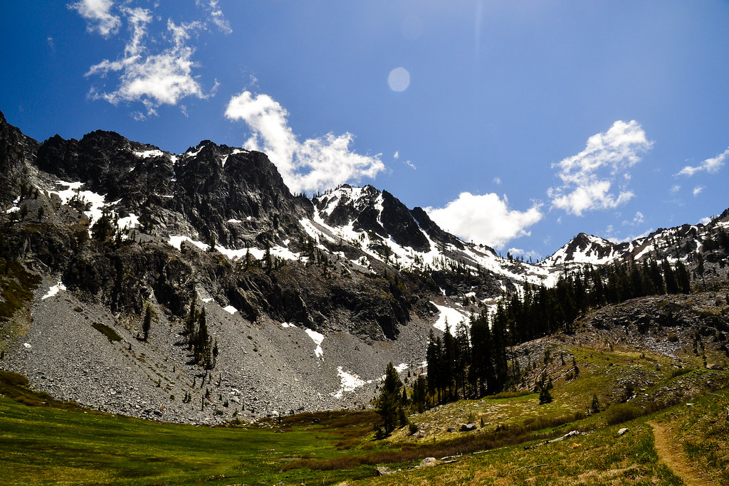 Photo: ilya_ktsn, CC BY 2.0 (via Flickr)
Cow Camp Spur
~7 min drive
0.6-mile out-and-back trail with 138 ft gain in California.
HIKE
Old Caribou Trail
~9 min drive
9.32-mile out-and-back hike in California with 5,600 ft elevation gain
 Photo: ilya_ktsn, CC BY 2.0 (via Flickr)
Willow Creek
~6 min drive
4.60-mile out-and-back trail in California with 2,412 ft elevation gain.
HIKE
Bear Basin
~3 min drive
7.91-mile out-and-back trail in California with 7,509 ft elevation gain.
