Ellen Trail
- 1.1 mi
- round trip
- 866 ft
- climb
- 1,740 ft
- high point
- Out and back
- route
- Oct–May
- best months
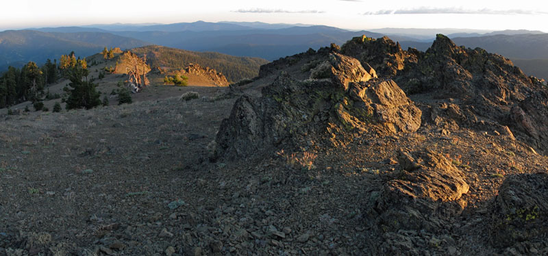
Ellen Trail is an easy out-and-back hike on Bureau of Land Management land within the Redding Field Office in northern California. The trail covers about 2.3 miles, with a total climb of 866 feet from a starting point at roughly 1,706 feet to a high point of 1,740 feet. That makes the route a short, low-effort outing for anyone looking to get a little elevation on the BLM land near Redding. The most comfortable months to go are spring and fall. Typical averages from a nearby weather station in Red Bluff show April highs around 72°F and October highs near 79°F, with the station sitting well below the trail so temperatures on the higher ground run cooler. Summer is hot, with July highs averaging about 98°F, and winter brings highs in the mid-50s and around 10 wet days a month. The trip takes about an hour. For more time on foot, Lanyan Trail is about 3.5 miles away and Bull Run Trail about 4 miles. Paddlers can head to Red Bank Creek or South Fork Cottonwood Creek, both about 4.3 miles off.
- Lanyan TrailHiking3.5 mi
- Bull Run TrailHiking4 mi
- Red Bank CreekCanoeing4.3 mi
- South Fork Cottonwood CreekCanoeing4.3 mi
- Cold ForkCanoeing6.2 mi
- North Fork Elder CreekCanoeing7.5 mi
Source: Roamze catalog (indexable pages within 10 miles, PostGIS distance)
- Lanyan TrailHiking · ~6 min drive
- Bull Run TrailHiking · ~7 min drive
- Cottonwood TrailHiking · ~19 min drive
- South Fork Cottonwood CreekHiking · ~30 min drive
- Humboldt TrailHiking · ~18 min drive
- Bull Run TrailHiking · ~9 min drive
- Old Cottonwood TrailHiking · ~20 min drive
- DEVILS HOLE RIDGEHiking · ~31 min drive
- Cottonwood TrailHiking · ~19 min drive
- Scorpion Camp TrailHiking · ~18 min drive
Also worth it near here
Best time to visit Ellen Trail
Best months: October–May. Best months have typical highs of 55–85 °F, lows of 30 °F or warmer (32 °F where the station doesn't record snow), at most one snowy day and no more than 12 wet days.
Jan
56° / 38°
10 wet
Feb
61° / 41°
10 wet
Mar
66° / 44°
9 wet
Apr
72° / 47°
7 wet
May
82° / 55°
5 wet
Jun
91° / 62°
2 wet
Jul
98° / 66°
1 wet
Aug
96° / 64°
0 wet
Sep
91° / 59°
1 wet
Oct
79° / 51°
4 wet
Nov
64° / 43°
8 wet
Dec
56° / 38°
10 wet
Typical high / low (°F) and days with rain or snow, 1991–2020. Measured at Red Bluff Muni Ap, CA, 20 mi away at 353 ft. The station sits about 1,400 ft lower than this place, so expect it a little cooler here. This station doesn't record snowfall. Source: NOAA NCEI U.S. Climate Normals 1991–2020.

Map and trail data © OpenStreetMap contributors
