Big Trees Loop Trail
1.74-mile out-and-back hike in California with 316 ft gain/loss.
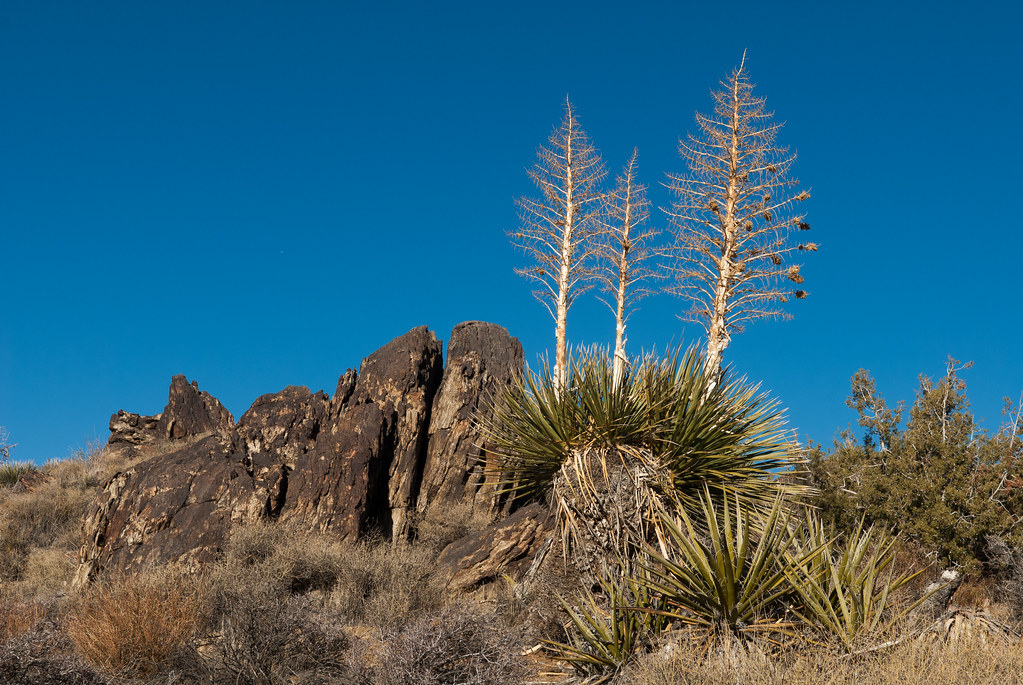 Photo: Jesse Wagstaff, CC BY 2.0 (via Flickr)
- 0.9 mi
- round trip
- 316 ft
- climb
- 4,731 ft
- high point
- Out and back
- route
Is Big Trees Loop Trail open right now?
Alert in the area
The National Park Service lists 3 alerts for Joshua Tree National Park.
Partial Trail Closure of West Side Loop
Park alert covering Joshua Tree National Park · NPS · Joshua Tree National Park
Inaccurate Third-Party Apps
Park alert covering Joshua Tree National Park · NPS · Joshua Tree National Park
Oasis of Mara Trail Partial Closure
Park alert covering Joshua Tree National Park · NPS · Joshua Tree National Park
As of · Source: NPS · Joshua Tree National Park. Agencies don't list every closure — check before you go.
Best time to visit Big Trees Loop Trail
Best months: October–May. Best months have typical highs of 55–85 °F, lows of 30 °F or warmer (32 °F where the station doesn't record snow), at most one snowy day and no more than 12 wet days.
Jan
58° / 38°
4 wet
Feb
61° / 39°
3 wet
Mar
67° / 40°
3 wet
Apr
73° / 46°
2 wet
May
82° / 52°
1 wet
Jun
91° / 59°
0 wet
Jul
96° / 66°
2 wet
Aug
96° / 68°
2 wet
Sep
89° / 60°
2 wet
Oct
80° / 50°
1 wet
Nov
66° / 41°
2 wet
Dec
58° / 34°
4 wet
Typical high / low (°F) and days with rain or snow, 1991–2020. Measured at Yucca Valley, CA, 17.5 mi away at 3,249 ft. The station sits about 1,500 ft lower than this place, so expect it a little cooler here. This station doesn't record snowfall. Source: NOAA NCEI U.S. Climate Normals 1991–2020.
Big Trees Loop Trail is a 1.74-mile out-and-back hike in California with 316 feet of elevation gain and loss. The trail reaches a maximum elevation of 4,731 feet.
Keep exploring — more trails worth the drive
Lost Horse Mine Trailhead
~1 min drive
The Lost Horse Mine trail is a 4-mile (round trip) out-and-back hike with 550 feet of elevation gain. Lost Horse Mine operated from 1893 to 1936, producing over 9,000 ounces of gold. It was one of the most successful mines in the Joshua Tree National Park area. Stay outside…
 Photo: Tony Webster, CC BY 2.0 (via Flickr)
California Riding and Hiking Trail
~2 min drive
30.16-mile out-and-back trail in California with 3,694 ft elevation gain/loss
Minerva Hoyt (Minerva Hoyt Trail)
~4 min drive
The Minerva Hoyt Trail is an out-and-back hike to the Hidden Valley picnic area. It is 3 miles roundtrip with 100 feet of elevation gain. From the parking lot, the trail follows an old road before it takes a sharp right towards Hidden Valley. The hike goes through a valley of…
Ryan Mountain Trailhead
~5 min drive
Ryan Mountain is a 3-mile (round trip) out-and-back hike with 1,050 feet of elevation gain. The summit rewards hikers with one of the best 360-degree views of any trail in the park. From the summit, you can see the Wonderland of Rocks, the Sheephole Wilderness, Mount San…
California Riding and Hiking Trail at Geology Tour Road
~8 min drive
Take a hike east or west from here on the California Riding and Hiking Trail. Carry water with you. The California Riding and Hiking Trail is 37 miles total, but smaller sections are popular day-hikes. This trailhead is in the middle of the California Riding and Hiking Trail…
 Photo: Jesse Wagstaff, CC BY 2.0 (via Flickr)
Lost Horse Mine Loop Trail
~1 min drive
3.98-mile out-and-back hike in California with 885 ft elevation gain and loss.
Cow Rock
~6 min drive
A rock formation that is shaped like a cow overlooking the Hidden Valley Trail. To find this rock formation while hiking the Hidden Valley Trail, stop at the Mountain Quail Interpretive Sign and look to the west. At the top of the tall wall of rocks is Cow Rock.
 Photo: inkknife_2000 (7.5 million views +), CC BY-SA 2.0 (via Wikimedia Commons)
Paac Kü̱vü̱hü̱’k Trail
~9 min drive
8.66-mile out-and-back trail in California with 1,061 ft elevation gain
Boy Scout Trailhead
~10 min drive
Explore the Wonderland of Rocks on the Boy Scout Trail. The Boy Scout Trail runs for a total of 8 miles one way(16 miles round trip), but hikes of any length can be a great way to experience the Wonderland of Rocks. Start from the Keys West Wilderness Backpacking Board along P…
Stubbe Springs Trailhead
~2 min drive
Stubbe Springs is a 12-mile “lollipop” loop hike in the Juniper Flats area. This trail is great for hikers looking for a long loop hike and solitude in the backcountry. It begins in an open valley filled with grasses, desert shrubs, and Joshua trees. The trail then passes…


Map and trail data © OpenStreetMap contributors
