Grouse Ridge
Campground
Campground · < 0.1 mi from the trail
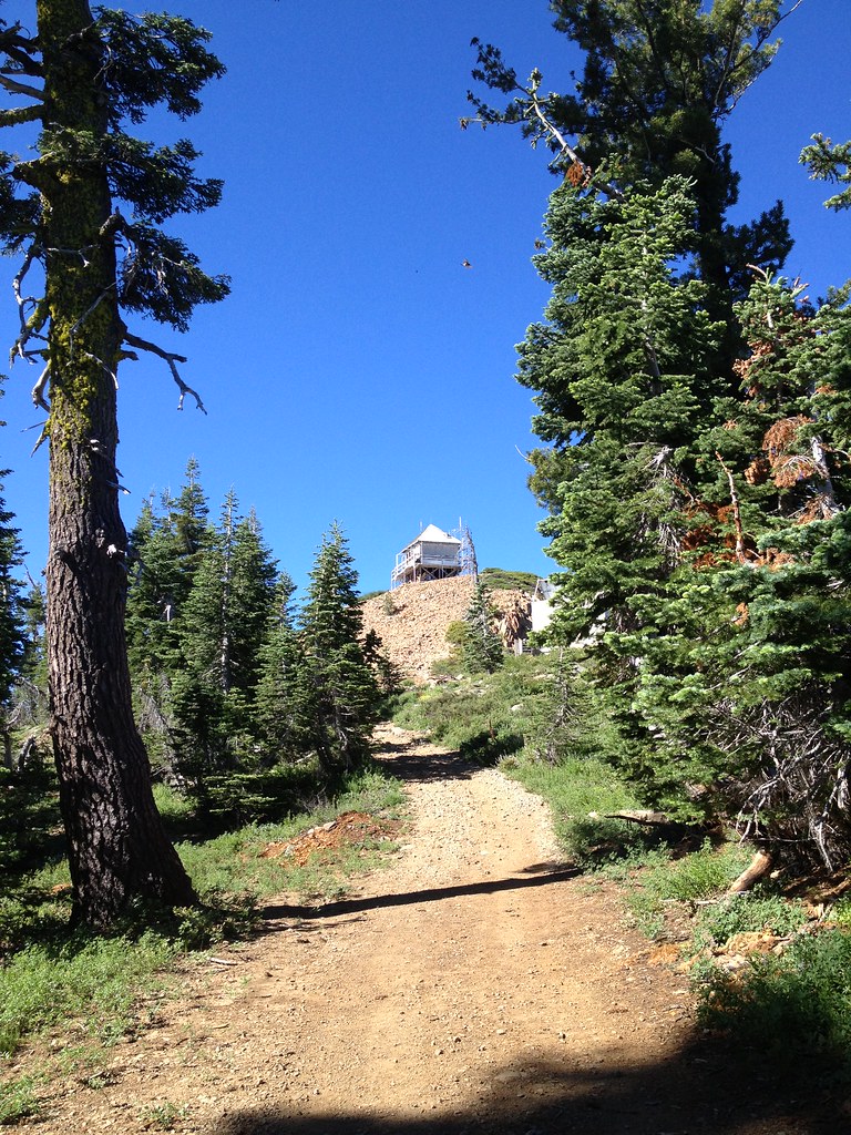 Photo: ray_explores — CC BY 2.0 (via Flickr)
Alert in the area
The Forest Service lists an alert for Tahoe National Forest.
Camping and Campfire Restrictions-Truckee and Sierraville Districts
Agency alert covering Tahoe National Forest · Order 17-25-05 · USFS · Tahoe National Forest
As of · Source: USFS · Tahoe National Forest. Agencies don't list every closure — check before you go.
Grouse Ridge Campground sits at the top of Grouse Ridge in California's Tahoe National Forest, within the Yuba River Ranger District. The Forest Service manages the land, and the site is set above the Grouse Lakes Area, with trails leading down from the ridge to the lakes below. The camp is known for its views of granitic boulders, alpine lakes, scattered pines and wildflowers, especially in summer. The site has nine campsites, each with a table and a fire ring, and five of them have space for small trailers. Bear boxes are available. There is a vault toilet, but no trash service, so visitors must pack in and pack out. The campground often opens late because snow banks can linger on the access road. Summer is the most comfortable time to visit. Typical July averages from a nearby weather station at Sagehen Creek run about 80°F for highs and 37°F for lows. That station sits roughly 1,100 feet below the ridge, so temperatures on the ridge run cooler. Sanford Lake and Downey Lake are both within a mile, and the Bowman/Emeralds climbing area and Island Lake Boulders are close by. Carr Lake campground is about 2 miles away.
Grouse Ridge
Campground
The Rustic Table
Restaurant
Golden Drift Museum
Museum
Places © OpenStreetMap contributors
More in Nevada CityBest months: June–August. Best months have typical highs of 55–85 °F, lows of 30 °F or warmer (32 °F where the station doesn't record snow), at most one snowy day and no more than 12 wet days.
Jan
40° / 15°
Feb
41° / 15°
Mar
48° / 19°
Apr
53° / 22°
May
62° / 28°
Jun
72° / 32°
Jul
80° / 37°
Aug
79° / 35°
Sep
73° / 31°
Oct
61° / 24°
Nov
49° / 20°
Dec
39° / 14°
Typical high / low (°F) and days with rain or snow, 1991–2020. Measured at Sagehen Creek, CA, 20 mi away at 6,337 ft. The station sits about 1,100 ft lower than this place, so expect it a little cooler here. This station doesn't record snowfall. Source: NOAA NCEI U.S. Climate Normals 1991–2020.
BED
Carr Lake
~3 min drive
BED
Mooney Creek
~4 min drive
Mooney Creek is a campground in California with 10 sites.
BED
Lindsey Lake
~4 min drive
BED
Bullpen Lake
~5 min drive
Bullpen Lake is a 15-site campground in California managed by the Forest Service.
BED
Beyers Lakes
~5 min drive
Beyers Lakes is a 15-site campground in California managed by the Forest Service.
BED
Five Lakes Basin
~5 min drive
Five Lakes Basin is a campground in California with 25 sites.
BED
Rucker Lake
~5 min drive
BED
Pierce Creek Cg
~6 min drive
BED
Canyon Creek Campground
~6 min drive
Canyon Creek Campground is a campground in California at about 5,963 feet. It is managed by the U.S. Forest Service.
BED
Sawmill Lake
~7 min drive
Sawmill Lake is a 30-site campground in California managed by the Forest Service.


