Hamilton Park Trail
- 0.3 mi
- loop
- 1,581 ft
- high point
- Loop
- route
- Easy
- difficulty
- Mar–Jun, Sep–Nov
- best months
Hamilton Park Trail is a short loop in northern Arkansas, about 0.5 miles from the town of Garfield. The route is easy, with no elevation gain and a total loss of only 22 feet over its 0.31-mile length. It runs flat for most of the way, and the steepest part is a grade of about 2% at roughly 0.14 miles in. The trail starts and ends near 1,579 feet, and the highest point on the loop reaches 1,581 feet. Spring and fall are the most comfortable times to go. Typical averages from the nearby Seligman, Missouri weather station show April highs around 68°F and October highs around 71°F, while July and August average highs near 88°F. The trip takes about half an hour. Gateway City Park Trail lies about 3.8 miles away. For camping, Lost Bridge South and Lost Bridge North are each about 5.5 miles off, and Indian Creek Campground (AR) is about 5.5 miles away.
Local outfitters
- Float Eureka14 mi away
- Kings River Outfitters20 mi away
Not on Roamze yet. Their page has how to reach them.
- Gateway City Park TrailHiking3.8 mi
 Lost Bridge SouthCampingPhoto: Recreation.gov (RIDB) / public domain5.5 mi
 Lost Bridge NorthCampingPhoto: Recreation.gov (RIDB) / public domain5.5 mi
 Indian Creek Campground (AR)CampingPhoto: Recreation.gov (RIDB) / public domain5.5 mi
- Big Sugar CreekCanoeing6.4 mi
 Starkey CampgroundCampingPhoto: Recreation.gov (RIDB) / public domain7 mi
- Little Sugar CreekCanoeing7.2 mi
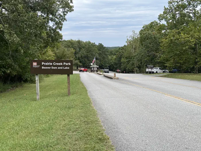 Prairie CreekRiver fishing7.3 mi
Source: Roamze catalog (indexable pages within 10 miles, PostGIS distance)
 Pigeon Roost TrailHiking · ~18 min drivePhoto: Doug Wertman from Rogers, AR, USA, CC BY 2.0 (via Wikimedia Commons)
 Devils Kitchen TrailHiking · ~22 min drivePhoto: dfellow, CC BY 2.0 (via Wikimedia Commons)
 Fire Tower TrailHiking · ~23 min drivePhoto: dfellow, CC BY 2.0 (via Flickr)
- Hidden Diversity Multi-Use TrailHiking · ~19 min drive
- Pigeon Roost Trail - Dry Creek LoopHiking · ~19 min drivePhoto: Doug Wertman from Rogers, AR, USA, CC BY 2.0 (via Wikimedia Commons)
 Tunnel Vision 7Hiking · ~26 min drivePhoto: bobsacks, CC BY 2.0 (via Flickr)
 Eagles Nest TrailHiking · ~21 min drivePhoto: dfellow, CC BY 2.0 (via Wikimedia Commons)
- Lago Vista-EastHiking · ~26 min drivePhoto: bobsacks, CC BY 2.0 (via Flickr)
- Springhouse TrailHiking · ~21 min drivePhoto: dfellow, CC BY 2.0 (via Wikimedia Commons)
 Tunnel VisionHiking · ~28 min drivePhoto: Doug Wertman, CC BY 2.0 (via Wikimedia Commons)
Best time to visit Hamilton Park Trail
Best months: March–June and September–November. Best months have typical highs of 55–85 °F, lows of 30 °F or warmer (32 °F where the station doesn't record snow), at most one snowy day and no more than 12 wet days.
Jan
45° / 23°
Feb
50° / 26°
Mar
58° / 34°
Apr
68° / 42°
May
76° / 52°
Jun
83° / 60°
Jul
88° / 65°
Aug
88° / 64°
Sep
81° / 55°
Oct
71° / 44°
Nov
58° / 33°
Dec
48° / 26°
Typical high / low (°F) and days with rain or snow, 1991–2020. Measured at Seligman, MO, 7.1 mi away at 1,530 ft. This station doesn't record snowfall. Source: NOAA NCEI U.S. Climate Normals 1991–2020.
Map and trail data © OpenStreetMap contributors
