Incinerator Ridge Dispersed Camping
Campground
Campground · 0.2 mi from the trail
Caution today
Agency alerts are in effect for this area; weather is good · USFS, OpenWeather · checked 8 h ago
Closure in the area
There's a closure order in Santa Catalina Ranger District. It doesn't name Kellogg, so check the source for the area it covers.
Marshall Gulch Closure Order
Agency closure covering Santa Catalina Ranger District · Order 03-05-05-26-009 · USFS · Santa Catalina Ranger District
Border Barrier Construction Closure
Agency alert covering Coronado National Forest · Order 03-05-00-26-011 · USFS · Coronado National Forest
No Fire Restrictions
Agency alert covering Coronado National Forest · USFS · Coronado National Forest
Barfoot Snake Closure Order 03-05-01-24-004
Agency alert covering Coronado National Forest · USFS · Coronado National Forest
As of · Source: USFS · Santa Catalina Ranger District. Agencies don't list every closure — check before you go.
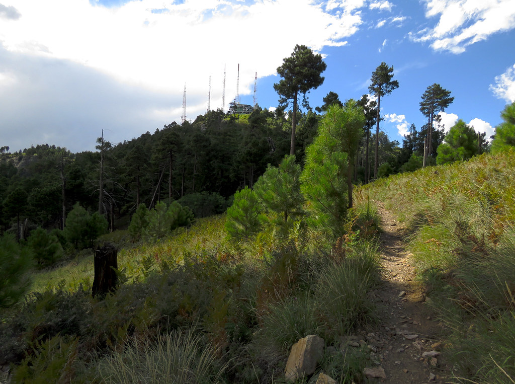
Kellogg is a short mountain biking route in Arizona's Coronado National Forest, within the Santa Catalina Ranger District. The Forest Service manages the land, and the ride starts at about 8,258 feet, climbing to a high point of 8,276 feet over a distance of about half a mile. The route is a short, low-elevation outing, with a total gain of 259 feet and a total loss of 557 feet, and the steepest stretch comes at about 0.3 miles in. Spring and fall are the most comfortable times to ride. Typical averages from a nearby weather station at Mt Lemmon Willow Canyon show May highs around 71°F and October highs around 68°F, while winter highs sit near 50°F. That station sits roughly 1,200 feet below the route, so temperatures on the trail run cooler. The Bigelow Trail #520 lies just 0.1 mile away, and the Bigelow hike is about 0.3 mile off. Palisades Ranger Residence Cabin and the Upper crag climbing area are both about 0.4 mile away.
Incinerator Ridge Dispersed Camping
Campground
Butler Hall
Fast food
Wildlife Viewing Area
Viewpoint
Places © OpenStreetMap contributors
More in OracleNot on Roamze yet. Their page has how to reach them.
 BigelowHikingPhoto: treegrow, CC BY 2.0 (via Flickr)0.3 mi
 KnaggeHikingPhoto: treegrow, CC BY 2.0 (via Flickr)0.5 mi
Source: Roamze catalog (indexable pages within 10 miles, PostGIS distance)
 Sunset Trail #90Mountain biking · ~3 min drivePhoto: Mcraycroft, CC BY-SA 4.0 (via Wikimedia Commons)SunsetMountain biking · ~5 min drivePhoto: Mcraycroft, CC BY-SA 4.0 (via Wikimedia Commons)
 Box SpringMountain biking · ~5 min drivePhoto: Debbie, CC BY 2.0 (via Wikimedia Commons)
 Box CampMountain biking · ~6 min drivePhoto: Debbie, CC BY 2.0 (via Wikimedia Commons)Marshall GulchMountain biking · ~6 min drivePhoto: Mcraycroft, CC BY-SA 4.0 (via Wikimedia Commons)Mint SpringsMountain biking · ~6 min drivePhoto: Debbie, CC BY 2.0 (via Wikimedia Commons)AspenMountain biking · ~7 min drivePhoto: Debbie, CC BY 2.0 (via Wikimedia Commons)
 Aspen DrawMountain biking · ~8 min drivePhoto: Colton Marshall abstractstatemachine, CC0 (via Wikimedia Commons)
 Meadow Trail #5AMountain biking · ~9 min drivePhoto: Jacob Kannel jrkannel, CC0 (via Wikimedia Commons)
 Sabino CanyonMountain biking · ~10 min drivePhoto: Raquel Baranow from Tucson, Arizona, U$A, CC BY-SA 2.0 (via Wikimedia Commons)
Best months: March–November. Best months have typical highs of 55–85 °F, lows of 30 °F or warmer (32 °F where the station doesn't record snow), at most one snowy day and no more than 12 wet days.
Jan
50° / 34°
Feb
50° / 33°
Mar
55° / 37°
Apr
62° / 43°
May
71° / 51°
Jun
80° / 60°
Jul
80° / 63°
Aug
79° / 62°
Sep
75° / 59°
Oct
68° / 49°
Nov
59° / 40°
Dec
49° / 33°
Typical high / low (°F) and days with rain or snow, 1991–2020. Measured at Mt Lemmon Willow Canyon, AZ, 2.1 mi away at 7,027 ft. The station sits about 1,200 ft lower than this place, so expect it a little cooler here. This station doesn't record snowfall. Source: NOAA NCEI U.S. Climate Normals 1991–2020.
Map and trail data © OpenStreetMap contributors


