Little Elden Springs Horsecamp
Campground
Campground · 1.9 mi from the trail
 Photo: Coconino National Forest, CC0 (via Wikimedia Commons)
Caution today
Agency alerts are in effect for this area; weather is good · USFS, OpenWeather · checked 10 h ago
Alert in the area
The Forest Service lists 5 alerts for Coconino National Forest.
West Fork Temporary Area Closure - Extension to 2/27/27
Agency alert covering Coconino National Forest · Order 03-04-00-26-09 · USFS · Coconino National Forest
Temporary Closure for West Wing Pile Burn
Agency alert covering Flagstaff Ranger District · Order 03-04-08-26-08 · USFS · Flagstaff Ranger District
Newman Park Pile Burn
Agency alert covering Flagstaff Ranger District · USFS · Flagstaff Ranger District
Kachina Village and Pumphouse Wash Camping and Campfire Restrictions
Agency alert covering Flagstaff Ranger District · Order 03-04-08-25-02 · USFS · Flagstaff Ranger District
Flagstaff-area camping and campfire restrictions in effect year-round
Agency alert covering Flagstaff Ranger District · Order 03-04-08-25-01 · USFS · Flagstaff Ranger District
As of · Source: USFS · Coconino National Forest. Agencies don't list every closure — check before you go.
Upper Oldham Trail is a mountain biking route in the Flagstaff Ranger District of Coconino National Forest in Arizona, managed by the Forest Service. The trail is about 1.6 miles long, and it climbs from roughly 7,900 feet to about 8,900 feet, with a total elevation gain of 964 feet. The route also descends about 1,180 feet, so the total change from start to finish is a net loss. Spring and fall are the most comfortable times to ride. Typical averages from a nearby weather station at Ft Valley show May highs around 71°F and October highs around 66°F, while July and August bring the most wet days, about 11 to 13 a month. That station sits well below the trail, so temperatures on the route run cooler. The trail sits close to other outdoor spots. Down Under is a hike about 0.2 miles away, and the West Elden climbing area is about half a mile off. Little Elden Springs Horsecamp is about 1.9 miles away, and Lockett Meadow Campground is about 6.9 miles away.
Little Elden Springs Horsecamp
Campground
Express Burritos
Mexican restaurant
Museum of Northern Arizona Research Center
Museum
Places © OpenStreetMap contributors, Places © Overture Maps Foundation
More in Kachina VillageNot on Roamze yet. Their page has how to reach them.
 Down UnderHikingPhoto: Coconino NF Photography, Public Domain Mark (via Flickr)0.2 miPrivate ReserveMountain bikingPhoto: Coconino National Forest, CC0 (via Wikimedia Commons)0.4 mi
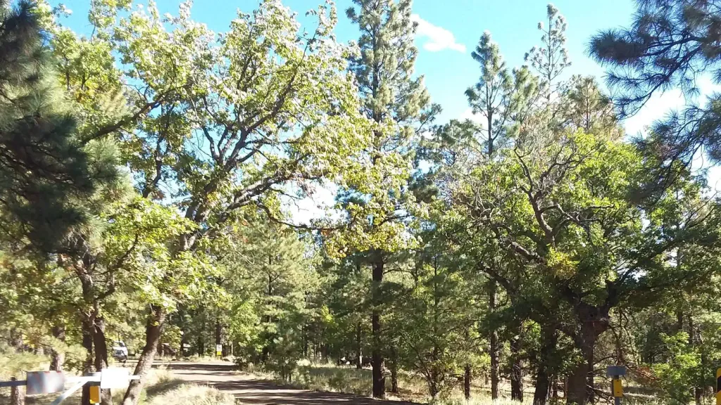 Little Elden Springs HorsecampCampingPhoto: Recreation.gov (RIDB) / public domain1.9 mi
 Walnut CreekCanoeingPhoto: Llrice1240, CC BY-SA 3.0 (via Wikimedia Commons)9.4 mi
Source: Roamze catalog (indexable pages within 10 miles, PostGIS distance)
Private ReserveMountain biking · Next doorPhoto: Coconino National Forest, CC0 (via Wikimedia Commons)Wasabi TrailMountain biking · Next doorPhoto: Coconino National Forest, CC0 (via Wikimedia Commons) Down UnderMountain biking · ~1 min drivePhoto: Coconino National Forest, CC0 (via Wikimedia Commons)El Viejo Corazon TrailMountain biking · ~2 min drivePhoto: Coconino National Forest, CC0 (via Wikimedia Commons)
 HeartMountain biking · ~2 min drivePhoto: Patty Ringle; Coconino National Forest, CC BY-SA 2.0 (via Wikimedia Commons)
 Lower Oldham TrailMountain biking · ~2 min drivePhoto: Brady Smith; Coconino National Forest, CC BY-SA 2.0 (via Wikimedia Commons)
 BrookbankMountain biking · ~2 min drivePhoto: Coconino National Forest, CC0 (via Wikimedia Commons)
 Pickle TrailMountain biking · ~2 min drivePhoto: Coconino National Forest, CC0 (via Wikimedia Commons)
 Easy Oldham TrailMountain biking · ~3 min drivePhoto: Coconino National Forest, CC BY-SA 2.0 (via Wikimedia Commons)Forces of NatureMountain biking · ~3 min drivePhoto: Coconino National Forest, CC BY-SA 2.0 (via Wikimedia Commons)
Best months: May–July and September. Best months have typical highs of 55–85 °F, lows of 30 °F or warmer (32 °F where the station doesn't record snow), at most one snowy day and no more than 12 wet days.
Jan
46° / 17°
8 wet
Feb
48° / 20°
8 wet
Mar
54° / 24°
7 wet
Apr
62° / 27°
5 wet
May
71° / 33°
4 wet
Jun
82° / 40°
3 wet
Jul
84° / 49°
11 wet
Aug
81° / 49°
13 wet
Sep
76° / 41°
8 wet
Oct
66° / 30°
5 wet
Nov
55° / 23°
5 wet
Dec
46° / 16°
7 wet
Typical high / low (°F) and days with rain or snow, 1991–2020. Measured at Ft Valley, AZ, 7.2 mi away at 7,347 ft. The station sits about 1,600 ft lower than this place, so expect it a little cooler here. This station doesn't record snowfall. Source: NOAA NCEI U.S. Climate Normals 1991–2020.
Map and trail data © OpenStreetMap contributors


