White House Trail
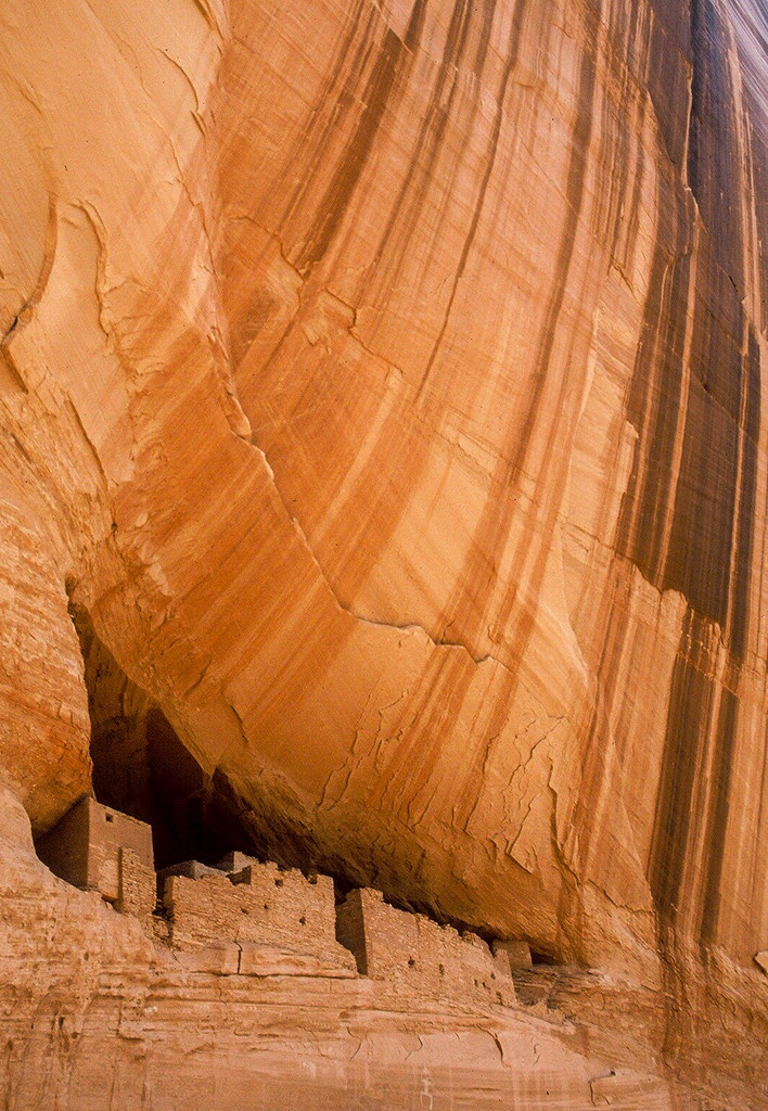 Photo: Jon Gudorf Photography — CC BY-SA 2.0 (via Flickr)
- 2.7 mi
- round trip
- 817 ft
- climb
- 6,184 ft
- high point
- Out and back
- route
- Apr–May, Sep–Oct
- best months
Is White House Trail open right now?
Alert in the area
The National Park Service lists an alert for Canyon de Chelly National Monument.
Weather Advisory and Storm Warnings
Park alert covering Canyon de Chelly National Monument · NPS · Canyon de Chelly National Monument
As of · Source: NPS · Canyon de Chelly National Monument. Agencies don't list every closure — check before you go.
White House Trail is a 2.7-mile out-and-back hike in Canyon de Chelly National Monument in Arizona, with an elevation gain of 817 feet from its low point of about 5,642 feet to a high of roughly 6,184 feet. The route is rated easy, and the land is managed by the National Park Service. Spring and fall are the most comfortable times to go. Typical averages from the nearby Canyon De Chelly weather station run to highs around 69°F in April and 70°F in October, while July highs average about 93°F. The station sits about 574 feet below the trail, so temperatures on the trail tend to run cooler. The trail is not wheelchair accessible, and bikes are not allowed. Plan for a straightforward walk over a gentle climb rather than a technical route.
- Nearby · Concrete Sidewalk · Pueblo Color Wash Trail · Cleopatra Needle Trail
Best time to go · Apr–May, Sep–Oct
Best time to visit White House Trail
Best months: April–May and September–October. Best months have typical highs of 55–85 °F, lows of 30 °F or warmer (32 °F where the station doesn't record snow), at most one snowy day and no more than 12 wet days.
Jan
44° / 19°
4 wet · 1 snow
Feb
51° / 24°
4 wet · 1 snow
Mar
61° / 29°
4 wet · 1 snow
Apr
69° / 36°
3 wet
May
79° / 44°
3 wet
Jun
90° / 52°
2 wet
Jul
93° / 60°
6 wet
Aug
90° / 59°
7 wet
Sep
83° / 50°
5 wet
Oct
70° / 37°
4 wet
Nov
56° / 26°
4 wet
Dec
43° / 20°
5 wet · 1 snow
Typical high / low (°F) and days with rain or snow, 1991–2020. Measured at Canyon De Chelly, AZ, 4.1 mi away at 5,610 ft. The station sits about 600 ft lower than this place, so expect it a little cooler here. Source: NOAA NCEI U.S. Climate Normals 1991–2020.
Keep exploring — more trails worth the drive
 Photo: Ronnie Macdonald, CC BY 2.0 (via Flickr)
Concrete Sidewalk
~7 min drive
Easy 0.90-mile out-and-back walk in Arizona.
HIKE
Pueblo Color Wash Trail
~50 min drive
1.34-mile out-and-back hike in Arizona with 11 ft of elevation gain.
HIKE
Cleopatra Needle Trail
~51 min drive
2.24-mile out-and-back trail in New Mexico with 117 ft elevation gain
HIKE
Royal Arch Trail
~1h 1m drive
0.88-mile out-and-back hike in Arizona with 299 ft elevation gain.
Map and trail data © OpenStreetMap contributors
