Waterhole Canyon Tour
- 1.0 mi
- round trip
- 504 ft
- climb
- 4,696 ft
- high point
- Out and back
- route
- Mar–May, Oct–Nov
- best months
Waterhole Canyon Tour is an easy out-and-back hike in northern Arizona, set within the Navajo Region Fire and Aviation Management area. The route is about 2 miles long, with a total elevation gain of 504 feet, and it starts and ends at roughly 4,540 feet. The high point on the trail reaches about 4,696 feet, and the steepest stretch comes near the middle of the route, where the grade reaches about 8%. Spring and fall are the most comfortable times to go. Typical averages from a nearby weather station in Page show April and October highs around 72°F, while July highs average about 98°F and January lows drop to about 30°F. The hike takes about an hour to complete. The Waterhole Canyon Trail lies about 0.3 miles away, and Horseshoe Bend on the Colorado River and the Vermilion View Trail are each about 3 miles off. Anchovy Point, a climbing area, is about 8.4 miles away.
Local outfitters
- Dixie's Lower Antelope Canyon Tours6 mi away
- Antelope Slot Canyon Tours6 mi away
Not on Roamze yet. Their page has how to reach them.
- Waterhole Canyon TrailHiking0.3 mi
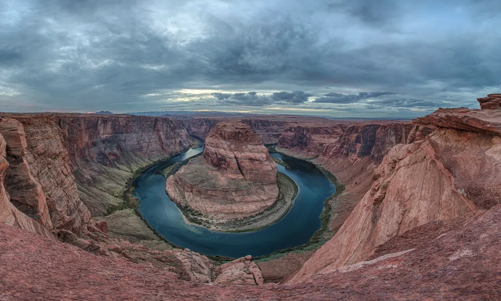 Horseshoe Bend on the Colorado RiverHikingPhoto: NPS / public domain3 mi
 Vermilion View TrailHikingPhoto: itia4u, CC BY 2.0 (via Flickr)3 mi
 Horseshoe Bend TrailHikingPhoto: itia4u, CC BY 2.0 (via Flickr)3 mi
- Path Through Nine-Mile DrawHikingPhoto: itia4u, CC BY 2.0 (via Flickr)3.5 mi
 Spencer TrailHikingPhoto: Capt' Gorgeous, CC BY 2.0 (via Flickr)4.8 mi
- Upper Ferry TrailHikingPhoto: Capt' Gorgeous, CC BY 2.0 (via Flickr)4.8 mi
 Anchovy PointRock climbingPhoto: dougnaka, CC BY 2.0 (via Flickr)8.4 mi
Source: Roamze catalog (indexable pages within 10 miles, PostGIS distance)
- Horseshoe Bend on the Colorado RiverHiking · ~5 min drive
- Vermilion View TrailHiking · ~5 min drivePhoto: itia4u, CC BY 2.0 (via Flickr)
- Horseshoe Bend TrailHiking · ~5 min drivePhoto: itia4u, CC BY 2.0 (via Flickr)
- Spencer TrailHiking · ~9 min drivePhoto: Capt' Gorgeous, CC BY 2.0 (via Flickr)
- Spencer TrailHiking · ~8 min drivePhoto: Capt' Gorgeous, CC BY 2.0 (via Flickr)
 Antelope Canyon X Loop TrailHiking · ~16 min drivePhoto: Nicola since 1972, CC BY 2.0 (via Flickr)
 Passage Slot CanyonHiking · ~5 min drivePhoto: Eric Kilby, CC BY-SA 2.0 (via Flickr)
- Rimview TrailHiking · ~11 min drive
 Historic District River TrailHiking · ~9 min drivePhoto: Capt' Gorgeous, CC BY 2.0 (via Flickr)
 Jackass Canyon RouteHiking · ~16 min drivePhoto: InSapphoWeTrust from Los Angeles, California, USA, CC BY-SA 2.0 (via Wikimedia Commons)
Best time to visit Waterhole Canyon Tour
Best months: March–May and October–November. Best months have typical highs of 55–85 °F, lows of 30 °F or warmer (32 °F where the station doesn't record snow), at most one snowy day and no more than 12 wet days.
Jan
46° / 30°
4 wet
Feb
53° / 34°
5 wet
Mar
63° / 41°
4 wet
Apr
72° / 47°
3 wet
May
82° / 56°
3 wet
Jun
94° / 66°
2 wet
Jul
98° / 73°
4 wet
Aug
95° / 70°
5 wet
Sep
87° / 62°
4 wet
Oct
72° / 49°
4 wet
Nov
57° / 38°
3 wet
Dec
45° / 30°
4 wet
Typical high / low (°F) and days with rain or snow, 1991–2020. Measured at Page Muni Ap, AZ, 7 mi away at 4,310 ft. This station doesn't record snowfall. Source: NOAA NCEI U.S. Climate Normals 1991–2020.

Map and trail data © OpenStreetMap contributors
