

Dixie's Lower Antelope Canyon Tours
Hiking business nearby (under a mile away) — hasn't claimed their Roamze page yet
Free — you'll pick up right here.
Watch this trail
Sign up to watch it — saving subscribes you to gate, closure and report changes.
Arizona
10.0 mi
Distance
278 ft
Gain
3h 28m
Time
No agency boundary, access route or field report is mapped to it — so there is no verdict, and we won't guess. We'll tell you the moment this trail has something to say.
Covered nearby
Trails within 25 miles where we do have a current picture.
Nobody's filed a report here yet — be the first.
Why you'll love it
Rimview Trail
AI-suggested draft · review before you go
No permit or access details on file for this trail — check with the local land manager before you go.
Rimview Trail is a 10.0-mile loop located in Arizona. This moderate trail features 278 feet of elevation gain, making it accessible for hikers of varying experience levels. The loop format allows hikers to complete the full circuit without retracing their steps, offering varied scenery throughout the journey. The relatively gentle elevation gain is spread across the full distance, creating a manageable grade suitable for a full day of hiking. The trail's loop design makes it popular for those seeking a complete wilderness experience without the monotony of an out-and-back route. This Arizona trail is ideal for hikers looking for a moderate-distance outing with minimal elevation challenge. The 10-mile distance provides substantial mileage while remaining achievable in a single day for most fitness levels. Whether you're a local exploring regional trails or visiting Arizona's outdoor offerings, Rimview Trail presents a balanced hiking experience with its combination of distance and modest elevation gain.
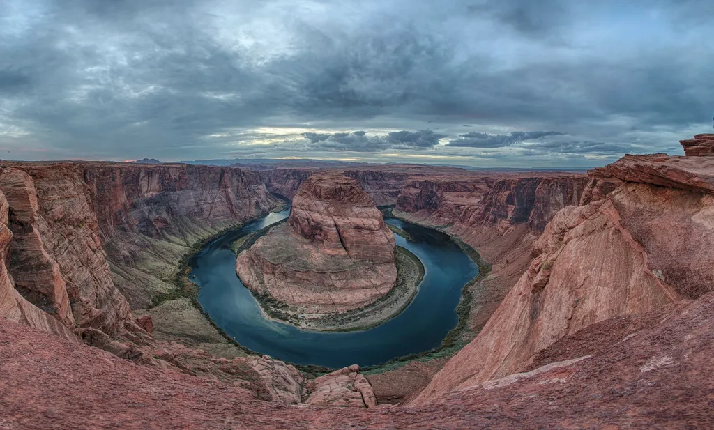
Horseshoe Bend on the Colorado River
~7 min drive
A social media darling, Horseshoe Bend has become one of the most recognized and visited places in Glen Canyon National Recreation Area. The parking lot and trailhead is located off US Highway 89, approximately 5 miles (8 km) south of the Carl Hayden Visitor Center. Changes a…
Spencer Trail
~13 min drive
3.9 mi · Easy
Navajo Route 6110
~46 min drive
A 1.56-mile moderate out-and-back doubletrack trail in Arizona that connects to the GWT - US 89 Connector system.
Hanging Garden
~2 min drive
Short out-and-back hike to a verdant hanging garden oasis.
Wildcat Tank Trail
~16 min drive
An easy 1.20-mile lollipop trail in Arizona ideal for casual hikers seeking a short desert walk.
Rim Trail
~2 min drive
Short rim-edge out-and-back with scenic Arizona vistas.
Cathedral Wash
~20 min drive
3.1 mi · Easy
Beehives Trail
~4 min drive
Quick out-and-back desert hike with scenic Arizona views.
Great Western Trail - Arizona
~46 min drive
An easy 12.37-mile out-and-back hike on dirt road in Arizona, perfect for casual trail exploration.
Horseshoe Bend Trail
~6 min drive
Easy out-and-back hike to iconic Colorado River viewpoint.
Local operatorsoffering guided trips. You book directly with them — Roamze doesn’t take a cut.
Dixie's Lower Antelope Canyon Tours
Hiking business nearby (under a mile away) — hasn't claimed their Roamze page yet
Antelope Slot Canyon Tours
Hiking business nearby (under a mile away) — hasn't claimed their Roamze page yet
Tsé Bíghanílíní Tours
Hiking business nearby (~3 mi away) — hasn't claimed their Roamze page yet