Sunset Loop
 Photo: Tony Webster, CC BY 2.0 (via Flickr)
- 2.0 mi
- loop
- 101 ft
- climb
- 3,816 ft
- high point
- Loop
- route
- Mar–Apr, Oct–Nov
- best months
Is Sunset Loop open right now?
Closure in the area
There's a closure order in Red Rock Ranger District. It doesn't name Sunset Loop, so check the source for the area it covers (2 listed).
Red Rock Ranger District affected by severe flooding; many closures in effect
Agency closure covering Red Rock Ranger District · USFS · Red Rock Ranger District
Banjo Bill Picnic Area Closure
Agency closure covering Red Rock Ranger District · Order 03-04-06-25-01 · USFS · Red Rock Ranger District
West Fork Temporary Area Closure - Extension to 2/27/27
Agency alert covering Coconino National Forest · Order 03-04-00-26-09 · USFS · Coconino National Forest
West Sedona Camping and Campfire Restrictions
Agency alert covering Red Rock Ranger District · Order 03-04-06-26-04 · USFS · Red Rock Ranger District
Sedona/ Oak Creek Canyon Camping and Campfire Restrictions
Agency alert covering Red Rock Ranger District · Order 03-04-06-23-03 · USFS · Red Rock Ranger District
As of · Source: USFS · Red Rock Ranger District. Agencies don't list every closure — check before you go.
Sunset Loop is an easy 2-mile loop hike in Arizona's Coconino National Forest, within the Red Rock Ranger District. The route gains about 100 feet in elevation, so it's a low-effort walk that can be done in under an hour. The trail starts and ends at roughly the same point, with the highest part of the loop reaching about 3,816 feet. Spring and fall are the most comfortable times to go. Typical averages from a nearby weather station show April highs around 79°F and October highs around 82°F, while July averages near 101°F. That station sits several hundred feet lower than the loop, so temperatures on the trail run a little cooler. Several other short hikes lie close by, including Mallard at 0.3 miles, Cedar Knoll at 0.5 miles and Golden Gulch at 0.6 miles. Paddlers can find Dry Beaver Creek about 4.6 miles away.
Local outfitters
- Camp Avalon Spiritual Nature Retreat13 mi away
- Canyon Outfitters Sedona16 mi away
Not on Roamze yet. Their page has how to reach them.
- MallardHikingPhoto: Tony Webster, CC BY 2.0 (via Flickr)0.3 mi
- Cedar KnollHiking0.5 mi
 Golden GulchHikingPhoto: Ken Lund, CC BY-SA 2.0 (via Flickr)0.6 mi
- Elmore WashHikingPhoto: Tony Webster, CC BY 2.0 (via Flickr)0.7 mi
- Dry Beaver CreekCanoeing4.6 mi
 Wet Beaver CrackRock climbingPhoto: Coconino National Forest, CC0 (via Wikimedia Commons)6.3 mi
- Verde Ranger DistrictRiver fishing7.7 mi
- Wet Beaver CreekCanoeing7.9 mi
Source: Roamze catalog (indexable pages within 10 miles, PostGIS distance)
- MallardHiking · Next doorPhoto: Tony Webster, CC BY 2.0 (via Flickr)
 Apache MaidHiking · ~11 min drivePhoto: Coconino NF Photography, Public Domain Dedication (CC0) (via Flickr)
 Kel FoxHiking · ~13 min drivePhoto: Mary P Madigan, CC BY 2.0 (via Flickr)
- Sacred MountainHiking · ~6 min drive
- Well Overlook Trail #1006AHiking · ~2 min drivePhoto: Tony Webster, CC BY 2.0 (via Flickr)
 West Clear CreekHiking · ~12 min drivePhoto: Coconino NF Photography, Public Domain Mark (via Flickr)
 Woods Canyon #93Hiking · ~14 min drivePhoto: cafuego, CC BY-SA 2.0 (via Flickr)
- MOWE Pasture Interpretive TrailHiking · ~2 min drivePhoto: Ken Lund, CC BY-SA 2.0 (via Flickr)
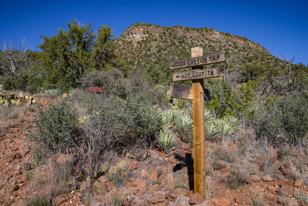 Hot Loop #40Hiking · ~15 min drivePhoto: Coconino NF Photography, Public Domain Dedication (CC0) (via Flickr)
 Belt Rock Pathway #96Hiking · ~19 min drivePhoto: Coconino National Forest, CC BY-SA 2.0 (via Wikimedia Commons)
Best time to visit Sunset Loop
Best months: March–April and October–November. Best months have typical highs of 55–85 °F, lows of 30 °F or warmer (32 °F where the station doesn't record snow), at most one snowy day and no more than 12 wet days.
Jan
61° / 26°
5 wet
Feb
65° / 29°
5 wet
Mar
72° / 35°
4 wet
Apr
79° / 40°
3 wet
May
88° / 47°
2 wet
Jun
98° / 54°
2 wet
Jul
101° / 64°
6 wet
Aug
99° / 63°
7 wet
Sep
93° / 55°
5 wet
Oct
82° / 43°
3 wet
Nov
69° / 31°
3 wet
Dec
59° / 25°
4 wet
Typical high / low (°F) and days with rain or snow, 1991–2020. Measured at Montezuma Castle Nm, AZ, 4.8 mi away at 3,180 ft. The station sits about 600 ft lower than this place, so expect it a little cooler here. Source: NOAA NCEI U.S. Climate Normals 1991–2020.

