Saguaro National Park West
 Photo: KimonBerlin, CC BY-SA 2.0 (via Flickr)
- Nov–Apr
- best months
Is Saguaro National Park West open right now?
Closure in the area
There's a closure order in Saguaro National Park. It doesn't name Saguaro National Park West, so check the source for the area it covers.
Bajada Loop Drive Closure in West District
Park closure covering Saguaro National Park · NPS · Saguaro National Park
Vehicle Break-Ins
Park alert covering Saguaro National Park · NPS · Saguaro National Park
As of · Source: NPS · Saguaro National Park. Agencies don't list every closure — check before you go.
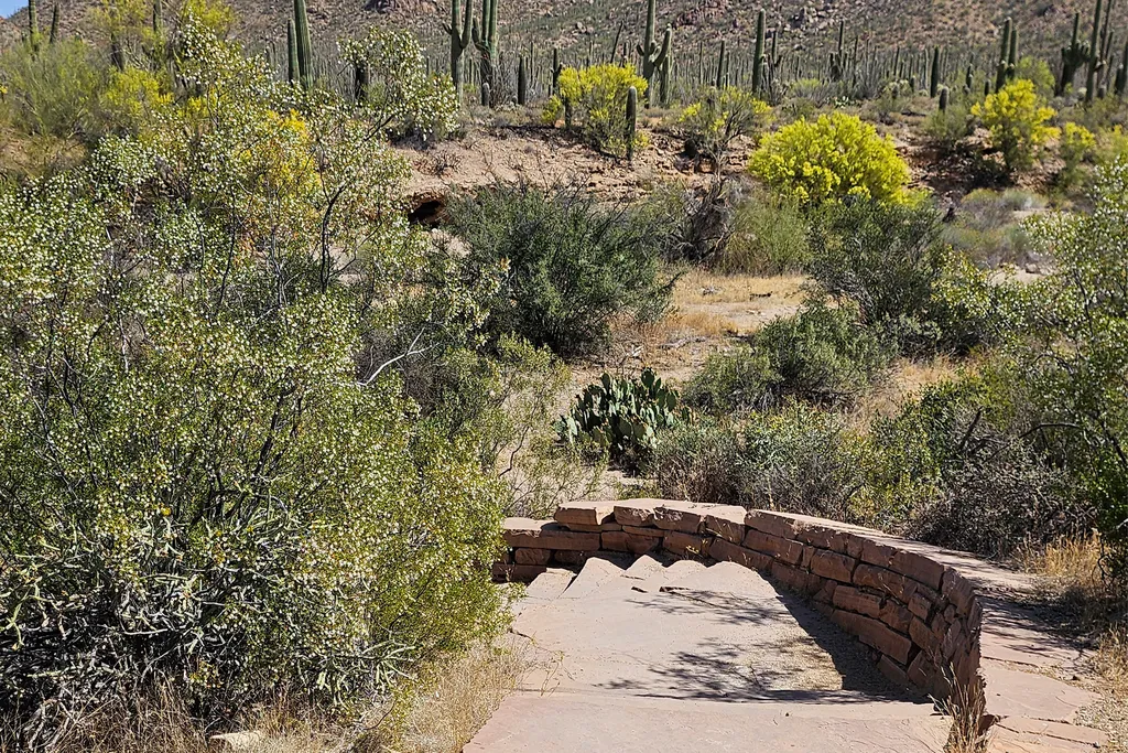
Saguaro National Park West is the western section of Saguaro National Park, managed by the National Park Service on the west side of Tucson, Arizona. The park protects the giant saguaro, the nation's largest cactus and a symbol of the American West, which grows in only a small part of the United States. The park sits west of the Anza Expedition historic route, and its desert looks much as it would have to the expedition in 1775. It is also a passport stamp location for the Anza Trail, and a classic place to watch the big cacti stand out against a desert sunset. The cooler months are the most comfortable time to visit. Typical averages from a nearby weather station run from highs around 67°F with lows near 39°F in January to highs of about 76°F in March and November, while June and July average highs of 102°F. An entrance fee is charged, and restrooms are available. They cover all of Saguaro National Park, not just this spot. Javelina Wash Trail and Cactus Garden Trail start about 0.1 mile away. The Desert Discovery Trail is about a mile off and the Hugh Norris Trail about 1.2 miles. Climbers can head to Gate's Pass, roughly 5.7 miles away.
 Javelina Wash TrailHikingPhoto: NPS / public domain0.1 mi
- Cactus Garden TrailHikingPhoto: KimonBerlin, CC BY-SA 2.0 (via Flickr)0.1 mi
- Desert Discovery TrailHiking1 mi
 Hugh Norris TrailHikingPhoto: dconvertini, CC BY-SA 2.0 (via Flickr)1.2 mi
 Gate's PassRock climbingPhoto: Daniel Ramirez from Honolulu, USA, CC BY 2.0 (via Wikimedia Commons)5.7 mi
- Tucson MountainsRock climbing6.3 mi
 The "Gimme Some" DomeRock climbingPhoto: «Gaurav», CC BY-SA 2.0 (via Flickr)6.3 mi
- Beast BoulderRock climbing6.5 mi
Source: Roamze catalog (indexable pages within 10 miles, PostGIS distance)
- Javelina Wash TrailHiking · Next door
- Hugh Norris TrailHiking · ~2 min drivePhoto: dconvertini, CC BY-SA 2.0 (via Flickr)
- Bajada Wash TrailHiking · ~2 min drivePhoto: dconvertini, CC BY-SA 2.0 (via Flickr)
 Encinas TrailHiking · ~6 min drivePhoto: w_lemay, CC BY-SA 2.0 (via Flickr)
- Cactus Garden TrailHiking · Next doorPhoto: KimonBerlin, CC BY-SA 2.0 (via Flickr)
 Hugh Norris Big LoopHiking · ~2 min drivePhoto: dconvertini, CC BY-SA 2.0 (via Flickr)
- Valley View TrailHiking · ~3 min drivePhoto: dconvertini, CC BY-SA 2.0 (via Flickr)
- Prospector TrailHiking · ~6 min drive
- Signal Hill (West District)Hiking · ~4 min drive
 King Canyon / Gould Mine LoopHiking · ~3 min drivePhoto: w_lemay, CC BY-SA 2.0 (via Flickr)
Also worth it near here
 Signal HillSummit · ~5 min drivePhoto: hakkun, CC BY-SA 3.0 (via Wikimedia Commons)
 Gilbert Ray CampgroundCamping · ~7 min drivePhoto: lamblukas — CC BY 2.0 (via Flickr)
- Triple C TrailMountain biking · ~7 min drive
- Gate's PassRock climbing · ~10 min drivePhoto: Daniel Ramirez from Honolulu, USA, CC BY 2.0 (via Wikimedia Commons)
Best time to visit Saguaro National Park West
Best months: November–April. Best months have typical highs of 55–85 °F, lows of 30 °F or warmer (32 °F where the station doesn't record snow), at most one snowy day and no more than 12 wet days.
Jan
67° / 39°
4 wet
Feb
70° / 41°
4 wet
Mar
76° / 46°
3 wet
Apr
84° / 51°
1 wet
May
93° / 59°
1 wet
Jun
102° / 69°
2 wet
Jul
102° / 74°
7 wet
Aug
100° / 72°
8 wet
Sep
97° / 68°
5 wet
Oct
87° / 57°
3 wet
Nov
76° / 47°
3 wet
Dec
66° / 39°
4 wet
Typical high / low (°F) and days with rain or snow, 1991–2020. Measured at Tucson 17 Nw, AZ, 0.1 mi away at 2,561 ft. Source: NOAA NCEI U.S. Climate Normals 1991–2020.
