Middle Witch
- 2.8 mi
- round trip
- 291 ft
- climb
- 5,537 ft
- high point
- Out and back
- route
- Sep–May
- best months
Is Middle Witch open right now?
Alert in the area
The Forest Service lists 3 alerts for Coronado National Forest.
Border Barrier Construction Closure
Agency alert covering Coronado National Forest · Order 03-05-00-26-011 · USFS · Coronado National Forest
No Fire Restrictions
Agency alert covering Coronado National Forest · USFS · Coronado National Forest
Barfoot Snake Closure Order 03-05-01-24-004
Agency alert covering Coronado National Forest · USFS · Coronado National Forest
As of · Source: USFS · Coronado National Forest. Agencies don't list every closure — check before you go.
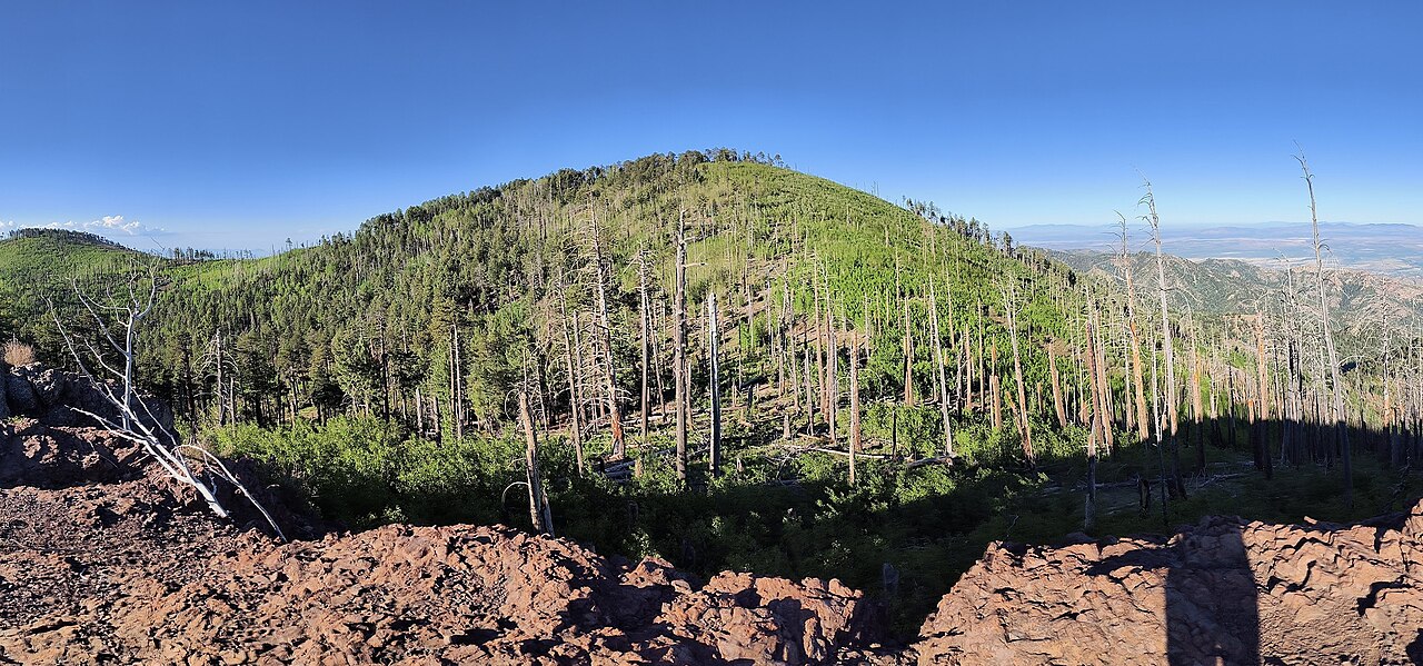
Middle Witch is a 2.8-mile out-and-back hike in the Chiricahua Wilderness, part of the Douglas Ranger District of Coronado National Forest in southeastern Arizona. The trail climbs from about 5,260 feet to roughly 5,537 feet, with a total gain of about 290 feet, and the Forest Service manages the surrounding land. Spring and fall are the most comfortable times to go. Typical averages from a nearby weather station show highs around 74°F in April and 76°F in October, while July and August bring highs near 90°F and about 12 wet days a month. The trail is natural-surface and allows bikes, but it is not accessible. The North Witch Trail #258 lies about a mile away, and Witch Ridge is about 1.5 miles off. For an overnight stay, Sycamore campground sits about 8 miles away.
Best time to go · Sep–May
Best time to visit Middle Witch
Best months: September–May. Best months have typical highs of 55–85 °F, lows of 30 °F or warmer (32 °F where the station doesn't record snow), at most one snowy day and no more than 12 wet days.
Jan
56° / 30°
5 wet
Feb
61° / 33°
5 wet
Mar
67° / 37°
4 wet
Apr
74° / 40°
2 wet
May
83° / 49°
2 wet
Jun
91° / 57°
4 wet
Jul
90° / 60°
12 wet
Aug
87° / 60°
12 wet
Sep
84° / 57°
7 wet
Oct
76° / 47°
4 wet
Nov
66° / 38°
4 wet
Dec
56° / 31°
5 wet
Typical high / low (°F) and days with rain or snow, 1991–2020. Measured at Chiricahua Nm, AZ, 6.2 mi away at 5,300 ft. Source: NOAA NCEI U.S. Climate Normals 1991–2020.
Keep exploring — more trails worth the drive
 Photo: w_lemay, CC BY-SA 2.0 (via Flickr)
Upper Rhyolite
~12 min drive
0.96-mile out-and-back trail in Arizona with 477 ft elevation gain.
 Photo: w_lemay, CC BY-SA 2.0 (via Flickr)
Lower Rhyolite
~12 min drive
1.46-mile out-and-back trail in Arizona with 493 ft gain.
HIKE
Witch Ridge
~3 min drive
26.02-mile out-and-back trail in Arizona with 2,200 ft elevation gain.
HIKE
Saulsbury
~13 min drive
10.06-mile out-and-back trail in Arizona with 2,175 ft elevation gain.
Photo: w_lemay, CC BY-SA 2.0 (via Flickr)Heart of Rocks Loop
~13 min drive
0.70-mile loop in Arizona with 159 ft gain and 161 ft loss.
 Photo: w_lemay, CC BY-SA 2.0 (via Flickr)
Sara Deming Trail
~13 min drive
1.53-mile out-and-back trail in Arizona with 6,567 ft elevation gain
HIKE
Fife Canyon
~5 min drive
7.45-mile out-and-back trail in Arizona with 918 ft elevation gain.
Photo: w_lemay, CC BY-SA 2.0 (via Flickr)Hailstone
~13 min drive
0.87-mile out-and-back trail in Arizona with 924 ft elevation gain.
 Photo: w_lemay, CC BY-SA 2.0 (via Flickr)
Natural Bridge
~13 min drive
2.37-mile out-and-back trail in Arizona with 1,009 ft of elevation gain.
HIKE
Rock Creek Trail #259
~8 min drive
15.12-mile out-and-back trail in Arizona with 3,108 ft elevation gain.