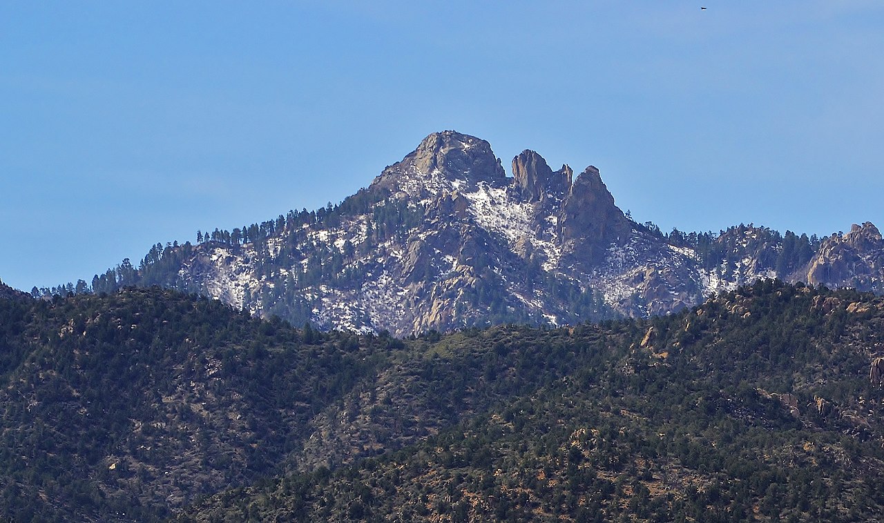
Hayden Peak Trail
 Photo: On^ste82, CC BY 3.0 (via Wikimedia Commons)
- 1.0 mi
- round trip
- 1,004 ft
- climb
- 8,112 ft
- high point
- Out and back
- route
Hayden Peak Trail is a 2-mile out-and-back hike in Arizona, with a moderate rating and a total elevation gain of 1,004 feet. The trail starts at about 8,096 feet and reaches a high point of 8,112 feet, with the steepest stretch coming within the first 0.18 miles at a grade of 26%. The nearest town is Getz, about 10.5 miles away. The route is rolling, and the climb is split evenly between ascent and descent. The trail is short enough to fit into a single day, and the estimated time is about an hour. Several other hikes sit close by. Mount Tipton Overlook is half a mile away, and Aspen Peak Trail and the Potato Patch Loop are each about a mile off. For an overnight stay, Wild Cow Springs Campground is roughly 2.6 miles away.
Local outfitters
- Settlin Inn RV Park24 mi away
- Sunrise Adventures Ridgeview Resort37 mi away
Not on Roamze yet. Their page has how to reach them.
- Mount Tipton OverlookHikingPhoto: On^ste82, CC BY 3.0 (via Wikimedia Commons)0.5 mi
 Aspen Peak TrailHikingPhoto: Victor Solanoy, CC BY 2.0 (via Flickr)0.8 mi
 Potato Patch LoopHikingPhoto: On^ste82, CC BY 3.0 (via Wikimedia Commons)1 mi
- Fire Evacuation FootpathHikingPhoto: On^ste82, CC BY 3.0 (via Wikimedia Commons)1 mi
- Aspen Peak TrailsHikingPhoto: On^ste82, CC BY 3.0 (via Wikimedia Commons)1.3 mi
- Hualapai MountainsRock climbingPhoto: On^ste82, CC BY 3.0 (via Wikimedia Commons)2.2 mi
 Wild Cow Springs CampgroundCampingPhoto: Recreation.gov (RIDB) / public domain2.6 mi
- East Buckboard TrailHiking3.7 mi
Source: Roamze catalog (indexable pages within 10 miles, PostGIS distance)
- Mount Tipton OverlookHiking · Next doorPhoto: On^ste82, CC BY 3.0 (via Wikimedia Commons)
- Aspen Peak TrailHiking · ~1 min drivePhoto: Victor Solanoy, CC BY 2.0 (via Flickr)
- Potato Patch LoopHiking · ~2 min drivePhoto: On^ste82, CC BY 3.0 (via Wikimedia Commons)
 Badger TrailHiking · ~27 min drivePhoto: inazakira, CC BY-SA 2.0 (via Flickr)
- Fire Evacuation FootpathHiking · ~2 min drivePhoto: On^ste82, CC BY 3.0 (via Wikimedia Commons)
- Wabayuma TrailHiking · ~14 min drive
- Castle Rock TrailHiking · ~28 min drive
- Aspen Peak TrailsHiking · ~2 min drivePhoto: On^ste82, CC BY 3.0 (via Wikimedia Commons)
- East Horseback TrailHiking · ~18 min drive
 Camp Beale Loop TrailHiking · ~23 min drivePhoto: zoso8203, Public Domain Mark (via Flickr)
Also worth it near here
Map and trail data © OpenStreetMap contributors
