Explorer Trail
- 2.0 mi
- round trip
- 746 ft
- climb
- 2,737 ft
- high point
- Out and back
- route
- Nov–Apr
- best months
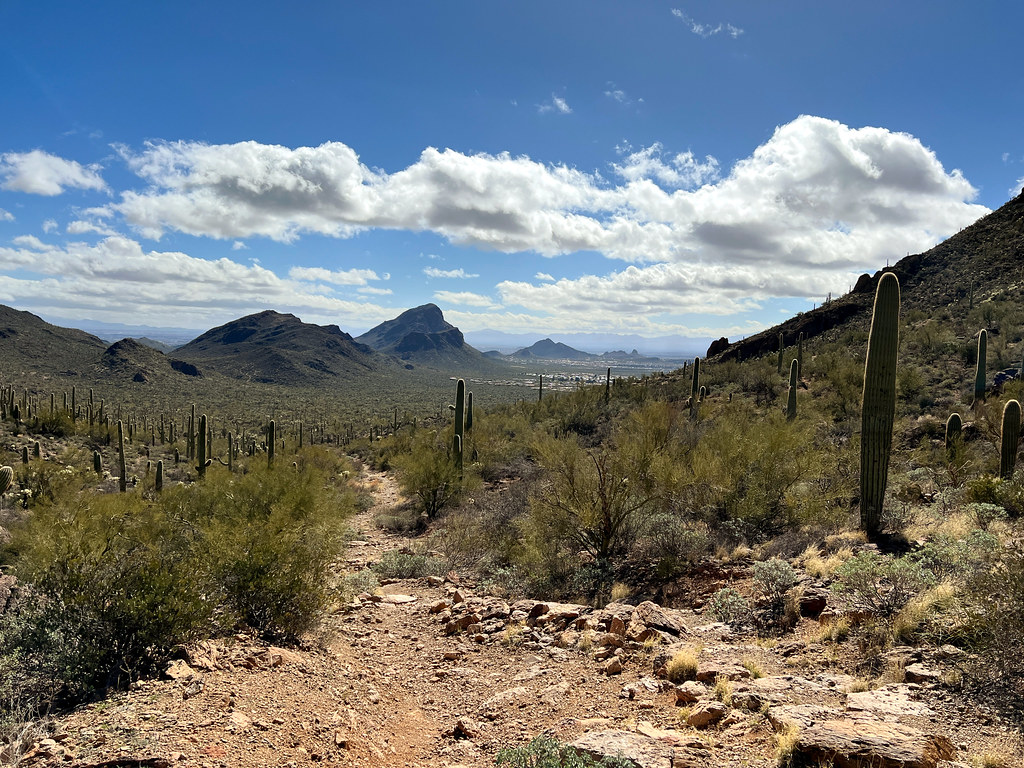
The Explorer Trail is an easy, out-and-back hike of about 4 miles in Tucson Mountain Park, Arizona, on county land. The route gains about 750 feet in elevation, with the high point at 2,737 feet, and the climb is steady, reaching a steepest stretch of 14% around 0.5 miles from the start. Winter and early spring are the most comfortable times to go. Typical averages from a nearby weather station show highs in the mid-60s and lows in the low 40s in December and January, while May and June average in the low 90s to over 100 degrees. The trip takes about 1.5 hours. The trail sits close to a cluster of mountain biking routes, including the Robles Pass Trail about 0.1 mile away and the Ledge Surfer Trail about 0.3 mile away. Climbers can find the Tucson Mountains climbing area roughly 4.7 miles away.
Local outfitters
- Patagonia RV Park47 mi away
Not on Roamze yet. Their page has how to reach them.
- Robles Pass TrailMountain biking0.1 mi
- Ledge Surfer TrailMountain biking0.3 mi
- West Mockingbird LaneMountain biking0.5 mi
- ExplorerMountain biking0.5 mi
- Sunset Pass TrailMountain biking0.6 mi
 The "Gimme Some" DomeRock climbingPhoto: «Gaurav», CC BY-SA 2.0 (via Flickr)4.7 mi
- Tucson MountainsRock climbing4.7 mi
 Gate's PassRock climbingPhoto: Daniel Ramirez from Honolulu, USA, CC BY 2.0 (via Wikimedia Commons)5 mi
Source: Roamze catalog (indexable pages within 10 miles, PostGIS distance)
 Gilbert Escandón Jiménez TrailHiking · ~5 min drivePhoto: Jon Roanhaus, CC BY-SA 3.0 (via Wikimedia Commons)
 Yetman TrailHiking · ~6 min drivePhoto: Bryan Pocius, CC BY 2.0 (via Flickr)
- Explorer TrailHiking · ~1 min drive
 Golden Gate TrailHiking · ~9 min drivePhoto: w_lemay, CC BY-SA 2.0 (via Flickr)
- Golden Gate Mountain LoopHiking · ~9 min drivePhoto: w_lemay, CC BY-SA 2.0 (via Flickr)
- Bittersweet TrailHiking · ~2 min drive
 Easy LoopHiking · ~9 min drivePhoto: RuggyBearLA, CC BY-SA 2.0 (via Flickr)
- Rock Wren TrailHiking · ~3 min drive
- Robles Pass TrailHiking · Next door
- Ledge Surfer TrailHiking · Next door
Best time to visit Explorer Trail
Best months: November–April. Best months have typical highs of 55–85 °F, lows of 30 °F or warmer (32 °F where the station doesn't record snow), at most one snowy day and no more than 12 wet days.
Jan
66° / 41°
4 wet
Feb
69° / 43°
4 wet
Mar
76° / 48°
3 wet
Apr
83° / 53°
2 wet
May
92° / 62°
1 wet
Jun
101° / 71°
2 wet
Jul
100° / 76°
8 wet
Aug
99° / 75°
8 wet
Sep
95° / 70°
5 wet
Oct
86° / 59°
3 wet
Nov
75° / 48°
3 wet
Dec
65° / 40°
4 wet
Typical high / low (°F) and days with rain or snow, 1991–2020. Measured at Tucson Intl Ap, AZ, 5.8 mi away at 2,549 ft. Source: NOAA NCEI U.S. Climate Normals 1991–2020.

Map and trail data © OpenStreetMap contributors
