Rock Wren Trail
- 2.5 mi
- round trip
- 1,541 ft
- climb
- 2,931 ft
- high point
- Out and back
- route
- Nov–Apr
- best months
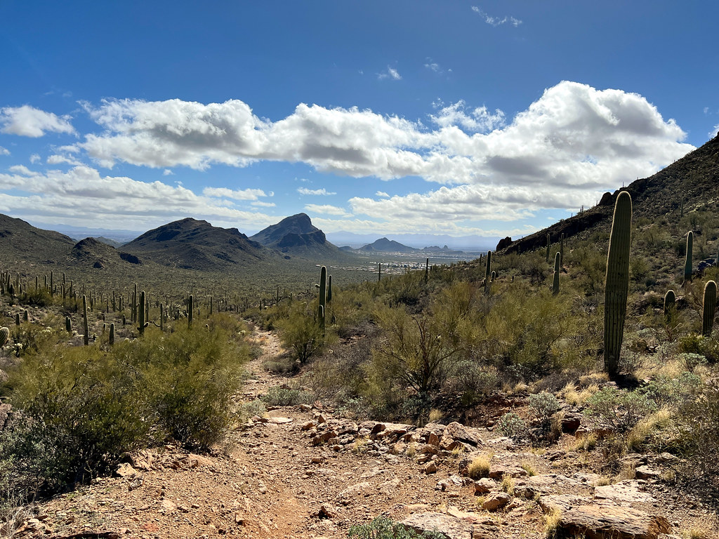
Rock Wren Trail is an easy out-and-back hike in Arizona, about 3 miles from Tucson Estates. The trail is roughly 5 miles long, with a total climb of about 1,500 feet, and the one-way gain is about 750 feet. The route is steady, with the steepest stretch around 2.2 miles in, where the grade reaches about 10%. Spring and fall are the most comfortable times to go. Typical averages from a nearby weather station show March highs around 75°F and October highs around 86°F, while June and July average near 100°F. Several other trails sit close by. Starr Pass Trail, a mountain biking route, is about 0.4 miles away, and the Max Shemwell Trail and Hidden Canyon Trail are each about 0.8 miles off. Climbers can find the Tucson Mountains about 3 miles away.
Local outfitters
- Patagonia RV Park49 mi away
Not on Roamze yet. Their page has how to reach them.
- Starr Pass TrailMountain biking0.4 mi
- 36th Street TrailMountain biking0.8 mi
- Max Shemwell TrailHiking0.8 mi
- Hidden Canyon TrailHiking0.8 mi
- Wild West TrailHiking1 mi
 The "Gimme Some" DomeRock climbingPhoto: «Gaurav», CC BY-SA 2.0 (via Flickr)3.2 mi
- Tucson MountainsRock climbing3.2 mi
 Gate's PassRock climbingPhoto: Daniel Ramirez from Honolulu, USA, CC BY 2.0 (via Wikimedia Commons)3.9 mi
Source: Roamze catalog (indexable pages within 10 miles, PostGIS distance)
 Yetman TrailHiking · ~5 min drivePhoto: Bryan Pocius, CC BY 2.0 (via Flickr)
 Gilbert Escandón Jiménez TrailHiking · ~5 min drivePhoto: Jon Roanhaus, CC BY-SA 3.0 (via Wikimedia Commons)
- Explorer TrailHiking · ~3 min drive
 Golden Gate Mountain LoopHiking · ~7 min drivePhoto: w_lemay, CC BY-SA 2.0 (via Flickr)
- Golden Gate TrailHiking · ~7 min drivePhoto: w_lemay, CC BY-SA 2.0 (via Flickr)
- Bittersweet TrailHiking · ~4 min drive
- Max Shemwell TrailHiking · ~1 min drive
- Hidden Canyon TrailHiking · ~1 min drive
- Starr Pass TrailHiking · ~2 min drive
- El Grupo LoopHiking · ~2 min drive
Best time to visit Rock Wren Trail
Best months: November–April. Best months have typical highs of 55–85 °F, lows of 30 °F or warmer (32 °F where the station doesn't record snow), at most one snowy day and no more than 12 wet days.
Jan
66° / 41°
6 wet
Feb
68° / 42°
5 wet
Mar
75° / 47°
4 wet
Apr
82° / 52°
3 wet
May
91° / 60°
1 wet
Jun
100° / 70°
2 wet
Jul
99° / 75°
10 wet
Aug
98° / 73°
10 wet
Sep
94° / 69°
6 wet
Oct
86° / 58°
4 wet
Nov
74° / 48°
3 wet
Dec
65° / 40°
6 wet
Typical high / low (°F) and days with rain or snow, 1991–2020. Measured at Tucson 11 W, AZ, 7.6 mi away at 2,733 ft. This station doesn't record snowfall. Source: NOAA NCEI U.S. Climate Normals 1991–2020.

Map and trail data © OpenStreetMap contributors
