Golden Gate Trail
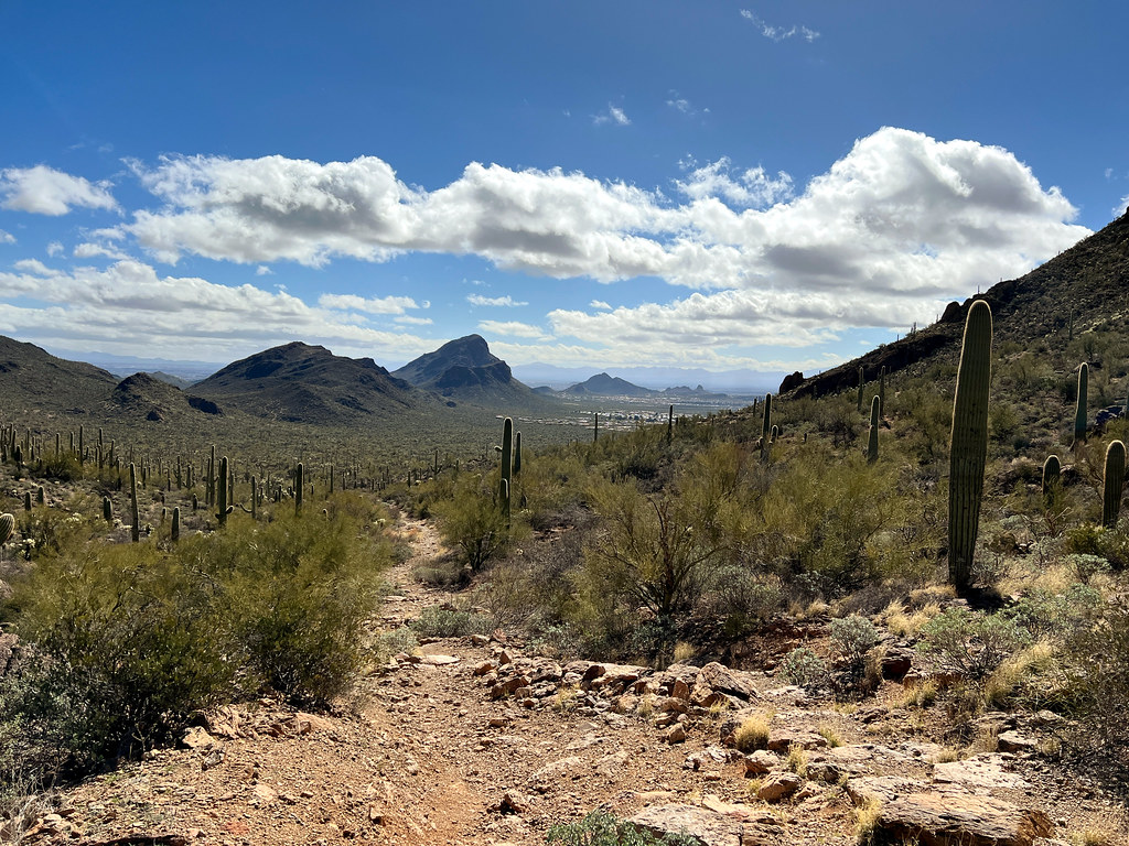
 Photo: w_lemay, CC BY-SA 2.0 (via Flickr)
- 1.1 mi
- round trip
- 389 ft
- climb
- 2,824 ft
- high point
- Out and back
- route
- Nov–Apr
- best months
Golden Gate Trail is a short, easy hike in Tucson Mountain Park, Arizona, on county land about 1.1 miles from the town of Tucson. The trail is an out-and-back route of about 2.2 miles, with a total climb of 389 feet and a high point of 2,824 feet. The steepest stretch comes early, at about 0.27 miles from the start, with a grade of 6 percent. Spring and fall are the most comfortable times to go. Typical averages from a nearby weather station show March highs around 75°F and October highs around 86°F, while June and July average near 100°F. Gate's Pass, a climbing area, sits just 0.1 mile away, and the Golden Gate Mountain Loop and the Chaparral mountain biking trail are each about 0.2 mile off. The Ringtail Trail is roughly 0.9 mile away.
 Gate's PassRock climbingPhoto: Daniel Ramirez from Honolulu, USA, CC BY 2.0 (via Wikimedia Commons)0.1 mi
- Golden Gate Mountain LoopHikingPhoto: w_lemay, CC BY-SA 2.0 (via Flickr)0.2 mi
- ChaparralMountain biking0.2 mi
- Yetman TrailMountain biking0.5 mi
- Ringtail TrailHiking0.9 mi
- Tucson MountainsRock climbing1.1 mi
 The "Gimme Some" DomeRock climbingPhoto: «Gaurav», CC BY-SA 2.0 (via Flickr)1.1 mi
- Beast BoulderRock climbing9 mi
Source: Roamze catalog (indexable pages within 10 miles, PostGIS distance)
- Golden Gate Mountain LoopHiking · Next doorPhoto: w_lemay, CC BY-SA 2.0 (via Flickr)
 Cougar TrailHiking · ~3 min drivePhoto: BFS Man from Webster, TX, USA, CC BY 2.0 (via Wikimedia Commons)
- Ironwood LoopHiking · ~6 min drive
 Yetman TrailHiking · ~2 min drivePhoto: Bryan Pocius, CC BY 2.0 (via Flickr)
- Orcut TrailHiking · ~3 min drivePhoto: BFS Man from Webster, TX, USA, CC BY 2.0 (via Wikimedia Commons)
- Prospector TrailHiking · ~6 min drive
 King Canyon / Gould Mine LoopHiking · ~7 min drivePhoto: w_lemay, CC BY-SA 2.0 (via Flickr)
 Coatimundi TrailHiking · ~4 min drivePhoto: BFS Man from Webster, TX, USA, CC BY 2.0 (via Wikimedia Commons)
- Brown Mountain Access TrailHiking · ~4 min drivePhoto: BFS Man from Webster, TX, USA, CC BY 2.0 (via Wikimedia Commons)
- Orcut TrailHiking · ~4 min drivePhoto: BFS Man from Webster, TX, USA, CC BY 2.0 (via Wikimedia Commons)
Best time to visit Golden Gate Trail
Best months: November–April. Best months have typical highs of 55–85 °F, lows of 30 °F or warmer (32 °F where the station doesn't record snow), at most one snowy day and no more than 12 wet days.
Jan
66° / 41°
6 wet
Feb
68° / 42°
5 wet
Mar
75° / 47°
4 wet
Apr
82° / 52°
3 wet
May
91° / 60°
1 wet
Jun
100° / 70°
2 wet
Jul
99° / 75°
10 wet
Aug
98° / 73°
10 wet
Sep
94° / 69°
6 wet
Oct
86° / 58°
4 wet
Nov
74° / 48°
3 wet
Dec
65° / 40°
6 wet
Typical high / low (°F) and days with rain or snow, 1991–2020. Measured at Tucson 11 W, AZ, 3.7 mi away at 2,733 ft. This station doesn't record snowfall. Source: NOAA NCEI U.S. Climate Normals 1991–2020.

Map and trail data © OpenStreetMap contributors
