Southfork Campground
Campground
< 0.1 mi from the trail
High Desert Nrt (Devils Pbowl) is a hard hike on natural trail surface in the San Gabriel Mountains National Monument Ranger District of Angeles National Forest, California, about 16 miles long with a one-way elevation gain of 1,364 feet. The route is an out-and-back that climbs from a low point of 4,535 feet to a high of 5,302 feet, and the trail is open year-round. The trail is managed by the Forest Service and is rated hard. Bikes and horses are both allowed. For an overnight base, Southfork Campground sits about 0.1 mile away, and the High Desert Nrt (Manzanita) segment starts about 0.2 mile off. Spring and fall are the most comfortable times to go. Typical averages from a nearby weather station in Wrightwood show May highs around 69°F and October highs around 64°F, while July climbs to about 83°F and winter lows dip into the mid-20s. Nearby, Dawson Saddle and the Behind the Scenes climbing area are both within about 2 miles, and the Devils Punchbowl Interpretive trail is about 2.5 miles away.
Where it is: San Gabriel Mountains National Monument Ranger District · Angeles National Forest
Near: Palmdale
Mid-March to late June and late August to mid-November are usually best for hiking here.
Typical highs of 54–80°F and lows of 30°F or warmer in those weeks.
Typical weather: NOAA 1991–2020 normals at Wrightwood, CA, 11 mi away. Not a forecast.
Typical weather by monthBest months: March–June and September–October. Best months are the ones mostly made of the best weeks for hiking: typical temperatures in its comfortable range, few snowy days and not usually wet, judged with the same limits as our good-day forecasts.
Jan
48°
26°
5 wet
Feb
48°
25°
8 wet
Mar
54°
29°
6 wet
Apr
60°
32°
4 wet
May
69°
39°
2 wet
Jun
78°
44°
1 wet
Jul
83°
53°
2 wet
Aug
82°
51°
2 wet
Sep
75°
46°
2 wet
Oct
64°
37°
3 wet
Nov
55°
29°
4 wet
Dec
47°
25°
5 wet
Typical high / low (°F) and days with rain or snow, 1991–2020. Measured at Wrightwood, CA, 10.7 mi away at 6,000 ft. The station sits about 700 ft higher than this place, so expect it a little warmer here. This station doesn't record snowfall. Source: NOAA NCEI U.S. Climate Normals 1991–2020.
Been here? Tell people how it was.
 Dawson SaddleHikingPhoto: mjhbower, CC BY-SA 2.0 (via Flickr)2.1 mi
 Behind the ScenesRock climbingPhoto: Michael R Perry, CC BY 2.0 (via Flickr)2.2 mi
 South AreaRock climbingPhoto: RuggyBearLA, CC BY 2.0 (via Flickr)2.4 miVD (Very Direct) WallRock climbingPhoto: RuggyBearLA, CC BY 2.0 (via Flickr)2.4 miDevils Punchbowl InterpretiveHikingPhoto: RuggyBearLA, CC BY 2.0 (via Flickr)2.5 miDawson SaddleHikingPhoto: mjhbower, CC BY-SA 2.0 (via Flickr)~4 min driveDevil's Chair TrailHikingPhoto: Michael R Perry, CC BY 2.0 (via Flickr)~4 min drive
 Mine GulchHikingPhoto: mjhbower, CC BY-SA 2.0 (via Flickr)~7 min drive
 South Fork TrailHikingPhoto: Alfa117, CC BY-SA 3.0 (via Wikimedia Commons)~5 min drive
 Half Knob TrailHikingPhoto: jesse?, CC BY 2.0 (via Flickr)~8 min drive
 LOST RIDGE TRAILHikingPhoto: mjhbower, CC BY-SA 2.0 (via Flickr)~7 min drive
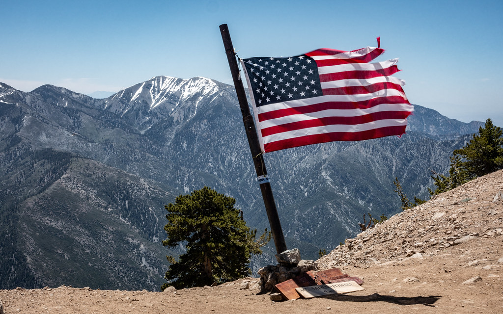 Limber Pines VistaHikingPhoto: mjhbower, CC BY-SA 2.0 (via Flickr)~7 min driveSouth Hawkins TrailHikingPhoto: mjhbower, CC BY-SA 2.0 (via Flickr)~7 min drive
 Bear Creek TrailHikingPhoto: Eeekster, CC BY-SA 3.0 (via Wikimedia Commons)~13 min drive
 Jackson LakeHikingPhoto: SuZi Zimmermann, CC BY-SA 3.0 (via Wikimedia Commons)~9 min drive
Also worth it near here
 High Desert Nrt (Manzanita)Mountain bikingPhoto: Crishazzard, CC BY-SA 4.0 (via Wikimedia Commons)~3 min drive
 Throop PeakSummitPhoto: Eeekster, CC BY 3.0 (via Wikimedia Commons)~6 min drive
 Waterfall WallRock climbingPhoto: RuggyBearLA, CC BY 2.0 (via Flickr)~7 min drive
Daily highs and lows, wind and the chance of precipitation at Start for the next 7 days, from the Open-Meteo model.
Questions about High Desert Nrt (Devils Pbowl): conditions, access, timing. Answers say when something isn't known.
Southfork Campground
Campground
 If it rainsThomas Ormston from Darmstadt, Germany, CC BY 2.0 · Wikimedia Commons
Aviation museum in Palmdale, California, United States
Places © OpenStreetMap contributors, Places © Overture Maps Foundation · Photos: Thomas Ormston from Darmstadt, Germany, CC BY 2.0 (commons)
More in Acton