Ontario Peak Trail
At a glance
Ontario Peak Trail is a 5.1-mile out-and-back hike in California's Cucamonga Wilderness, part of the Front Country Ranger District of San Bernardino National Forest. The trail climbs from about 7,576 feet to 8,681 feet, a gain of 1,158 feet, and is rated moderate. The Forest Service manages the land, and the route is on natural surface with no designated bike access. The trail is open year-round, and the surrounding wilderness makes it a destination for a full day in the backcountry. The Bighorn Peak Trail and the Cucamonga Pk-Icehouse Saddle route both start about 0.1 mile away, and the Icehouse Canyon Trail is roughly 0.9 mile off. For an overnight stay, Manker Flat campground sits about 2.7 miles away.
- round trip
- 5.1 mi
- climb
- 1,158 ft
- high point
- 8,681 ft
- route
- Out and back
Where it is: Cucamonga Wilderness · Front Country Ranger District
Near: Rancho Cucamonga
Been here? Tell people how it was.
 BIGHORN PEAK TRAILHikingPhoto: Mitch from Costa Mesa, CA, USA, CC BY-SA 2.0 (via Wikimedia Commons)0.1 mi
- Cucamonga Pk- Icehouse SaddleHikingPhoto: Mitch from Costa Mesa, CA, USA, CC BY-SA 2.0 (via Wikimedia Commons)0.1 mi
 Icehouse Canyon TrailHikingPhoto: simonov, CC BY-SA 2.0 (via Flickr)0.9 mi
- Icehouse CanyonRock climbing1.6 mi
- Mount Baldy RoadRock climbing2.5 mi
- Manker FlatCamping2.7 mi
- Lytle Creek - Cajon Pass Recreation AreaRiver fishing6.5 mi
- LupineCamping7.5 mi
 Telegraph Peak TrailHikingPhoto: Moo.The.Cow, CC BY 2.0 (via Flickr)~2 min drive
 Chapman TrailHikingPhoto: inkknife_2000 (7.5 million views +), CC BY-SA 2.0 (via Wikimedia Commons)~3 min drive
 Three T'sHikingPhoto: inkknife_2000 (7.5 million views +), CC BY-SA 2.0 (via Wikimedia Commons)~3 min drive
 Cucamonga Peak - Non WildernesHikingPhoto: GSEC, CC BY 2.0 (via Flickr)~5 min drive
 Three Ts TrailHikingPhoto: inkknife_2000 (7.5 million views +), CC BY-SA 2.0 (via Wikimedia Commons)~4 min drive
 Middlefork - WildernessHikingPhoto: joedecruyenaere on Flickr, CC BY-SA 2.0 (via Wikimedia Commons)~4 min drive
- Stonehouse - Stonehouse Cut-OfHikingPhoto: joedecruyenaere on Flickr, CC BY-SA 2.0 (via Wikimedia Commons)~5 min drive
- Devils Backbone TrailHikingPhoto: inkknife_2000 (7.5 million views +), CC BY-SA 2.0 (via Wikimedia Commons)~4 min drive
- Register RidgeHikingPhoto: inkknife_2000 (7.5 million views +), CC BY-SA 2.0 (via Wikimedia Commons)~5 min drive
 Chaparral NeighborhoodHikingPhoto: inkknife_2000 (7.5 million views +), CC BY-SA 2.0 (via Wikimedia Commons)~11 min drive
Also worth it near here
 Bighorn Peak TrailMountain bikingPhoto: User:agriffith14, CC BY-SA 3.0 (via Wikimedia Commons)Next door
- Kelly CampCamping~1 min drive
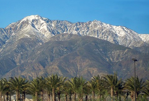 Cucamonga PeakSummitPhoto: Cliff Hutson; later cropping and color editing by Daniel Case., CC BY 2.0 (via Wikimedia Commons)~2 min drive
- Icehouse CanyonRock climbing~3 min drive
Conditions and forecast on Ontario Peak
Caution todayAgency alerts are in effect for this areaUSFS · checked 9 min agoDaily highs and lows, wind and the chance of precipitation at the summit and route start for the next 7 days, from the Open-Meteo model.
Ask about this place
Questions about Ontario Peak Trail: conditions, access, timing. Answers say when something isn't known.
Questions about this route
How long is the Ontario Peak Trail on Ontario Peak?
About 5.1 mi round trip.
How much elevation gain is on the Ontario Peak Trail?
About 1,158 ft of climbing round trip.
How hard is the Ontario Peak Trail?
It is rated moderate.
When is the best time for the Ontario Peak Trail?
Year-round.
