Bell Mountain
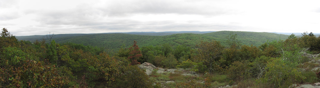 Photo: cm195902, CC BY 2.0 (via Flickr)
At a glance
Bell Mountain is a hard hike in Missouri's Bell Mountain Wilderness, part of the Potosi / Fredericktown Ranger District of Mark Twain National Forest. The trail is an out-and-back of about 8.4 miles, with a total climb of roughly 1,228 feet, and it starts at an elevation of about 1,320 feet, reaching a high point of about 1,703 feet. The steepest stretch comes early, with a grade of about 16% at about 0.15 miles in. The route is on natural surface, and horses are allowed. Bikes are not. The trail is not accessible. For comfortable weather, aim for late spring or early fall. Typical averages from a nearby weather station in Potosi show May highs around 74°F and September highs around 78°F, with October cooling to about 68°F. That station sits about 600 feet lower than the high point, so temperatures on the mountain run cooler. The hike takes about 3.5 hours, and the trail is open year-round. The Bell Mountain Connector lies about 1.7 miles away, and the Ozark Trail - Taum Sauk and Lindsey Mountain Trail are both within about 3 miles. Paddlers can head to the East Fork Black River, about 5.6 miles off.
- round trip
- 8.4 mi
- climb
- 1,228 ft
- high point
- 1,703 ft
- route
- Out and back
- time
- About 3 hours
- best months
- Mar–Jun, Aug–Oct
Where it is: Bell Mountain Wilderness · Potosi / Fredericktown Ranger District
Near: Farmington
Best time to visit Bell Mountain
Best months: March–June and August–October. Best months have typical highs of 55–85 °F, lows of 30 °F or warmer (32 °F where the station doesn't record snow), at most one snowy day and no more than 12 wet days.
Jan
40°
21°
8 wet
Feb
45°
25°
8 wet
Mar
55°
33°
10 wet
Apr
66°
44°
11 wet
May
74°
54°
12 wet
Jun
82°
63°
10 wet
Jul
86°
67°
9 wet
Aug
85°
65°
8 wet
Sep
78°
57°
7 wet
Oct
68°
46°
9 wet
Nov
54°
35°
8 wet
Dec
43°
26°
8 wet
Typical high / low (°F) and days with rain or snow, 1991–2020. Measured at Potosi 4 Sw, MO, 17.6 mi away at 1,105 ft. The station sits about 600 ft lower than this place, so expect it a little cooler here. This station doesn't record snowfall. Source: NOAA NCEI U.S. Climate Normals 1991–2020.
Been here? Tell people how it was.
 Bell Mountain ConnectorHikingPhoto: cm195902, CC BY 2.0 (via Flickr)1.7 mi
- Ozark Trail - Taum SaukHikingPhoto: cm195902, CC BY 2.0 (via Flickr)2.2 mi
- Lindsey Mountain TrailHiking2.7 mi
- East Fork Black RiverCanoeing5.6 mi
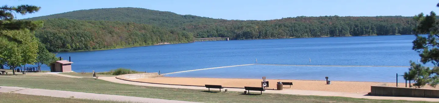 Council Bluff Recreation AreaLake fishing5.8 mi
- Council Bluff (Wbr) CgCamping6.5 mi
 EM: Johnson Shut-InsRock climbingPhoto: Kbh3rd, CC BY 4.0 (via Wikimedia Commons)7.3 mi
 Upper CliffRock climbingPhoto: Wikipedian Kbh3rd, CC BY-SA 3.0 (via Wikimedia Commons)7.4 mi
- Bell Mountain ConnectorHikingPhoto: cm195902, CC BY 2.0 (via Flickr)~3 min drive
 Goggins Mountain Equestrian TrailHikingPhoto: Kbh3rd, CC BY-SA 3.0 (via Wikimedia Commons)~9 min drive
- Ozark Trail - Taum SaukHikingPhoto: cm195902, CC BY 2.0 (via Flickr)~4 min drive
- Brushy Creek - Blue 1Hiking~12 min drive
 Campground Trail SystemHikingPhoto: CC BY-SA 3.0 (via Wikimedia Commons)~10 min drive
- Ozark Trail - Middle ForkHiking~18 min drive
- Lindsey Mountain TrailHiking~5 min drive
- Brushy Creek - RedHiking~15 min drive
- Scour TrailHikingPhoto: CC BY-SA 3.0 (via Wikimedia Commons)~11 min drive
- Council Bluff TrailHiking~12 min drive
Also worth it near here
Conditions and forecast on Bell Mountain
Caution todayAgency alerts are in effect for this areaUSFS · checked 21 min agoDaily highs and lows, wind and the chance of precipitation at the summit and route start for the next 7 days, from the Open-Meteo model.
Ask about this place
Questions about Bell Mountain: conditions, access, timing. Answers say when something isn't known.
Other routes up Bell Mountain
Questions about this route
How long is the Bell Mountain on Bell Mountain?
About 8.4 mi round trip.
How much elevation gain is on the Bell Mountain?
About 1,228 ft of climbing round trip.
How hard is the Bell Mountain?
It is rated hard.
How long does the Bell Mountain take?
About 3 hours round trip.
When is the best time for the Bell Mountain?
Year-round.
How many routes go up Bell Mountain?
2: Bell Mountain and Bell Mountain.
