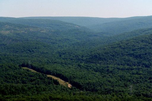
Campground Trail System
 Photo: CC BY-SA 3.0 (via Wikimedia Commons)
- 2.5 mi
- round trip
- 469 ft
- climb
- 975 ft
- high point
- Out and back
- route
- Mar–Jun, Aug–Oct
- best months
The Campground Trail System is an easy out-and-back hike in Missouri, about 0.8 miles from the town of Monterey. The route is roughly 5 miles long, with a total elevation gain of about 122 feet, and it reaches a high point of 975 feet. The trail is open to bikes, and horses are not allowed. Spring and fall are the most comfortable times to go. Typical averages from a nearby weather station show October highs around 68°F with lows near 46°F, and May highs around 74°F. That station sits about 23 miles away and at a slightly higher elevation, so temperatures on the trail may run a little warmer. Several other trails and climbing areas lie within a short drive. Scour Trail is about 0.8 miles away, and the Black River Trail System is about a mile off. EM: Johnson Shut-Ins, a climbing area, is about 1.5 miles away, and paddlers can reach the East Fork Black River about 3 miles from the trail.
- Scour TrailHikingPhoto: CC BY-SA 3.0 (via Wikimedia Commons)0.8 mi
 Black River Trail SystemHikingPhoto: SymphonicPoet, CC BY 2.0 (via Flickr)1 mi
 EM: Johnson Shut-InsRock climbingPhoto: Kbh3rd, CC BY 4.0 (via Wikimedia Commons)1.5 mi
 Goggins Mountain Equestrian TrailHikingPhoto: Kbh3rd, CC BY-SA 3.0 (via Wikimedia Commons)1.6 mi
 Upper CliffRock climbingPhoto: Wikipedian Kbh3rd, CC BY-SA 3.0 (via Wikimedia Commons)1.7 mi
- Horseshoe Glade TrailHikingPhoto: CC BY-SA 3.0 (via Wikimedia Commons)1.8 mi
- East Fork Black RiverCanoeing3.1 mi
- Middle Fork Black RiverCanoeing8.7 mi
Source: Roamze catalog (indexable pages within 10 miles, PostGIS distance)
- Scour TrailHiking · ~1 min drivePhoto: CC BY-SA 3.0 (via Wikimedia Commons)
- Goggins Mountain Equestrian TrailHiking · ~3 min drivePhoto: Kbh3rd, CC BY-SA 3.0 (via Wikimedia Commons)
 Ozark Trail - Taum SaukHiking · ~9 min drivePhoto: cm195902, CC BY 2.0 (via Flickr)
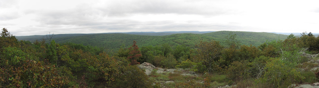 Bell MountainHiking · ~10 min drivePhoto: cm195902, CC BY 2.0 (via Flickr)
- Black River Trail SystemHiking · ~2 min drivePhoto: SymphonicPoet, CC BY 2.0 (via Flickr)
- Ozark Trail - Middle ForkHiking · ~18 min drive
- Lindsey Mountain TrailHiking · ~8 min drive
- Bell MountainHiking · ~13 min drive
- Horseshoe Glade TrailHiking · ~3 min drivePhoto: CC BY-SA 3.0 (via Wikimedia Commons)
- Brushy Creek - RedHiking · ~15 min drive
Also worth it near here
Best time to visit Campground Trail System
Best months: March–June and August–October. Best months have typical highs of 55–85 °F, lows of 30 °F or warmer (32 °F where the station doesn't record snow), at most one snowy day and no more than 12 wet days.
Jan
40° / 21°
8 wet
Feb
45° / 25°
8 wet
Mar
55° / 33°
10 wet
Apr
66° / 44°
11 wet
May
74° / 54°
12 wet
Jun
82° / 63°
10 wet
Jul
86° / 67°
9 wet
Aug
85° / 65°
8 wet
Sep
78° / 57°
7 wet
Oct
68° / 46°
9 wet
Nov
54° / 35°
8 wet
Dec
43° / 26°
8 wet
Typical high / low (°F) and days with rain or snow, 1991–2020. Measured at Potosi 4 Sw, MO, 23.2 mi away at 1,105 ft. This station doesn't record snowfall. Source: NOAA NCEI U.S. Climate Normals 1991–2020.