Brushy Creek - Blue 1
- 7.8 mi
- round trip
- 1,439 ft
- climb
- 1,272 ft
- high point
- Out and back
- route
- Mar–Jun, Aug–Oct
- best months
Is Brushy Creek - Blue 1 open right now?
Alert in the area
The Forest Service lists 10 alerts for Mark Twain National Forest.
Crane Lake Dam
Agency alert covering Mark Twain National Forest · USFS · Mark Twain National Forest
Delays on Forest Road 557
Agency alert covering Mark Twain National Forest · USFS · Mark Twain National Forest
Forest Order - Trail 119 Closure Extended (Chadwick Motorized Trail System)
Agency alert covering Mark Twain National Forest · USFS · Mark Twain National Forest
Weather Conditions
Agency alert covering Mark Twain National Forest · USFS · Mark Twain National Forest
Red Bridge Road - Bridge Closure
Agency alert covering Mark Twain National Forest · USFS · Mark Twain National Forest
As of · Source: USFS · Mark Twain National Forest. Agencies don't list every closure — check before you go.
Brushy Creek - Blue 1 is a 7.79-mile out-and-back hike in Missouri's Mark Twain National Forest, within the Potosi / Fredericktown Ranger District. The trail is a hard-difficulty route with 779 feet of elevation gain and a total climb of about 1,439 feet, making it a challenging outing rather than a short day on foot. The route is a steady climb, peaking at 1,272 feet, with the steepest stretch around 3.6 miles in at a grade of 18%. The trail is open year-round and takes about 3.5 hours to complete. It is a natural-surface trail that is not accessible and allows both bikes and horses. Spring and fall are the most comfortable seasons to go. Typical averages from a nearby weather station show May highs around 74°F and October highs around 68°F, while July highs reach about 86°F and January lows dip to 21°F. Several other destinations sit close by. Brushy Creek - Blue is just 0.4 miles away, and Brushy Creek - Connector C is 0.6 miles off. The Middle Fork Black River, a canoeing route, is about 3.4 miles away. Sutton Bluff Recreation Area, about 7.5 miles away, offers river fishing and camping.
- Brushy Creek - BlueHiking0.4 mi
- Brushy Creek - Connector CHiking0.6 mi
- Middle Fork Black RiverCanoeing3.4 mi
- Cook SpringCamping6.7 mi
 Sutton Bluff Recreation AreaRiver fishing7.5 mi
- Sutton BluffCamping7.5 mi
 EM: Johnson Shut-InsRock climbingPhoto: Kbh3rd, CC BY 4.0 (via Wikimedia Commons)8.2 mi
 Upper CliffRock climbingPhoto: Wikipedian Kbh3rd, CC BY-SA 3.0 (via Wikimedia Commons)8.3 mi
Source: Roamze catalog (indexable pages within 10 miles, PostGIS distance)
 Goggins Mountain Equestrian TrailHiking · ~10 min drivePhoto: Kbh3rd, CC BY-SA 3.0 (via Wikimedia Commons)
 Bell Mountain ConnectorHiking · ~10 min drivePhoto: cm195902, CC BY 2.0 (via Flickr)
- Ozark Trail - Taum SaukHiking · ~8 min drivePhoto: cm195902, CC BY 2.0 (via Flickr)
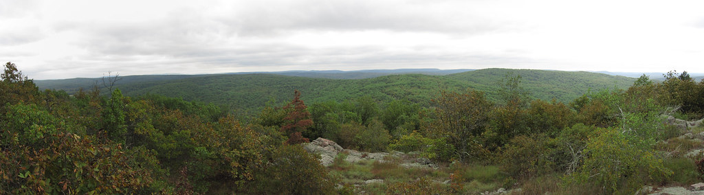 Bell MountainHiking · ~12 min drivePhoto: cm195902, CC BY 2.0 (via Flickr)
- Ozark Trail - Middle ForkHiking · ~6 min drive
 Campground Trail SystemHiking · ~12 min drivePhoto: CC BY-SA 3.0 (via Wikimedia Commons)
- Lindsey Mountain TrailHiking · ~15 min drive
- Brushy Creek - RedHiking · ~3 min drive
 Black River Trail SystemHiking · ~13 min drivePhoto: SymphonicPoet, CC BY 2.0 (via Flickr)
- Council Bluff TrailHiking · ~19 min drive
Best time to visit Brushy Creek - Blue 1
Best months: March–June and August–October. Best months have typical highs of 55–85 °F, lows of 30 °F or warmer (32 °F where the station doesn't record snow), at most one snowy day and no more than 12 wet days.
Jan
40° / 21°
8 wet
Feb
45° / 25°
8 wet
Mar
55° / 33°
10 wet
Apr
66° / 44°
11 wet
May
74° / 54°
12 wet
Jun
82° / 63°
10 wet
Jul
86° / 67°
9 wet
Aug
85° / 65°
8 wet
Sep
78° / 57°
7 wet
Oct
68° / 46°
9 wet
Nov
54° / 35°
8 wet
Dec
43° / 26°
8 wet
Typical high / low (°F) and days with rain or snow, 1991–2020. Measured at Potosi 4 Sw, MO, 22.9 mi away at 1,105 ft. This station doesn't record snowfall. Source: NOAA NCEI U.S. Climate Normals 1991–2020.
