The Butt
At a glance
The Butt is a summit of 4,025 feet in Virginia's Mount Rogers National Recreation Area, part of the George Washington and Jefferson National Forest. The nearest town is Lebanon, about 4.5 miles away. September is the most comfortable time to visit, with typical highs around 75°F and lows near 58°F, and it has the fewest wet days of the year. Those figures are typical averages from a nearby weather station at Nora, which sits well below the summit, so temperatures up high run cooler. The Brumley Mountain Trail starts just 0.3 miles away, and Brumley Creek, a canoeing spot, is about 3.9 miles off. Farther afield, the Channels Trail and Big Moccasin Creek are both within roughly 7.5 miles.
- summit
- 4,025 ft
- way up
- 1
- best months
- Apr, Sep–Oct
Where it is: Mount Rogers National Recreation Area · George Washington and Jefferson National Forest
Near: Lebanon · 4.5 mi
Best time to visit The Butt
Best months: April and September–October. Best months have typical highs of 55–85 °F, lows of 30 °F or warmer (32 °F where the station doesn't record snow), at most one snowy day and no more than 12 wet days.
Jan
40°
24°
16 wet
Feb
44°
27°
14 wet
Mar
52°
34°
14 wet
Apr
63°
44°
12 wet
May
71°
52°
14 wet
Jun
77°
61°
13 wet
Jul
80°
64°
14 wet
Aug
80°
63°
13 wet
Sep
75°
58°
10 wet
Oct
64°
47°
11 wet
Nov
52°
36°
12 wet
Dec
44°
29°
15 wet
Typical high / low (°F) and days with rain or snow, 1991–2020. Measured at Nora 4 Sse, VA, 17.8 mi away at 2,658 ft. The station sits about 1,400 ft lower than this place, so expect it a little cooler here. This station doesn't record snowfall. Source: NOAA NCEI U.S. Climate Normals 1991–2020.
Been here? Tell people how it was.
Map © Mapbox © OpenStreetMap contributors - Turkey Knob3,637 ft · Virginia1 route3.7 mi away
- Middle Knob4,200 ft · Virginia1 route6.7 mi away
- Beaver Creek Knobs2,116 ft · Tennessee5 routes19 mi away
- McQueen Knob3,883 ft · Tennessee1 route20 mi away
- Little Oak Mountain2,017 ft · Tennessee1 route22 mi away
- Locust Knob4,034 ft · Tennessee1 route23 mi away
- Brumley Mountain TrailHiking0.3 mi
- Brumley CreekCanoeing3.9 mi
- Channels TrailHiking7.1 mi
- Big Moccasin CreekCanoeing7.5 mi
- Big Cedar Creek TrailHiking8.5 mi
- Clinch RiverRiver fishing8.7 mi
 Grapevine Hill TrailHikingPhoto: vastateparksstaff, CC BY 2.0 (via Wikimedia Commons)8.9 mi
- Rebel WallRock climbing8.9 mi
 Three Top MountainSummitPhoto: James St. John, CC BY 2.0 (via Wikimedia Commons)~1h 8m drive
 Mount JeffersonSummitPhoto: Matthew Applewood, CC BY-SA 3.0 (via Wikimedia Commons)~1h 19m drive
 Beech MountainSummitPhoto: Thomson200, CC0 (via Wikimedia Commons)~1h 19m drive
 Howard KnobSummitPhoto: Bigmacthealmanac, CC BY-SA 4.0 (via Wikimedia Commons)~1h 22m drive
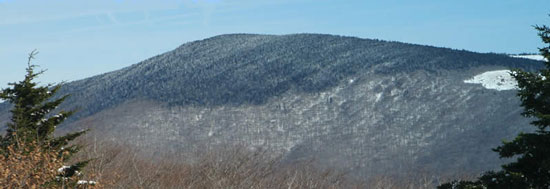 Mount RogersSummitPhoto: USDA-FS, Public domain (via Wikimedia Commons)~56 min drive
- Turkey KnobSummit~6 min drive
- Beaver Creek KnobsSummit~33 min drive
- McQueen KnobSummit~35 min drive
- Locust Pole KnobSummit~37 min drive
- Little Oak MountainSummit~37 min drive
Conditions and forecast
Daily highs and lows, wind and the chance of precipitation at the summit and route start for the next 7 days, from the Open-Meteo model.
Questions about The Butt
How tall is The Butt?
4,025 ft (1,227 m).
How many routes go to the summit of The Butt?
One: Brumley Mountain Trail.
Ask about this place
Questions about The Butt: conditions, access, timing. Answers say when something isn't known.
