Tepee Rocks
At a glance
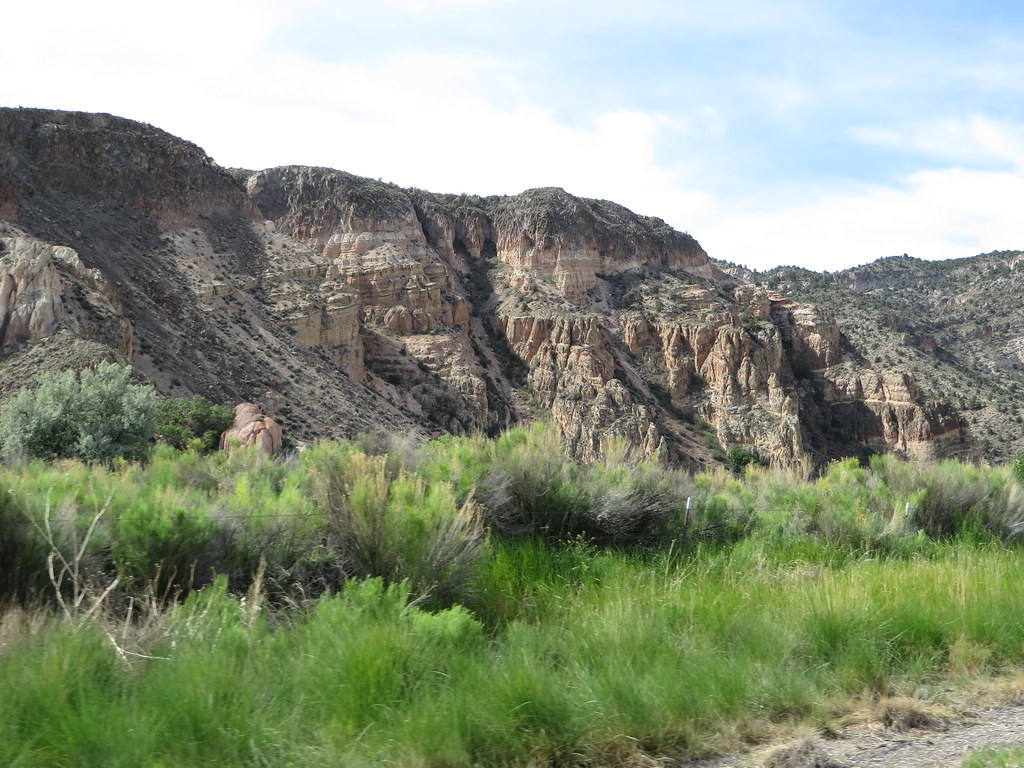
Tepee Rocks is a summit in Nevada's Ely District, on Bureau of Land Management land about 4.5 miles from the town of Caliente. It sits at 5,242 feet, and the Barnes Canyon Trailhead lies just 0.1 mile away, making it an easy addition to a day spent exploring the trailhead's network of hiking and mountain biking routes. Spring and fall are the most comfortable times to visit. Typical averages from a nearby weather station in Caliente show May highs around 79°F and October highs around 74°F, while July averages climb to about 97°F. That station sits roughly 860 feet lower than the summit, so temperatures on top run cooler. The Barnes Canyon Trailhead offers several hiking options, including Board's Head and Wake Up Call, both about 0.1 mile away, and Rocky Top at 0.7 mile. Mountain bikers can ride the Mongoose trail, also about 0.7 mile off.
- summit
- 5,242 ft
- ways up
- 5
- best months
- Apr–May, Oct
Where it is: Ely District
Near: Caliente · 4.5 mi
Best time to visit Tepee Rocks
Best months: April–May and October. Best months have typical highs of 55–85 °F, lows of 30 °F or warmer (32 °F where the station doesn't record snow), at most one snowy day and no more than 12 wet days.
Jan
49°
19°
4 wet
Feb
53°
23°
5 wet
Mar
62°
28°
5 wet
Apr
69°
34°
4 wet
May
79°
42°
4 wet
Jun
90°
50°
3 wet
Jul
97°
57°
4 wet
Aug
94°
55°
4 wet
Sep
87°
46°
3 wet
Oct
74°
34°
3 wet
Nov
60°
24°
3 wet
Dec
48°
18°
4 wet
Typical high / low (°F) and days with rain or snow, 1991–2020. Measured at Caliente, NV, 4.9 mi away at 4,379 ft. The station sits about 900 ft lower than this place, so expect it a little cooler here. This station doesn't record snowfall. Source: NOAA NCEI U.S. Climate Normals 1991–2020.
Been here? Tell people how it was.
- Barnes Canyon Trailhead - Wake Up CallEasyabout 341 ft of climbing1.7 mi round trip
- Barnes Canyon Trailhead - Rocky TopEasyabout 121 ft of climbing1.9 mi
- Mongoose TrailModerateabout 1,406 ft of climbing5.3 mi round trip
- Barnes Canyon Trailhead - ParallelEasyabout 40 ft of climbing2.8 mi round trip
- Barnes Canyon Trailhead - Board's HeadEasyabout 208 ft of climbing3.0 mi round trip
Compare the routes Barnes Canyon Trailhead - Wake Up Call Barnes Canyon Trailhead - Rocky Top Mongoose Trail Barnes Canyon Trailhead - Parallel Climbing About 341 ft About 121 ft About 1,406 ft About 40 ft Round trip 1.7 mi 1.9 mi 5.3 mi 2.8 mi Difficulty Easy Easy Moderate Easy Terrain Hike Hike Hike Hike Map © Mapbox © OpenStreetMap contributors - Land Hill3,311 ft · Utah1 route51 mi away
 North Black Rocks3,150 ft · Utah1 route52 mi awayPhoto: Masohpotato, CC BY-SA 3.0 (via Wikimedia Commons)
- Shinob Kibe3,308 ft · Utah1 route62 mi away
- Sand Mountain4,218 ft · Utah2 routes69 mi away
- Mollies Nipple4,617 ft · Utah1 route71 mi away
- Gooseberry Mesa5,444 ft · Utah1 route75 mi away
- Barnes Canyon Trailhead - Board's HeadHiking0.1 mi
- Barnes Canyon Trailhead - Wake Up CallHiking0.1 mi
- MongooseMountain biking0.7 mi
- Barnes Canyon Trailhead - Rocky TopHiking0.7 mi
- Barnes Canyon Trailhead - Back 40Hiking0.8 mi
- Barnes Canyon Trailhead - ParallelHiking0.9 mi
- Back 40Mountain biking1 mi
- Clover CreekCanoeing9.4 mi
Conditions and forecast
Daily highs and lows, wind and the chance of precipitation at the summit and route start for the next 7 days, from the Open-Meteo model.
Questions about Tepee Rocks
How tall is Tepee Rocks?
5,242 ft (1,598 m).
How many routes go to the summit of Tepee Rocks?
5: Barnes Canyon Trailhead - Wake Up Call, Barnes Canyon Trailhead - Rocky Top, Mongoose Trail, Barnes Canyon Trailhead - Parallel and Barnes Canyon Trailhead - Board's Head.
What is the shortest route up Tepee Rocks?
Barnes Canyon Trailhead - Wake Up Call, about 1.7 mi round trip.

Ask about this place
Questions about Tepee Rocks: conditions, access, timing. Answers say when something isn't known.
