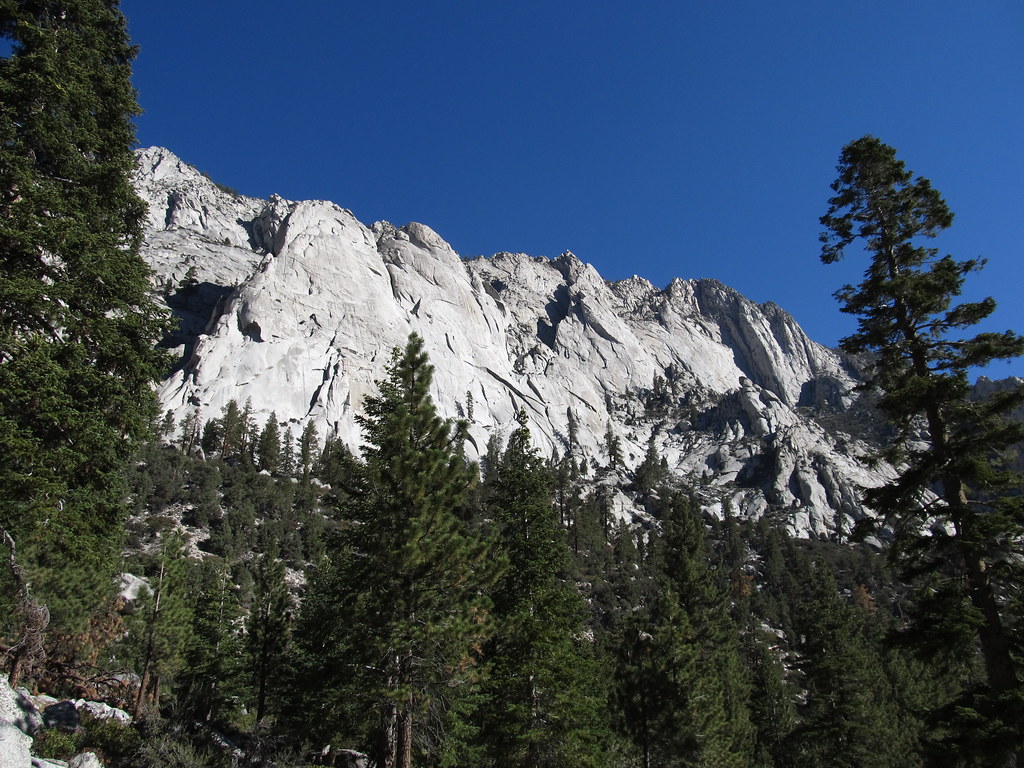
Oz Rock - North Face
 Photo: RuggyBearLA, CC BY 2.0 (via Flickr)
At a glance
Oz Rock - North Face is a climbing area in California on Bureau of Land Management land within the Bishop Field Office. It sits among a cluster of climbing spots, with the East Face of Oz Rock just 0.1 mile away and Alabama Hills North and the Eastern Choss Proving Grounds within a mile. The area has five routes, four of which are sport and one is trad. The grades run from 5.8 up to 5.11a/b, with Flying Monkeys and Wicked Witch both at 5.11a. Cowardly Line is the trad route at 5.8, and If I Only Had a Brain is the hardest at 5.11a/b. Spring and fall are the most comfortable times to climb. Typical averages from a nearby weather station in Independence show April highs around 76°F and October highs around 81°F, while July and August average in the low 100s. That station sits about 1,000 feet lower than the area, so temperatures here run cooler. Tuttle Creek Campground is about 3.6 miles away, and Lone Pine is about 4.5 miles away. The Alabama Hills Trail and Arch Loop Trail are both about a mile off.
5 routes · 5.8 – 5.11a/b · Sport · Trad
- best months
- Feb–May, Oct–Nov
Where it is: Bishop Field Office
Near: Lone Pine
Best time to visit Oz Rock - North Face
Best months: February–May and October–November. Best months have typical highs of 55–85 °F, lows of 30 °F or warmer (32 °F where the station doesn't record snow), at most one snowy day and no more than 12 wet days.
Jan
58°
30°
4 wet
Feb
61°
33°
4 wet
Mar
69°
39°
3 wet
Apr
76°
44°
1 wet
May
85°
53°
1 wet
Jun
96°
62°
1 wet
Jul
102°
67°
1 wet
Aug
101°
65°
1 wet
Sep
93°
58°
1 wet
Oct
81°
48°
1 wet
Nov
67°
36°
2 wet
Dec
57°
29°
4 wet
Typical high / low (°F) and days with rain or snow, 1991–2020. Measured at Independence, CA, 13.7 mi away at 3,950 ft. The station sits about 1,000 ft lower than this place, so expect it a little cooler here. This station doesn't record snowfall. Source: NOAA NCEI U.S. Climate Normals 1991–2020.
Been here? Tell people how it was.
- Oz Rock - East FaceRock climbingPhoto: RuggyBearLA, CC BY 2.0 (via Flickr)0.1 mi
 Alabama Hills NorthRock climbingPhoto: lamblukas, CC BY 2.0 (via Flickr)0.8 mi
 Eastern Choss Proving GroundsRock climbingPhoto: cogdogblog, CC BY 2.0 (via Wikimedia Commons)0.9 mi
 Alabama Hills TrailHikingPhoto: kalestews, CC BY 2.0 (via Flickr)1 mi
 Arch Loop TrailHikingPhoto: hakkun, CC BY-SA 3.0 (via Wikimedia Commons)1 mi
- Tuttle Creek CampgroundCamping3.6 mi
- Lone PineCamping4.5 mi
- Tuttle Creek TrailHiking6 mi
- Alabama Hills NorthRock climbingPhoto: lamblukas, CC BY 2.0 (via Flickr)~1 min drive
 Kearsarge Dome aka The Battle ShipRock climbingPhoto: RuggyBearLA, CC BY 2.0 (via Flickr)~2 min drive
 South PileRock climbingPhoto: RuggyBearLA, CC BY 2.0 (via Flickr)~2 min drive
 Paul's BackyardRock climbingPhoto: lamblukas, CC BY 2.0 (via Flickr)~2 min drive
- Paul's ParadiseRock climbingPhoto: lamblukas, CC BY 2.0 (via Flickr)~2 min drive
- Hillbilly PillarRock climbingPhoto: lamblukas, CC BY 2.0 (via Flickr)~2 min drive
 Alabama HillsRock climbingPhoto: RuggyBearLA, CC BY 2.0 (via Flickr)~2 min drive
 Zoo WallRock climbingPhoto: lamblukas, CC BY 2.0 (via Flickr)~2 min drive
 Cattle Pocket and Corridors AreaRock climbingPhoto: mjhbower, CC BY-SA 2.0 (via Flickr)~2 min drive
- The Eye of HorusRock climbingPhoto: lamblukas, CC BY 2.0 (via Flickr)~2 min drive
Also worth it near here
- Alabama Hills TrailHikingPhoto: kalestews, CC BY 2.0 (via Flickr)~2 min drive
 Mobius ArchNatural archPhoto: Clyde Charles Brown, CC BY-SA 4.0 (via Wikimedia Commons)~2 min drive
 Lone Pine PeakSummitPhoto: UFGS Region 5, CC BY 2.0 (via Wikimedia Commons)~13 min drive
 Whitney Trailhead Walk In CampgroundCampingPhoto: Ken Lund — CC BY-SA 2.0 (via Flickr)~13 min drive
Conditions and forecast
Daily highs and lows, wind and the chance of precipitation at Oz Rock - North Face for the next 7 days, from the Open-Meteo model.
Ask about this place
Questions about Oz Rock - North Face: conditions, access, timing. Answers say when something isn't known.
