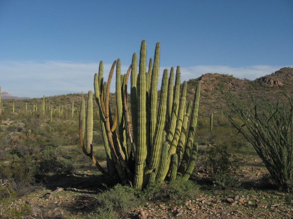
Palo Verde Trail
 Photo: daveynin, CC BY 2.0 (via Flickr)
At a glance
Palo Verde Trail is a short, easy out-and-back hike in Organ Pipe Cactus National Monument in Arizona, managed by the National Park Service. The trail is about 2.8 miles long, with a low point of 1,634 feet and a high of 1,704 feet, so the climb is gentle, with a total elevation gain of about 79 feet. Winter and early spring are the most comfortable times to go. Typical averages from a nearby weather station show January highs around 71°F and lows near 41°F, while June and July average highs in the low 100s. The station sits at nearly the same elevation as the trail, so temperatures here run similarly. The trail is not wheelchair accessible, and a fee is charged. Horses are allowed. Several other hikes start close by, including Desert View Trail and Victoria Mine Trail, each about a mile away.
- round trip
- 2.8 mi
- climb
- 79 ft
- high point
- 1,704 ft
- route
- Out and back
- time
- About 1 hour
- best months
- Mid-Nov–mid-Mar
Where it is: Organ Pipe Cactus National Monument
Near: Ajo
Best weeks to go
Mid-November to mid-March is usually best for hiking here.
Typical highs of 69–79°F and lows of 40°F or warmer in those weeks.
Typical weather: NOAA 1991–2020 normals at Organ Pipe Cactus Nm, AZ, 0 mi away. Not a forecast.
Typical weather by monthBest time to visit Palo Verde Trail
Best months: November–March. Best months are the ones mostly made of the best weeks for hiking: typical temperatures in its comfortable range, few snowy days and not usually wet, judged with the same limits as our good-day forecasts.
Jan
71°
41°
3 wet
Feb
73°
43°
4 wet
Mar
79°
47°
3 wet
Apr
86°
52°
1 wet
May
93°
59°
1 wet
Jun
102°
68°
1 wet
Jul
104°
76°
4 wet
Aug
103°
75°
6 wet
Sep
99°
70°
3 wet
Oct
90°
59°
2 wet
Nov
79°
48°
2 wet
Dec
70°
41°
4 wet
Typical high / low (°F) and days with rain or snow, 1991–2020. Measured at Organ Pipe Cactus Nm, AZ, 0.1 mi away at 1,678 ft. Source: NOAA NCEI U.S. Climate Normals 1991–2020.
Been here? Tell people how it was.
- Campground Perimeter TrailHikingPhoto: daveynin, CC BY 2.0 (via Flickr)1 mi
- Desert View TrailHikingPhoto: daveynin, CC BY 2.0 (via Flickr)1 mi
 Victoria Mine TrailHikingPhoto: daveynin, CC BY 2.0 (via Flickr)1.2 mi
- Martinez-Victoria Mine TrailHiking2.5 mi
- Lost Cabin Mine TrailHiking2.7 mi
 Baker Mine TrailHikingPhoto: Ken Lund, CC BY-SA 2.0 (via Flickr)3.1 mi
- Senita Basin-Red TanksHikingPhoto: Ken Lund, CC BY-SA 2.0 (via Flickr)3.1 mi
- Sentia Basin Loop TrailHiking3.4 mi
- Campground Perimeter TrailHikingPhoto: daveynin, CC BY 2.0 (via Flickr)~2 min drive
- Baker Mine TrailHikingPhoto: Ken Lund, CC BY-SA 2.0 (via Flickr)~5 min drive
 Mount Ajo TrailHikingPhoto: RuggyBearLA, CC BY-SA 2.0 (via Flickr)~13 min drive
- Sp-M Cráter La EscoriaHiking~56 min drive
- Desert View TrailHikingPhoto: daveynin, CC BY 2.0 (via Flickr)~2 min drive
- Grass Canyon Access TrailHiking~19 min drive
- Sp-NHiking~1h 8m drive
- Victoria Mine TrailHikingPhoto: daveynin, CC BY 2.0 (via Flickr)~2 min drive
- Sp-L IiHiking~1h 9m drive
- Senita Basin-Red TanksHikingPhoto: Ken Lund, CC BY-SA 2.0 (via Flickr)~5 min drive
Conditions and forecast
Daily highs and lows, wind and the chance of precipitation at Start for the next 7 days, from the Open-Meteo model.


Ask about this place
Questions about Palo Verde Trail: conditions, access, timing. Answers say when something isn't known.
Map and trail data © OpenStreetMap contributors
