Chavez Crossing
Campground
The next 4 weekends are full on Recreation.gov
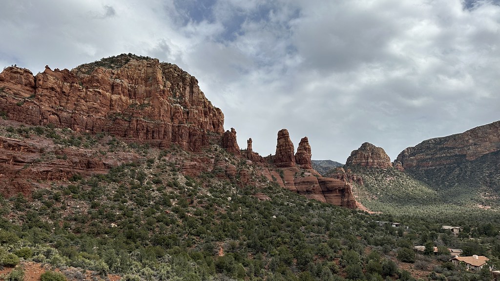 Photo: jasonwoodhead23, CC BY 2.0 (via Flickr)
Hog Wash #125C is an easy out-and-back hike in the Red Rock Ranger District of Coconino National Forest in Arizona, about 3 miles from the Broken Arrow parking area. The trail rises about 80 feet from a low point of 4,321 feet to a high of 4,418 feet, making it a short, low-effort outing. Spring and fall are the most comfortable times to go. Typical averages from a nearby weather station in Sedona show October highs around 79°F with lows near 51°F, while July highs reach about 97°F. The trail is open to both horses and bikes, so it works for riders and pack animals as well as hikers. The Mystic #157 hike and the Genetic Wall climbing area sit about 0.1 mile away, and the Chavez Crossing campground is about half a mile off.
Where it is: Red Rock Ranger District · Coconino National Forest
Near: Sedona
Mid-October to early May is usually best for hiking here.
Typical highs of 57–79°F and lows of 32°F or warmer in those weeks.
Typical weather: NOAA 1991–2020 normals at Sedona, AZ, 4 mi away. Not a forecast.
Typical weather by monthBest months: October–April. Best months are the ones mostly made of the best weeks for hiking: typical temperatures in its comfortable range, few snowy days and not usually wet, judged with the same limits as our good-day forecasts.
Jan
58°
34°
5 wet
Feb
61°
36°
6 wet
Mar
67°
40°
6 wet
Apr
75°
44°
3 wet
May
84°
53°
3 wet
Jun
94°
61°
2 wet
Jul
97°
68°
6 wet
Aug
94°
67°
9 wet
Sep
89°
61°
5 wet
Oct
79°
51°
3 wet
Nov
67°
41°
4 wet
Dec
58°
33°
4 wet
Typical high / low (°F) and days with rain or snow, 1991–2020. Measured at Sedona, AZ, 4 mi away at 4,220 ft. This station doesn't record snowfall. Source: NOAA NCEI U.S. Climate Normals 1991–2020.
Been here? Tell people how it was.
 Genetic WallRock climbingPhoto: inkknife_2000 (7.5 million views +), CC BY-SA 2.0 (via Wikimedia Commons)0.1 mi
 The PlanetariumRock climbingPhoto: Coconino NF Photography, Public Domain Mark (via Flickr)0.3 mi
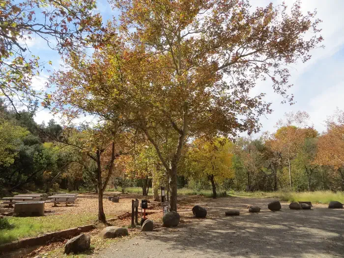 Chavez CrossingCampingPhoto: Recreation.gov (RIDB) / public domain0.5 miHog Heaven #125DHikingPhoto: jasonwoodhead23, CC BY 2.0 (via Flickr)~1 min drive
 Templeton #156HikingPhoto: dconvertini, CC BY-SA 2.0 (via Flickr)~3 min drive
 Little Horse #61HikingPhoto: jasonwoodhead23, CC BY 2.0 (via Flickr)~2 min driveLlama #650HikingPhoto: jasonwoodhead23, CC BY 2.0 (via Flickr)~2 min drive
 High on the Hog #125EHikingPhoto: jasonwoodhead23, CC BY 2.0 (via Flickr)~2 min drive
 Broken Arrow #125HikingPhoto: Klaus Eltrop, CC BY-SA 3.0 (via Wikimedia Commons)~2 min driveMargs Draw #163HikingPhoto: Klaus Eltrop, CC BY-SA 3.0 (via Wikimedia Commons)~2 min drive
 Chapel #213HikingPhoto: jasonwoodhead23, CC BY 2.0 (via Flickr)~2 min driveJim Bryant #199HikingPhoto: jasonwoodhead23, CC BY 2.0 (via Flickr)~2 min drive
Daily highs and lows, wind and the chance of precipitation at Start for the next 7 days, from the Open-Meteo model.
Questions about Hog Wash #125C: conditions, access, timing. Answers say when something isn't known.
Chavez Crossing
Campground
Stan Rose Images
Gallery
Places © OpenStreetMap contributors, Places © Overture Maps Foundation
More in Kachina VillageNot on Roamze yet. Their page has how to reach them.
Map and trail data © OpenStreetMap contributors
