Trillium Trail
At a glance
Trillium Trail is a short, easy loop in Kolomoki Mounds State Park in Georgia, managed by the State Department of Natural Resources. The trail is about 1.2 miles long, with a total elevation gain of 94 feet and a total loss of 224 feet, making it a gentle walk that can be done in about half an hour. The route starts and ends at roughly the same point, with the high point at 302 feet and the low at 215 feet. The steepest stretch comes early on, at about 0.08 miles in, with a grade of 7 percent. Bikes are not allowed on this trail. Spring and fall are the most comfortable times to go. Typical averages from a nearby weather station show April highs around 76°F and October highs around 78°F, while July highs reach about 91°F. Several other trails sit close by. Spruce Pine Trail is about half a mile away, White Oak Trail is about 0.8 miles away, and Temple Mound Trail is about 1.2 miles away. For paddling, Kolomoki Creek is about 5 miles off.
- loop
- 1.2 mi
- climb
- 94 ft
- high point
- 302 ft
- route
- Loop
- time
- About 30 minutes
- best months
- Oct–May
Where it is: Kolomoki Mounds State Park
Near: Blakely
Best time to visit Trillium Trail
Best months: October–May. Best months have typical highs of 55–85 °F, lows of 30 °F or warmer (32 °F where the station doesn't record snow), at most one snowy day and no more than 12 wet days.
Jan
59°
38°
Feb
62°
40°
Mar
69°
45°
Apr
76°
52°
May
84°
62°
Jun
89°
69°
Jul
91°
72°
Aug
90°
72°
Sep
87°
67°
Oct
78°
56°
Nov
69°
46°
Dec
62°
41°
Typical high / low (°F) and days with rain or snow, 1991–2020. Measured at Ft Gaines 2, GA, 12.5 mi away at 210 ft. This station doesn't record snowfall. Source: NOAA NCEI U.S. Climate Normals 1991–2020.
Been here? Tell people how it was.
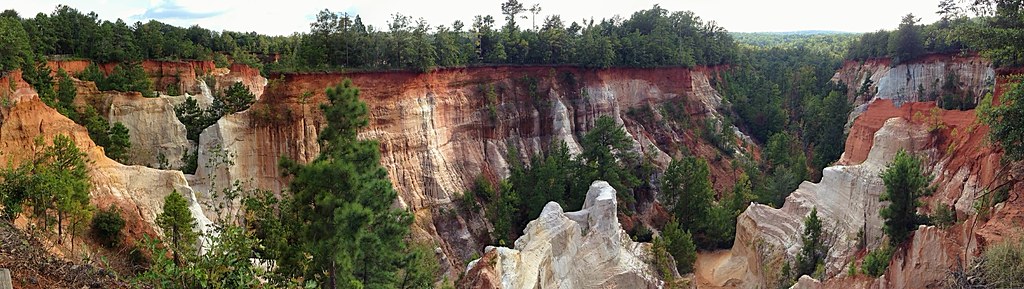 Canyon Loop TrailHikingPhoto: StephenGA, Public Domain Dedication (CC0) (via Flickr)~1h 11m drive
 Backcountry TrailHikingPhoto: StephenGA, Public Domain Dedication (CC0) (via Flickr)~1h 11m drive
- CanyonsHikingPhoto: StephenGA, Public Domain Dedication (CC0) (via Flickr)~1h 11m drive
 River Trail (Blue)HikingPhoto: State Library and Archives of Florida, Public domain (via Wikimedia Commons)~1h 22m drive
- White Oak TrailHiking~1 min drive
- Temple Mound TrailHiking~2 min drive
- Cotton Hill Nature TrailHiking~28 min drive
- Big Oaks TrailHiking~46 min drive
- Memorial TrailHiking~54 min drive
- Yoholo Micco, the Creek Indian TrailHiking~55 min drive
Conditions and forecast
Daily highs and lows, wind and the chance of precipitation at Start for the next 7 days, from the Open-Meteo model.

Ask about this place
Questions about Trillium Trail: conditions, access, timing. Answers say when something isn't known.
Map and trail data © OpenStreetMap contributors
