Backcountry Trail
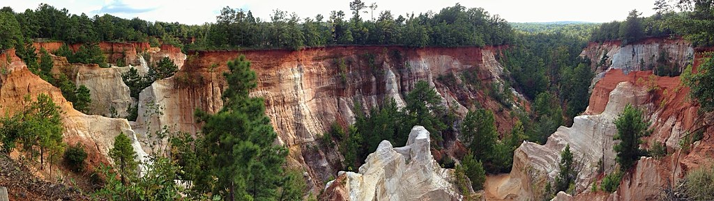
 Photo: StephenGA, Public Domain Dedication (CC0) (via Flickr)
- 4.9 mi
- round trip
- 1,200 ft
- climb
- 650 ft
- high point
- Out and back
- route
- Oct–Apr
- best months
Clear today
Weather is good · OpenWeather · checked just now
Backcountry Trail is a 9.7-mile out-and-back hike in Georgia's Providence Canyon Outdoor Recreation Area, managed by the State Department of Natural Resources. The route starts at about 539 feet and climbs steadily to a high point of 650 feet, with a total gain of 1,200 feet over the round trip. The steepest stretch comes at about 1.4 miles in, where the grade reaches 11 percent. Spring and fall are the most comfortable times to go. Typical averages from a nearby weather station show October highs around 80°F with lows near 51°F, and April is similar at about 79°F by day and 48°F at night. Summer highs typically reach the low 90s. The hike takes about four hours. The Canyon Loop Trail and the Canyons hike both start about 0.1 mile away. Hodchodkee Creek, a canoeing spot, is about 6.9 miles off, and Florence Marina, a lake fishing destination, is about 7.9 miles away.
- CanyonsHikingPhoto: StephenGA, Public Domain Dedication (CC0) (via Flickr)0.1 mi
 Canyon Loop TrailHikingPhoto: StephenGA, Public Domain Dedication (CC0) (via Flickr)0.1 mi
- Hodchodkee CreekCanoeing6.9 mi
- Florence MarinaLake fishing7.9 mi
Source: Roamze catalog (indexable pages within 10 miles, PostGIS distance)
- Nature TrailHiking · ~20 min drive
- Lumpkin TrailHiking · ~29 min drive
- Sedan TrailHiking · ~24 min drive
- County Line TrailHiking · ~41 min drive
- Sedan TrailHiking · ~25 min drive
- Buzancy TrailHiking · ~49 min drive
- Yoholo Micco, the Creek Indian TrailHiking · ~30 min drive
- Lonely Hunter Loop TrailHiking · ~1h 1m drive
- Yoholo Micco, the Creek Indian TrailHiking · ~31 min drive
- Keystone TrailHiking · ~31 min drive
Best time to visit Backcountry Trail
Best months: October–April. Best months have typical highs of 55–85 °F, lows of 30 °F or warmer (32 °F where the station doesn't record snow), at most one snowy day and no more than 12 wet days.
Jan
60° / 34°
8 wet
Feb
65° / 36°
7 wet
Mar
72° / 41°
7 wet
Apr
79° / 48°
6 wet
May
86° / 57°
6 wet
Jun
91° / 64°
9 wet
Jul
92° / 68°
9 wet
Aug
92° / 67°
8 wet
Sep
88° / 62°
6 wet
Oct
80° / 51°
5 wet
Nov
71° / 39°
5 wet
Dec
63° / 35°
6 wet
Typical high / low (°F) and days with rain or snow, 1991–2020. Measured at Lumpkin 2 Se, GA, 8.4 mi away at 485 ft. Source: NOAA NCEI U.S. Climate Normals 1991–2020.
Map and trail data © OpenStreetMap contributors
