Cotton Hill Nature Trail
- 0.9 mi
- loop
- 21 ft
- climb
- 212 ft
- high point
- Loop
- route
- Oct–May
- best months
Cotton Hill Nature Trail is a short, easy loop in Georgia's Walter F. George Recreation Area, managed by the Army Corps of Engineers. The trail is 0.86 miles long and rises about 20 feet from a low point of 193 feet to a high of 212 feet, with the steepest stretch at about 0.22 miles in, where the grade reaches 4 percent. It is a low-effort outing, and the climb is gentle enough to fit easily into a longer visit to the recreation area. Spring and fall are the most comfortable times to go. Typical averages from a nearby weather station at Ft Gaines show April highs around 76°F and October highs around 78°F, while July and August average in the low 90s. Cotton Hill campground sits just 0.3 miles away, and George T. Bagby State Park, a lake fishing spot, is about 0.8 miles off. Paddlers can head to Cemochechobee Creek, roughly 6.7 miles away.
Best time to go · Oct–May
Best time to visit Cotton Hill Nature Trail
Best months: October–May. Best months have typical highs of 55–85 °F, lows of 30 °F or warmer (32 °F where the station doesn't record snow), at most one snowy day and no more than 12 wet days.
Jan
59° / 38°
Feb
62° / 40°
Mar
69° / 45°
Apr
76° / 52°
May
84° / 62°
Jun
89° / 69°
Jul
91° / 72°
Aug
90° / 72°
Sep
87° / 67°
Oct
78° / 56°
Nov
69° / 46°
Dec
62° / 41°
Typical high / low (°F) and days with rain or snow, 1991–2020. Measured at Ft Gaines 2, GA, 4.2 mi away at 210 ft. This station doesn't record snowfall. Source: NOAA NCEI U.S. Climate Normals 1991–2020.
Keep exploring — more trails worth the drive
 Photo: StephenGA, Public Domain Dedication (CC0) (via Flickr)
Canyons
~49 min drive
0.6-mile out-and-back trail in Georgia with 163 ft of elevation gain.
Photo: StephenGA, Public Domain Dedication (CC0) (via Flickr)Backcountry Trail
~49 min drive
9.7-mile out-and-back trail in Georgia with 1,200 ft elevation gain.
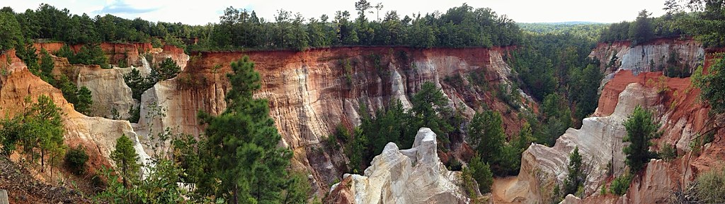 Photo: StephenGA, Public Domain Dedication (CC0) (via Flickr)
Canyon Loop Trail
~49 min drive
2.12-mile loop in Georgia with 502 ft gain and 660 ft max elevation.
HIKE
Lumpkin Trail
~1h 16m drive
7.08-mile out-and-back hike in Georgia with 566 ft elevation gain
HIKE
White Oak Trail
~27 min drive
1.22-mile loop trail in Georgia with 150 ft elevation gain.
HIKE
Temple Mound Trail
~27 min drive
0.98-mile out-and-back hike in Georgia with 48 ft elevation gain.
HIKE
Yoholo Micco, the Creek Indian Trail
~27 min drive
1.5-mile out-and-back trail in Alabama with 337 ft elevation gain and loss.
HIKE
Trillium Trail
~28 min drive
1.16-mile loop with 224 ft elevation gain in Georgia
HIKE
Spruce Pine Trail
~29 min drive
2.65-mile loop with 489 ft gain in Georgia
HIKE
Yoholo Micco, the Creek Indian Trail
~29 min drive
4.5-mile out-and-back trail in Alabama with 418 ft elevation gain and loss.
Map and trail data © OpenStreetMap contributors
